adventure

Sun, fun and skiing the Scandinavian Alps‏

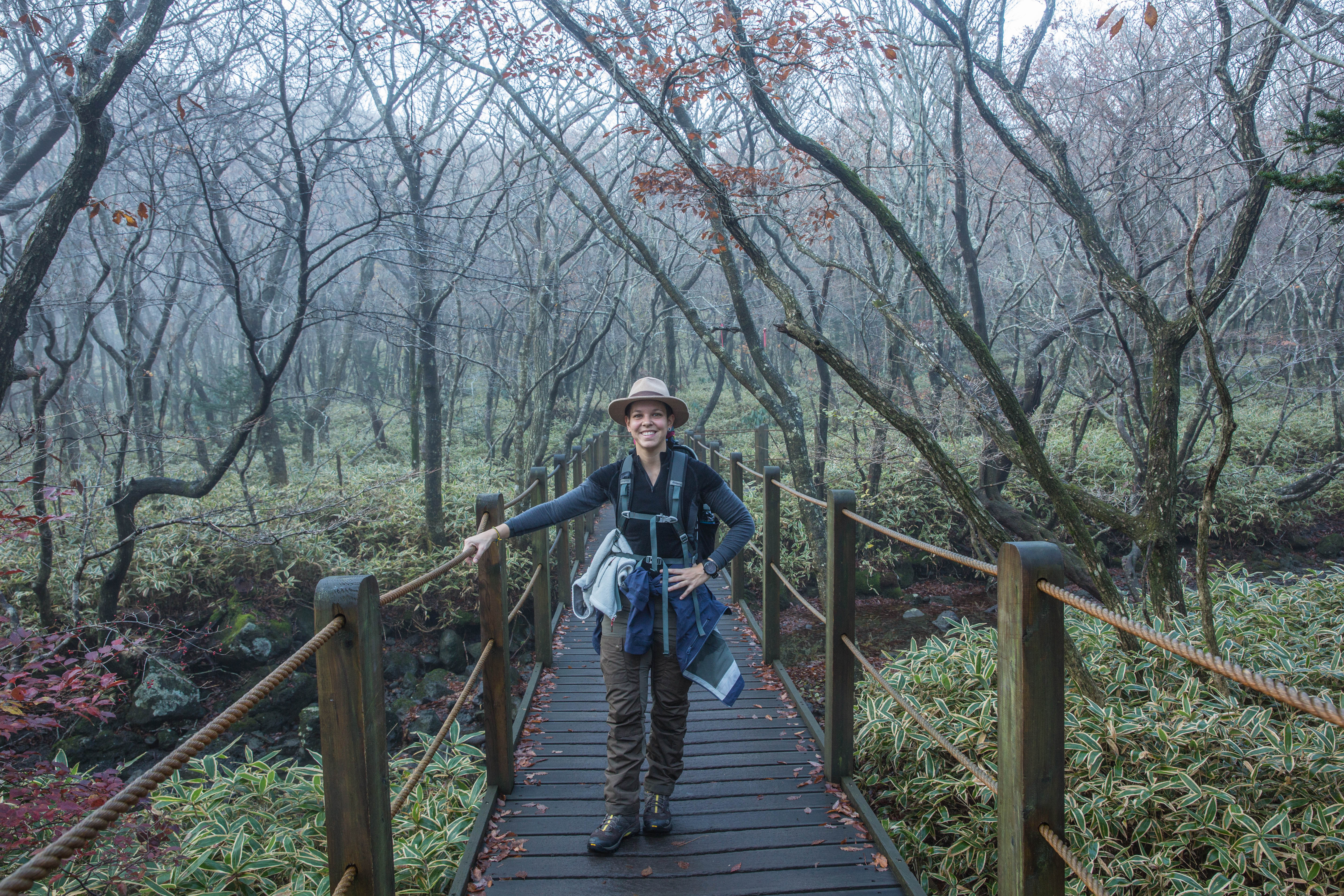
I just arrived from Kuala Lumpur to Singapore. It’s the easter weekend and my memory goes back a few years to my Easter holiday in the Norwegian mountains and makes me think back to how much i miss skiing. In Norway Easter is the time of the year when most people head up to the mountain for a skiing holiday to enjoy some time with family and friends. Either they spend it in their own mountain cabin or they book a stay at some of the more popular hotels in famous skiing destinations in Norway.

As I was on a business trip in Oslo during this time and Chiara took some time off from work and traveled from Brazil to join me in Oslo we decided to booked a 5 days stay in Hemsedal. Or at least I believed i had booked a stay in Hemsedal. I rented a car, picked Chiara up at the airport and off we went. Driving on a winding mountain road with beautiful nature all around, enjoying the drive. Just after we passed Gol I saw a sign to Golsfjellet and in the back of my mind I remembered this name. I had been to Gol a few times before but many years ago so was assuming that this was the reason for me remembering the name, so we continued driving until we reached Hemsedal.


Hemsedal with a population of around 2000 people is small so easy to find your way around. I asked Chiara to check out the hotel name, so looking at the print out she told me it was Storefjell Resort Hotel and for some reason I remembered the sign golsfjellet that we had passed earlier, but we continued driving to see if we could find a sign with the hotel name. Passing through the small town and entering the ski resort area we had not found any sign with the hotel name, so we turned around and stopped at a petrol station to check. The guy at the petrol station was nice and told me I had to drive back to Gol and take to the left when I could see the sign to golsfjellet.


So finally a bell was ringing in my head that I had not booked hotel at hemsedal as I was planning. I usually book my hotel stay at booking.com and realised that when the hotels are fully booked in the area you search it suggest hotels close to the the place. But as I was in a hurry when booking i did not notice this. So we just had to turn back and find our way to golsfjellet and the hotel I had booked. A bit disappointed as we had been looking forward to be staying in Hemsedal and be close to the ski resort and the activities around, including after skiing.


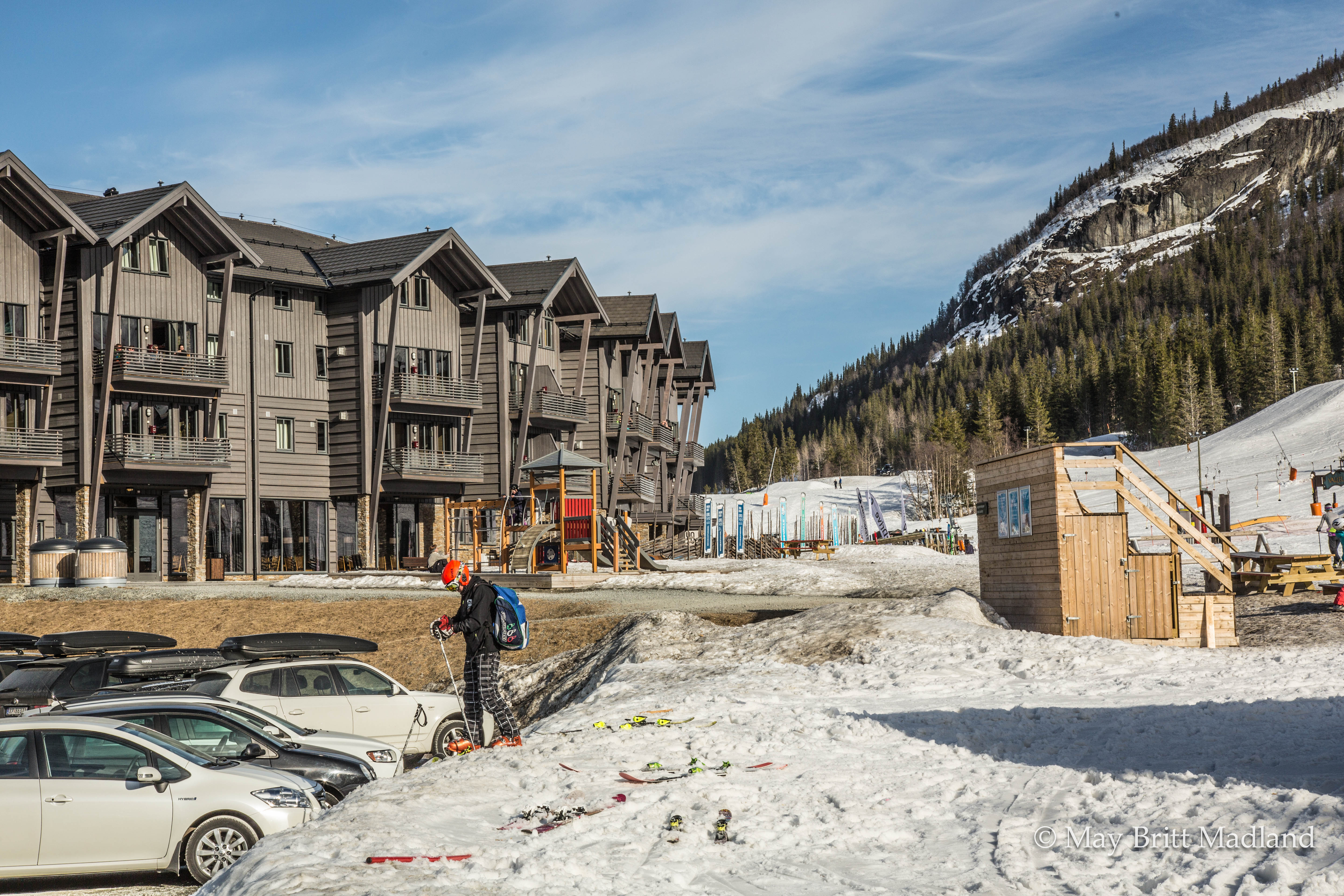
We arrived at Storefjell Resort Hotel, checked in and found out there is a ski area just next to the hotel, so that made us feel a bit better. Still it was not Hemsedal, but the hotel was nice and location on the mountain was nice as well with a good view and the distance to drive to Hemsedal was not to far. So overall we ended up enjoying our stay at the Resort.


We enjoyed the evening with good food and drinks and decided to check out the ski lift next to the hotel the next day and then take a trip to Hemsedal the following day to check out the ski arena there. This would give us some time to practice a bit skiing before enter the more advanced ski slopes as well, with Chiara being quite new to skiing.

Even do we ended up staying at a different place than planned at least we had luck with the weather. We had sunny days and blue sky, so it could not be more perfect that that.


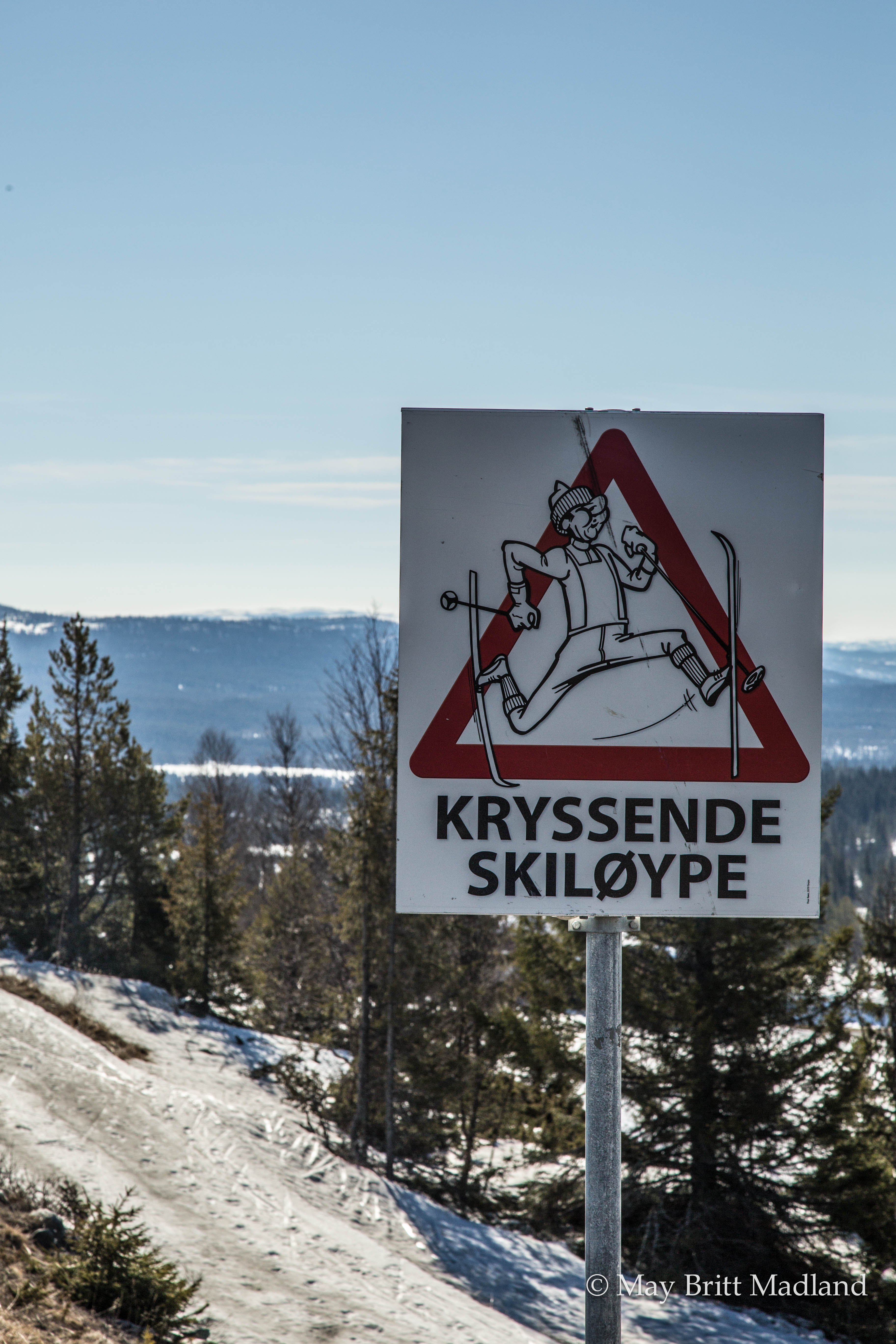
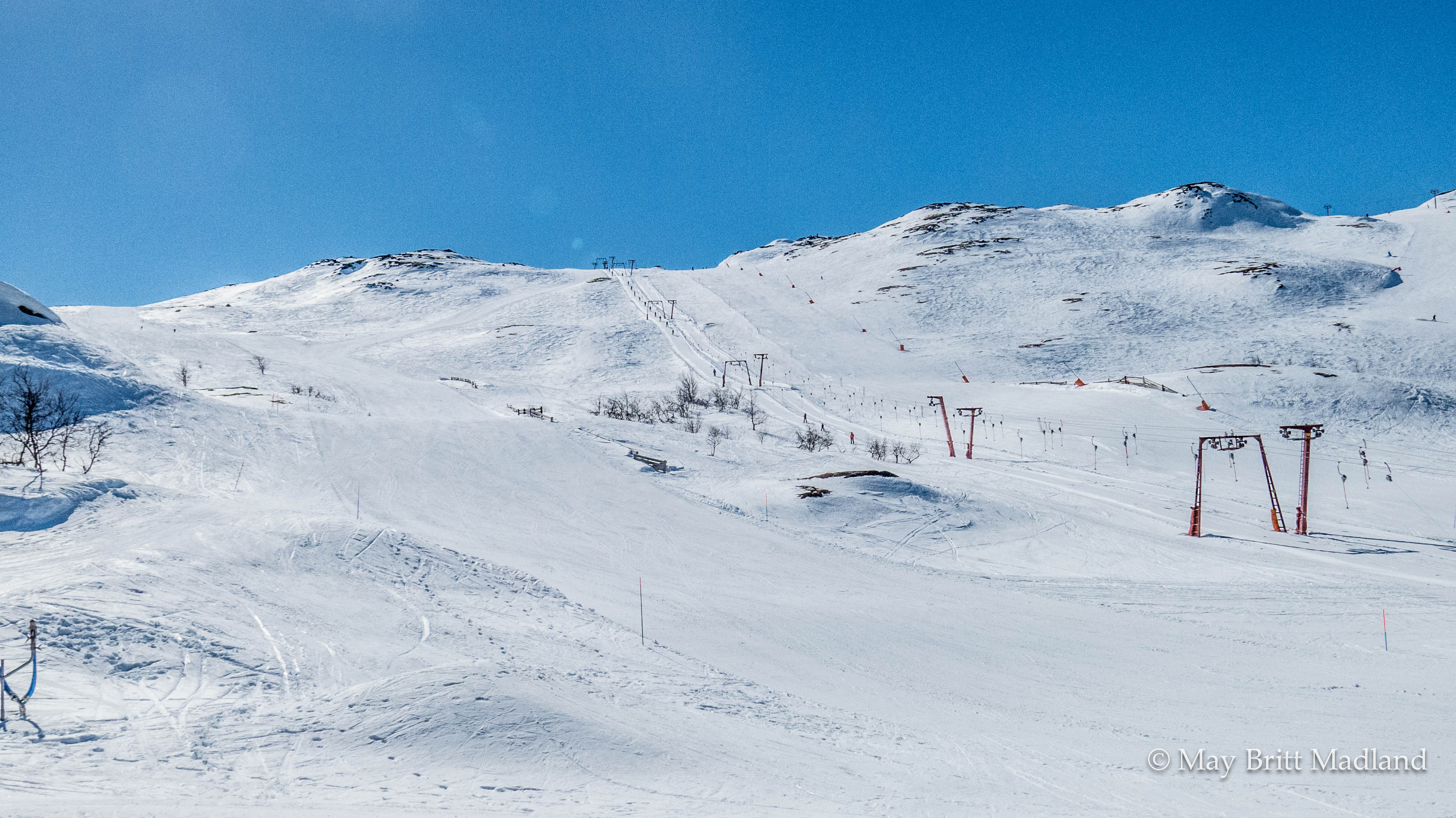
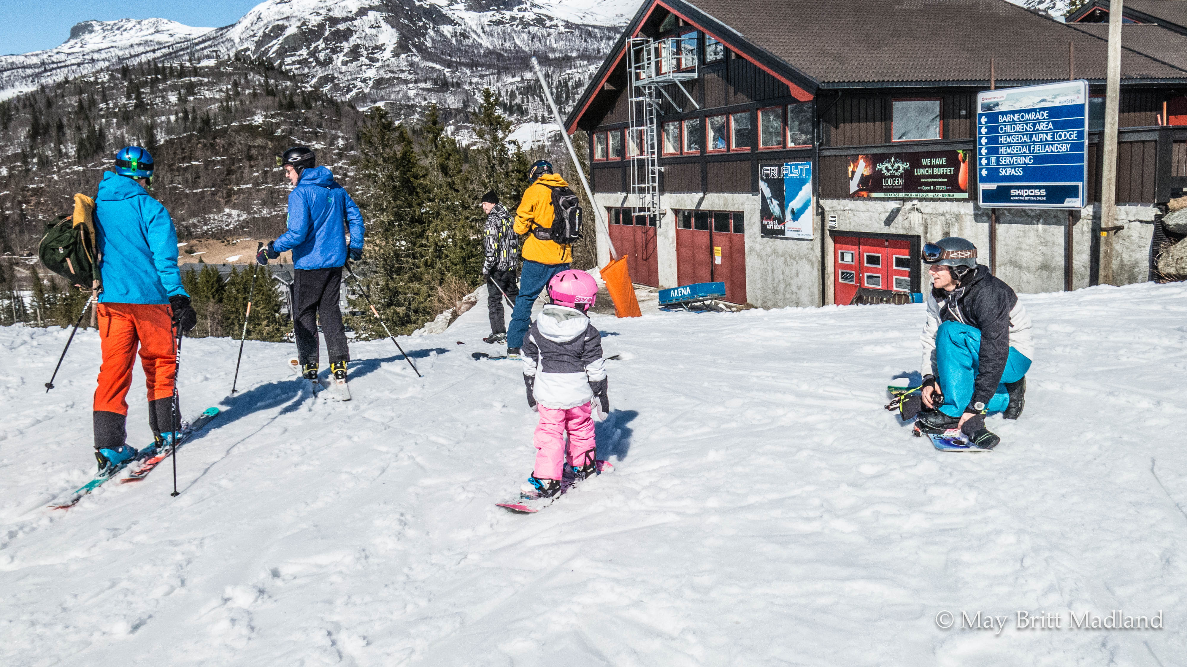
Hemsedal is considered a true heaven for ski lovers with snow from November to early May.  You will find all from off-piste skiing to cross-country skiing where you can enjoy well prepped mountain tracks in beautiful wild surroundings.


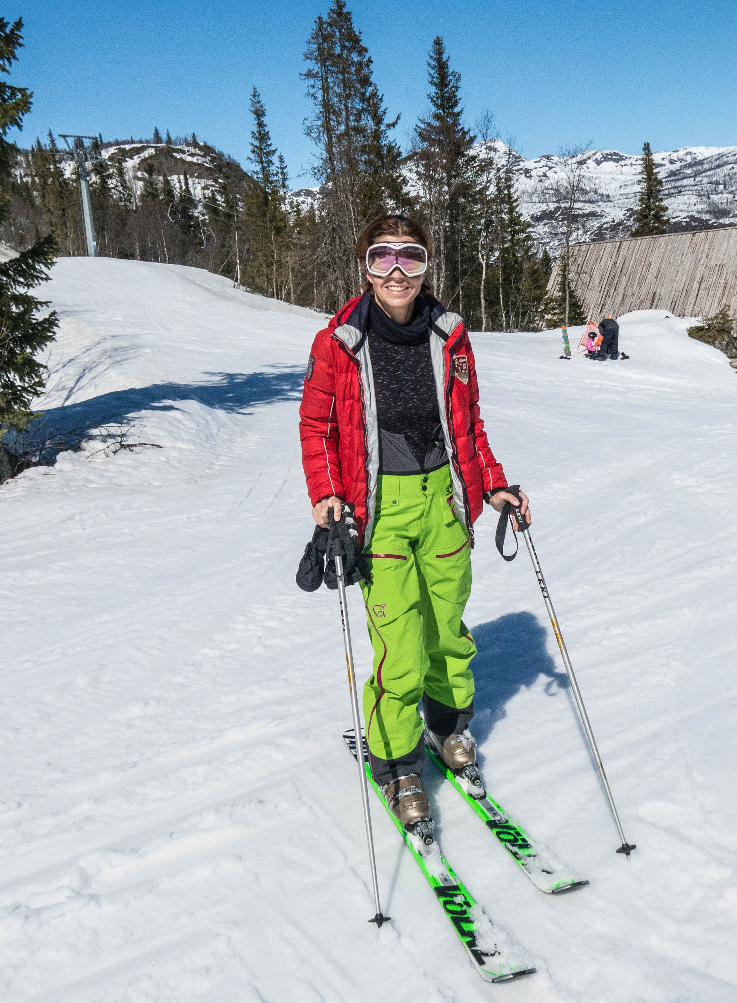
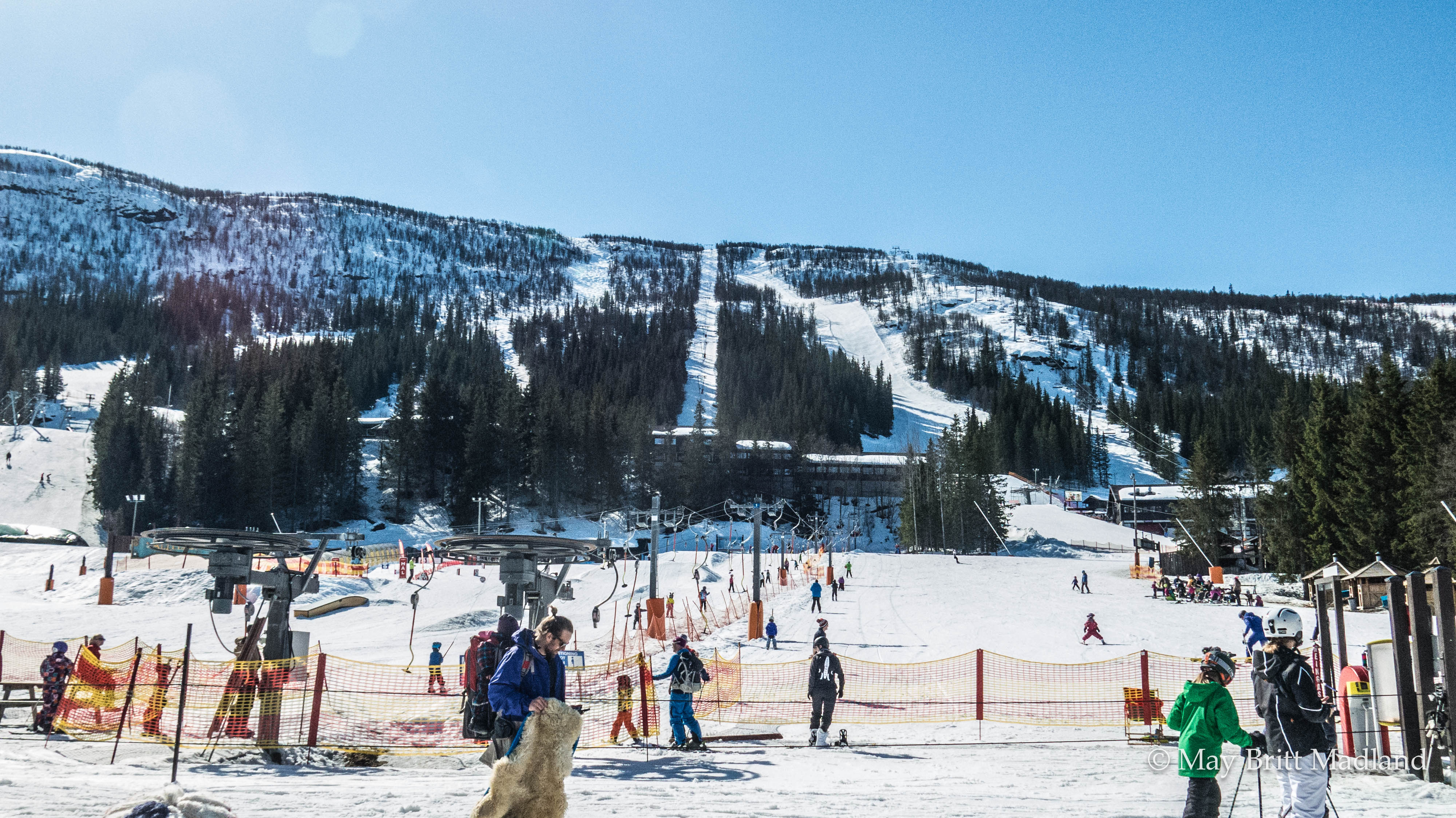
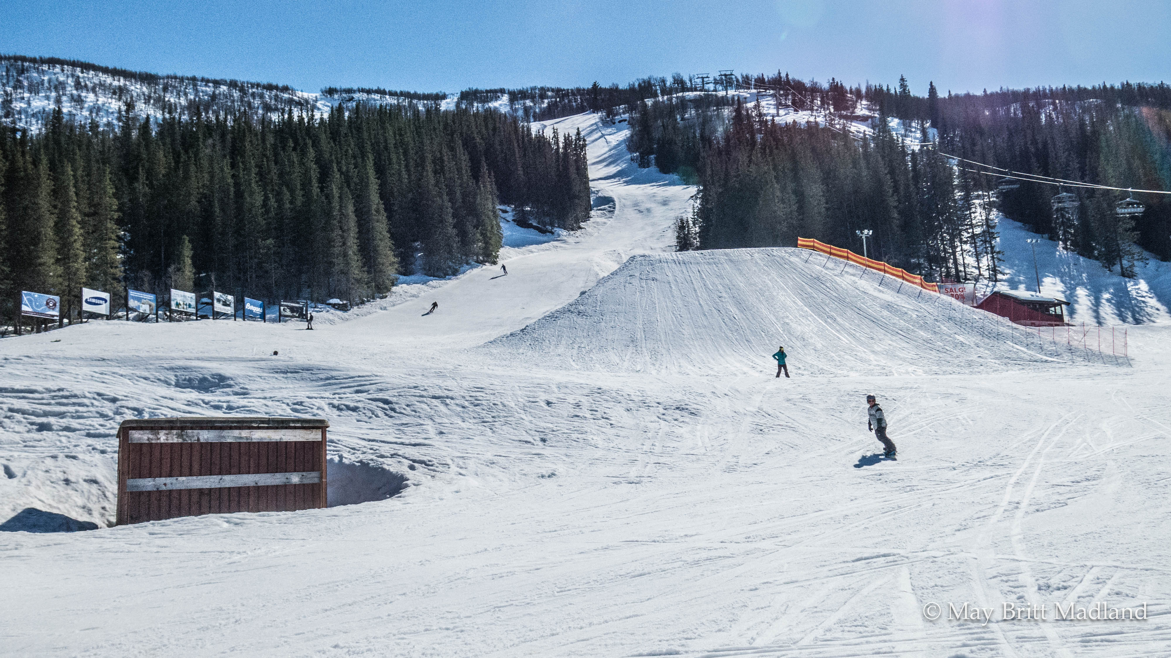
With the car it was easy to drive to Hemsedal so we tried out the ski area there as well and it ended up being another fantastic sunny day with lots of fun in the ski slopes. Chiara was struggling a bit in the fist ski lift but she got a hang of it after a few time with falling off as the first part of the ski lift is the one you are standing and not the seated ski lift. So with the snowboard it is a bit more tricky.


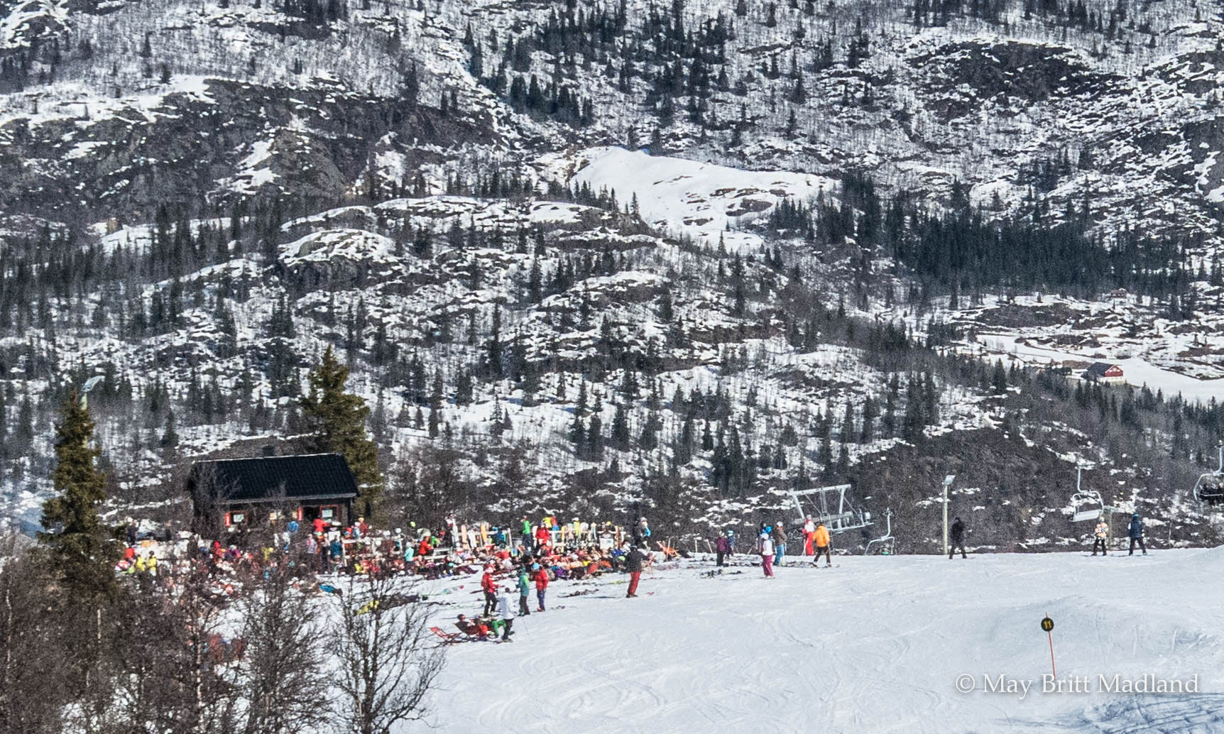
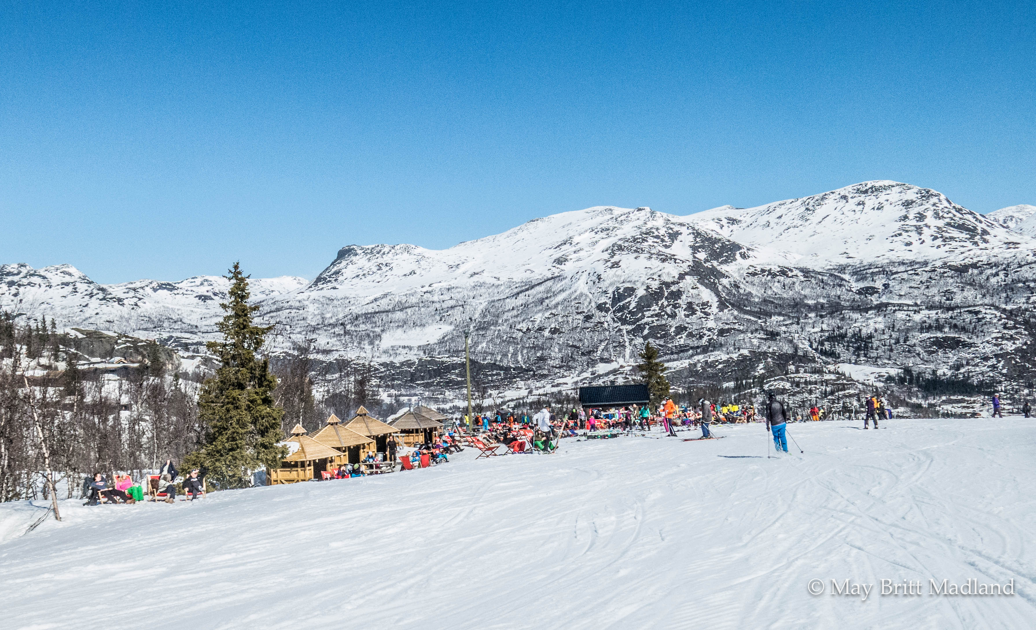
No matter what your level is you will enjoy the slopes so it is just to choose the level of comfort. And if you feel like stopping for a refreshment along the way you have the options for that as well.


We tested out the slopes and had a fantastic time, enjoying the sunny weather.


After a long day trying out all the slopes our appetite was high so we headed over to the city center to find a place to eat.


We ended up at Hemsedal Cafe and had a fantastic meal follow by some coffee as we had to drive back to our hotel after.


Back at Storefjell Resort hotel we find our way to the after ski event.


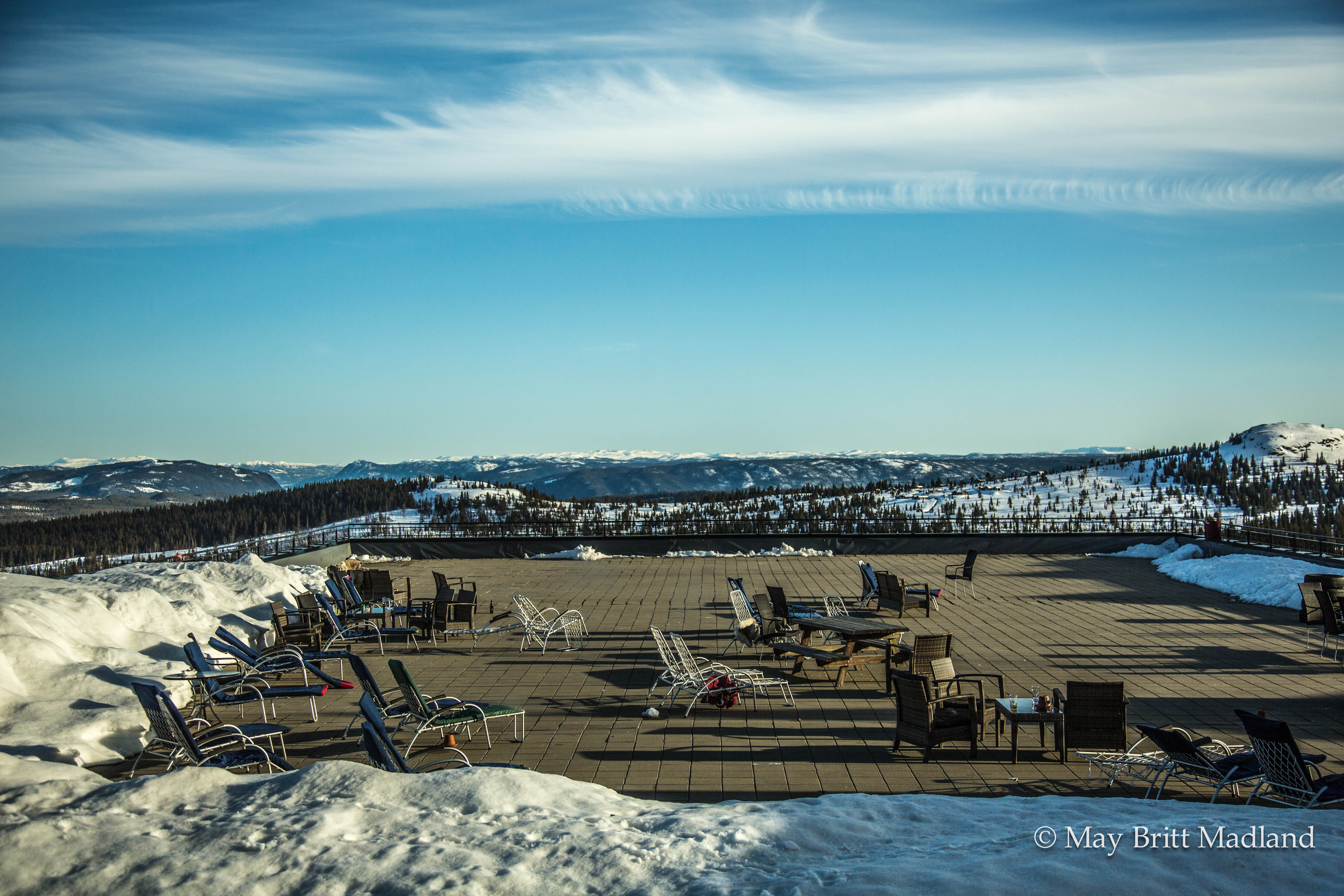
Taking in the beautiful view of the mountain with a drink before dinner, it was a perfect end to our day.

Hemsedal is one of the largest ski resorts in Norway. A very popular resort, 3.5 hrs. drive from Oslo. The stable climate and the absolute guarantee of snow will ensure an unforgettable winter sport vacation. The season starts as early as November and runs until May.

We had a memorable time and looking forward to our next stay and maybe next time we would be lucky enough to book book a say in Hemsedal.


A Sunday stroll around Bangsar Village

I woke up early this Sunday morning and opened the curtains just to find out it was raining so my plan to head over for Breakfast at Bangsar Village seamed like a bad option. So I quickly came up with a plan B, to hope for the rain to stop and find my way over to the Village for a nice lunch instead.

_60a3564 _60a3565

I visited the Bangsar Village a few weeks ago with a friend for dinner and was told it is a great place to hang out during the day as it has a wide selection of cafe’s, Restaurants and shops.

_60a3566  _60a3567

As soon as the rain stopped i booked a grab taxi, took my camera and I was lucky that the traffic was not to heavy, so it did not take me to long to get there.

_60a3579  _60a3568

The area has a wide selection of restaurants serving everything from Local food, Japanese, Thai, Chinese and Western cuisine.

_60a3578 _60a3581

_60a3585  _60a3580

I checked out the lunch menu at the Ril’s Bangsar restaurant and ended up ordering a fantastic tasting Beef. The place have a nice atmosphere, great service and amazing tasting food, so well worth a visit.

_60a3575  _60a3574

_60a3572  _60a3576

The Pasar Malam Bangsar market is located just next to the village mosque.

_60a3613  _60a3588

_60a3602  _60a3594

_60a3593  _60a3601

You will find a mix of stalls with option to buy fruit and vegetables, taste the local cooked food or shop for cloths and other items. For sure an interesting place for a stroll and people watching.

_60a3620  _60a3617

_60a3615  _60a3621

I spent some time at the market, before I found my way over to the shopping center.

_60a3608  _60a3612

As everywhere else in Kuala Lumpur you have to watch out for the motorbikes and cars as they are driving everywhere.

_60a3609  _60a3586

At the shopping you will find a wide selection of shops to choose from including the high class brands. So for the once loving shopping it would be easy to spend some hours checking out the stores. As I had spent a few hours walking around outside the shopping centers I decided that the only shopping I would to this Sunday, other than buying a some fruit at the market, would be to buy a few items at the grocery store to take back to my hotel. So exploring the shopping centers will have to be for next time.

_60a3605

Bangsar Village is located within one of Kuala Lumpur’s most affluent neighbourhoods and is Easily accessible via the Bangsar LRT station, Rapid KL’s Kelana Jaya Line has a stopover along Jalan Bangsar. Jalan Telawi – Bangsar Village I & II’s address – is a five-minute cab ride away. Alternatively, you can hop on the Rapid KL bus U87 (which also goes past Mid Valley Megamall) to get to Bangsar Baru and then walk to the retail emporium.


A stroll around the Jagalchi Fish Market

I was strolling the streets early on a Sunday morning on my way to Jagalchi fish market. It was December and the street was still very quiet and only a few stalls was open at this time. Others were getting ready to open and preparing for the day.

_60A0038  _60A0048

_60A0043  _60A0051

Some cleaning in front of the store and some laying out the fish ready to be sold. The closer i got to the fish market the more busy it was. I passed the stalls and headed in to the indoor wet fish market.

_60A0068  _60A0056

_60A0078  _60A0069

I walked inside the building but as it was still quiet i decided to head over to the outdoor wet market that is located just next to the indoor market.

_60A0082  _60A0088

Fish was unloaded from small and large fishing boats and the outdoor market got busy.

_60A0098  _60A0097

Passing this i was thinking why not try out the waffles like thing looking like fish? Well i decided to miss it this time and headed in the direction of the harbor as i could see lots of fishing boats had anchored up and was unloading fish to be sold at the marked and transported off to other places in the country to be sold.

_60A0127  _60A0123

_60A0122  _60A0132

The harbor was busy and people was shouting at all corners to make sure the fish got to the right trucks or sold off to the local marked.

_60A0146  _60A0144

_60A0138  _60A0154

All was very well organized and boxes got stored in different location or transported direct on the trucks for transportation.

_60A0129  _60A0170

_60A0145  _60A0107

The Jagalchi fish market is the largest fish market in Korea and you will find fresh fish that can be purchased for a good price. With the location beside Nampo port the fish can be delivered quickly and kept fresh.

_60A0104  _60A0101

The market is famous as many elderly woman run the fish stands and have done so since the men were off fighting in the Korean War. Meals are served to locals and tourist alike in the small restaurants they have set up behind the stalls were they are selling the fish.

_60A0099  _60A0105

A lot of restaurants come here to buy fish from wholesalers.

_60A0178  _60A0177

At the time I left the market it was getting really busy.

If you visit Busan make sure you visit the Jagalchi market. Try out some of the food stalls or just stroll around. Either way it is worth the visit.


Maafushivaru

Arriving on Maafushivaru after a 25 min seaplane ride from Male we were dropped off in the middle of the sea on a pontoon. A Dhoni (traditional Maldivian boat) was ready to pick us up and at the Island we were surrounded by friendly staff handing out ice-cold face towels and a color-full refreshing Welcome drink.

_60A0491  _60A0484

Shoeless in the sand and with our snorkelling/diving equipment in our bags we were ready to celebrate Christmas.

_60A0296  _60A0441

Our new home was an overwater villa, modern and minimalistic, lots of natural light in the room with large windows overlooking the endless stretch of turquoise water.

_60A0339  _60A0288

A nice sundeck terrace, with stairs straight in to the water, large bathroom with a bathtub overlooking the balcony and the ocean and a shower was installed just in the entrance from the Balcony to the bathroom.

_60A0365  _60A0300

Maafushivaru means “The Flower Island” and on this small Island you will find 48 Villas, a wine cellar, a library / cafe, a restaurant Gallery Cuisine, a spa and yoga area, the Water bar, a big freshwater pool and a small stage for the different entertainment during the week. Furthermore there is the diving center, a small boutique, a water sports center, and the restaurant 135 Degrees East.

_60A0390  _60A0400  _60A0467

_60A0358  _60A0413

The Island also have a small sister-island, Lonubo, that is uninhabited and different trips can be arranged to the island.

DSCF0851  DSCF0883

Maafushivaru is located on the southern tip of the Ari atoll, so this makes it one of the best places to get the chance to swim with the whale shark. And as we wanted to see the life beyond the beach, we signed up for a few aquatic adventure. The Christmas snorkeling on Lonubo Island, Manta Ray snorkeling trip & not to be missed, Diving with the Whale shark.

IMG_7170  IMG_7413

IMG_7337  IMG_7463

We rented a Kayak and went paddling across the island’s lagoon, crossing over to the nearby Lonubo Island. It almost felt like being inside a picture perfect postcard of the Maldives.

DSCF0845  _60A0414

IMG_7190  IMG_7186

We did not spend a long time at the Island before that relaxing feeling you get in the Maldives came sneaking up on us so before we knew, we were sitting at the Water bar sipping cocktails with same colors as the ocean admiring the amazing view.

_60A0313  _60A0442

_60A0314  _60A0378

The Island is surrounded by coral reef, that houses different fish, in all different color, small sharks and sea-turtles. Once you get in the water with your snorkel, there is a world beneath the surface inviting you to see thing from another perspective. We tried to get close up to the black tip sharks swimming in the lagoon, but they were too fast for us.

_60A0446  _60A0461

Snorkeling in the Maldives is a must try thing to do even if you have not done snorkeling before.

IMG_7275  IMG_7453

The underwater life is beyond amazing and what we saw during our snorkeling trips was all from Manta Ray, Sharks, Turtles, corals and fish in all kind of colors swimming around us. And not to forget the whale shark.  

IMG_7501  IMG_7575

IMG_7511  IMG_7577

Early morning on the way to our dive site a school of dolphins decided to welcome us by swimming alongside the boat. At this time both my camera and my phone was downstairs and i had no time to get any of them to capture it on film, so I just enjoyed the view of watching them leaping up and down of the water. What i did get a photo of was the whale shark, but it was difficult to get a clear shot as we only saw it during snorkeling and not during diving. Same for the manta ray as it was difficult following them while snorkeling. You really need to swim fast to try to catch up with them.

IMG_7417  IMG_7213

One of the evening we got invited for a complementary dinner at The restaurant 135 degrees East. We were served a fantastic dinner with sushi and teppanyaki. The service was great and the location just amazing.

_60A0409  _60A0372

On reflection, the fluency of the Maldives is found not on the sun lounger but out at sea, surrounded by crystal blue water. We dived beneath the surface and the ocean and found a Maldives that is much more than just relaxing and eating and left with memories that will be cherished forever.

How to get there:

Direct flight from Singapore to Male with Singapore airlines.

As we arrived late we had to stay over at Male city so we booked one night at Somerset hotel. Hotel provided pick up service from/to Airport.

Check in for the seaplane is at the airport and transport is then provided to the seaplane terminal by bus.


Thaipusam – sacrifice at every step

Singapore is a city with multicultural diversity and during the full moon of the 10th Tamil month, called Thai, the traditional festival, Thaipusam is held.

Urban Seoul BW -0845 Urban Seoul BW -0839

Urban Seoul BW -0840  Urban Seoul BW -0843

The festival is celebrated in honour of Lord Subramaniam (also known as Lord Murugan), who represents virtue, youth and power, and is the destroyer of evil.

Urban Seoul BW -0859  Urban Seoul BW -0853

Urban Seoul BW -0895  Urban Seoul BW -0948

I headed over to the Sri Thendayuthapani Temple early morning to witness the devotee as they prepare themselves for the walk to Sri Mariamman Temple. Men and women are working themselves into a trance before piercing cheeks and tongue with silver needles and pricking the body with hooks and spare-like needles.

Urban Seoul BW -0923  Urban Seoul BW -0894

Urban Seoul BW -0868  Urban Seoul BW -0892

Some wearing ‘Kavadi’ and others just simply carry a pot of milk, an offering which symbolises abundance and fertility to the Hindus.

Urban Seoul BW -0854  Urban Seoul BW -0896  Urban Seoul BW -0856

Urban Seoul BW -0945  Urban Seoul BW -0926

‘Kavadi’ literally means ‘sacrifice at every step’ in Tamil, and indeed, this proves to be the case if you take a closer look. A semi-circular steel or wooden frame, a ‘kavadi’ is meant to be hoisted by a devotee for the length of the procession. It has bars for support on the shoulders, is decorated with flowers and peacock feathers, and has spikes that pierce into the body.

Urban Seoul BW -1071  Urban Seoul BW -1022

Urban Seoul BW -1031  Urban Seoul BW -1013

I followed the devotees along the way from the Sri Thendayuthapani Temple to Sri Mariamman Temple, Singapore’s oldest Hindu temple. Devotees will walk the 4.5 kilometres, along with relatives and friends who chant hymns and prayers to support and encourage them.

Urban Seoul BW -1164  Urban Seoul BW -1128

Urban Seoul BW -1167  Urban Seoul BW -1151  Urban Seoul BW -1105

The Symbolism of carrying KAVADI originated from a myth where the kavadi represents a mountain, with Lord murugan at its apex. A spike kavadi can weigh up to 40kg and reach a height of 4m.

Urban Seoul BW -1162  Urban Seoul BW -1279

Urban Seoul BW -1283  Urban Seoul BW -1076  Urban Seoul BW -1297

I first went to see this festival some years back when I got to know about it from some friends. It falls on different days depending on the time of the full moon, so this time as it was during the weekend I had the changes to see it again and take some photos.

Urban Seoul BW -1245  Urban Seoul BW -1231

Urban Seoul BW -1201  Urban Seoul BW -1294

Urban Seoul BW -1295  Urban Seoul BW -1305

What I witnessed this day was a powerful festival, full of group support, lots of energy, determination and teamwork. I was amazed to see that with discipline over mind and body, anything is possible.


Hiking Geumjeong-san

Autumn leaves was falling from the trees on this cloudy November day. With the shift of seasons the temperature had dropped and the temperature this Sunday morning was showing 5 deg C. But the low temperature did not seem to have scared off the locals from finding the way out in the nature. The trail was packed with Korean hikers sporting the very latest in alpine fashion, heading up the mountain.

_60A9519  _60A9505

We picked the Geumjong fortress as our hiking destination for the day. It is one of Korea’s Historical sites and is known for some of the city’s best hiking with spectacular view overlooking the city of Busan.

_60A9493 _60A9489 _60A9495

_60A9482  _60A9487

We took the subway to Beomeosa station and a short bus ride to Beomeosa temple that was our starting point for the hike. It was easy to find the bus to take as it was just to follow all the other hikers heading in the same direction. The bus was packed and sins we did not have any idea of where to get off the bus we just went off where most of the other people went off.

_60A9490  _60A9497

_60A9498  _60A9499

Well off the bus we tried to look for any sign in English on where to go next, but there are no sign. And we did not find any showing the way to the temple so we walked up some stairs and at this point we passed a small building and spotted that it said information. We went in and asked what direction to take and if they had any maps showing the area and they had. And surprisingly they gave us one in  English. The women pointed out the direction for us to continue uphill and told us to keep on the left side of the temple.

_60A9506  _60A9517

_60A9511  _60A9518

From Beomeosa temple we followed the river course uphill on a rocky path and ascended relatively steadily. It took us about 40 min to reach the North Gate. At this point we needed a short break and something to eat. It was quite cold with a bit of wind so all the clothes taken off during or uphill climb had to get back on to try to stay warm when not moving.

_60A9525  _60A9531

_60A9521  _60A9529

The mountain contains a network of hiking trails and at the North gate the trails goes in different direction and this is when the map came in handy. Looking at the map we decided to follow the fortress wall to the south gate and from there descend by the cable car.

_60A9514 _60A9535 _60A9533

_60A9540  _60A9543

From the North gate it was again steep uphill for a short part and from there a mix of uphill and downhill, so quite pleasant hiking. We passed several watchtowers with some spectacular view of the city along the way.

_60A9545  _60A9556

_60A9568  _60A9571

Arriving at the different watchtower we checked on the map to located our self to make sure we were heading in the right direction.

_60A9586  _60A9602

_60A9591  _60A9592

Geumjeong Fortress is the largest mountain fortress in South Korea and was built in 1703 by King Sukjong in response to previous Japanese and Manchu invasions. The gates and 17km of walls have been mostly restored after destruction during the Japanese occupation (1910-45). The fortified area is immense and not particularly fertile thus it has fallen into disrepair several times throughout history.

_60A9595  _60A9593

_60A9603  _60A9599

Arriving at the South gate we followed the path to the gondola to return down from the mountain. It’s possible to walk down from the different gates but for us after hours of hiking we choose the easy way down.

_60A9610  _60A9611

_60A9600  _60A9615

Well down we walked to the Oncheonjang Station and from there took the subway back to our hotel.

_60A9621

To get to Beomeosa temple:

Take subway line 1 to Beomeosa Station. Walk to the Open air bus terminal and take Bus 90 to Beomeosa temple.

Jangsan mountain‏ in autumn colors

The path wound its way along the river,  covered in leaves. It’s Autumn with winter just around the corner. The air is fresh with the sun trying to find its opening in the clouds. Nice temperature for a Sunday hike and a few hours surrounded by nature.

_60A9944  _60A9947

Just what we needed after a Saturday evening out.

_60A9940  _60A9937

My first visit to Jangsan Mountain was a few weeks earlier, so i new where to go this time. First time around was a bit tricky and along the way I had to ask for the right path taking me to the top as all signs was in Korean. Some spoke a bit English but others not that much, but with some body language and a picture taken at the entrance from one of the maps I managed to reach to the view point and from there found my way up to the top.

_60A9300  _60A9319

The only sign in English is at the entrance of the park were it show the way to the physical park and Peak.

_60A9945 _60A9952 _60A9953

Maybe it was the winter getting closer or maybe it was that it was later in the afternoon, but this Sunday the trail was less crowded. We went up the mountain the same way as i had done the first time, just to make sure we did not get lost.

_60A9313  _60A9317

People were doing some exercise in the physical park, sitting around chatting at the same time and some had stopped for lunch along the way. Along the river there are wooden platforms that you can sit down on and enjoy some quality time with a good meal and at the same time enjoy being in the nature.

_60A9955  _60A9956

We continued our way uphill until we came to a junction. At this point we choose the easy path around the mountain to get a bit of a break before the next steep uphill until reaching the view point.

_60A9962 _60A9961 _60A9979

A bit of a rest here and there was needed this day, so we stopped to enjoy the nice view of the mountain showing off the beautiful autumn colors.

_60A9958  _60A9981

_60A9980  _60A9957

Reaching the viewing platform the view is stunning and you have view overlooking the city of Busan. Haeundae District with the famous Haeundae beach in one direction and Gwangandaegyo Bridge with Gwangalli beach close by.

_60A9341  _60A9343

_60A9348  _60A9967

From the viewing platform you can see the peak. The path leading up to the peak it’s steep uphill. The top of the mountain is fenced off, but you can walk around and there are different trails that leads back to the viewing platform.

_60A9340  _60A9969

_60A9349 _60A9355

At one part of the mountain there is still land minds buried from the Korean war, so arriving at this area it’s all fenced off  with warning signs all over to keep people away from entering in to these areas.

_60A9368  _60A9369

Most people are walking on the trails, but the easy trails can be done by bike and some people passed us on bikes on the very steep part down along the river. I think they regretted taken that way as they were struggling quite a lot having to carry the bike most of the way.

_60A9377  _60A9372

On our return we were quite happy having done the hike even do it was quite challenging in the beginning after a late Saturday night out.

_60A9983  _60A9990

And it must have been the fresh mountain air that gave some energy to fling around in the trees.

_60A9986  _60A9345

As most of the parks in Korea this also have a station with air blowers to clean off the dry dirt and dust from your shoes and pants before heading back home.

_60A9304

Some info about the mountain:

Jangsan is a Mountain located in Haeundae-gu in Busan with an elevation of 643 Meter above sea level. Signs posted indicate that an active land mine field is located on the mountain.

To get to Jangsan mountain exit the subway at the Jangsan station that is the end station on the green line. Take exit 10 and just follow the road to Daecheon park and from there it’s just to find your way to the peak.  

Hiking Mt. Hallasan

Arriving at the entrance of the Seongpanak trail the temperature was quite nice to be early November and entering the trail, autumn colours where showing off everywhere. It was early morning so still quiet with a few other hikers in front of us and some Crows flying above our heads. It was almost a magical atmosphere with the trees still covered in mist from the morning rain.

_60A9698  _60A9708

_60A9724  _60A9728

In Norway we have a saying, there is no bad weather just bad clothing. So we were well prepared for a day of rain as weather forecast for the day was heavy rain. But the weather gods were on our side so the heavy rain ended up being a nice and sunny day.

_60A9714  _60A9818 _60A9835  _60A9727

The trail started with light uphill, winding its way through the forest. The first 4 km until we passed the Sokbat shelter, was quite pleasant and easy hiking.

_60A9726  _60A9718

From Sokbat shelter to Jindallaebat shelter the trail started to be more challenging due to the heavy rain the day before. So the next kilometres climbing uphill on wet rocks our focus was to keep a nice pace and put our feet in the right place to not slip on the wet rocks.

_60A9749  _60A9748

_60A9746  _60A9751

We had to pass the Jindallaebat shelter before noon to be able to continue to the summit. If you arrive after this time you will not be able to continue as they want to make sure people have time to get back down before the sun goes down. This timing changes depending on the seasons so good to check up front.

_60A9739  _60A9760   _60A9767

After a short rest at Jindallaebat shelter we continued uphill were we changed from walking in terrain of thick forest to enter out to more open landscape as we were getting above the tree limit. At this point we could see the summit at a distance. It looked so close but with a steep uphill it was the hardest part of the trek. The trail changed from slippery rocks to man made wooden stairs with a quite crowded trail at this point. Some going up and some coming down.

_60A9761  _60A9774

_60A9763  _60A9785

About 4.5 hours later, with backpacks much lighter due to a few stops along the way to fuel our body to get some energy, we were standing at the top of Mt Hallasan, South Korea’s tallest mountain with an altitude of 1950m above sea level.

_60A9778  _60A9780

The summit is known to spend most of the days surrounded by clouds and today was one of those days with only a few openings here and there.

_60A9794  _60A9810

_60A9769  _60A9795

The size and depth of the Baengnokdam crater lake varies according to the season and at this time it was almost dry. Baengnokdam means white deer lake. Its from the legend attributing the name of the lake to otherworldly men who descend from heaven to play with the white deer. 

_60A9789  _60A9797

It was crowded at the summit and people were queuing up to take photos next to the stone with inscriptions in Korean. The wind was strong at the top so after taking in the view we found a place sheltered from the wind to enjoy our lunch and hot chocolate. We needed a good rest before our return down again.

_60A9808  _60A9799

Hallasan mountain have different trail and two of them are going to the summit. The Seongpanak trail that we went and the Gwaneumsa Trail that we were planning to return down from. Due to blockage of the Gwaneumsa Trail we had to return down the same trail as we came from. The Gwaneumsa trail supposed to be more strenuous with fantastic sceneries.

_60A9798  _60A9788

On our way down we stopped again at the Jindallaebat shelter for a rest as we were struggling on our way down to put our feet at the right place on the slippery rocks. So with one of us having problem with the knees we decided it was better to take it slow.

 _60A9738  _60A9817

Back inside the forest the mist was quite thick so with water drops falling from the trees it almost felt like it was raining.

_60A9824  _60A9826

Happy to have made it back to the car park our plan was to find a bus to take us back to the resort, but when a free taxi turned in to the car park we change our decision and returned by taxi. Tired and hungry we were looking forward to getting back to the hotel.

_60A9823   _60A9821

Well back at the hotel, showered and sitting in the restaurant with a good meal and some wine, looking back at the day and the hike, we were thinking, it was tough, but we loved it.

_60A9837  _60A9839

Getting to the entrance of the trail you can take the bus, drive or take a taxi.

There are five hiking trails on Hallasan. They are:

  • Gwaneumsa Trail – 8.7 km
  • Eorimok Trail – 4.7 km
  • Seongpanak Trail – 9.6 km
  • Yeongsil Trail – 3.7 km
  • Donnaeko Trail – 9.1 km

Only the Gwaneumsa and Seongpanak trails lead to the summit.

We hiked Mt. Hallasan November 2015


The White Beach

After an overnight flight from Singapore to Caticlan, we finally put our feet in the soft white sand that made this tropical Island paradise famous and on the top list of Island to visit.

Welcome to Boracay. A tiny Island among the 7000 that makes up the Philippines.

20150529-_60A6803  20150528-_60A6749

We checked in to Villa Caemilla, a beach front boutique hotel at station 3 and headed over to the Sunny side Café at station 2 to try out the breakfast. Egg Benedicts with Bacon, not the best choice from the menu, but at least it filled up an empty stomach.

White Beach is divided into three sections named after the former boat stations: Station 1 at the north end of the beach, Station 2 in the middle & Station 3 at the south end of the beach.

20150528-_60A6771  20150528-_60A6753

While we were Strolling the beach a “mermaid” appears in front of us, trying to find her way in too the sea.

20150528-_60A6785  20150528-_60A6789

This flashy Island is one of the best known holiday destinations in Asia. Having some of South East Asia’s best stretches of soft and powdery white sand.

White Beach is the main hub of the island, stretching along the west coast.

20150528-_60A6760  20150528-_60A6758

We walked along the sandy beach path running parallel to the shore.  Being at Station 3 that is quiet and relaxed you will feel the difference as soon as you enter over to Station 2. It becomes busy and you stumble into people everywhere. Straight away you understand why it is known as the party place on the Island and it is where you find the majority of the restaurants, bars and clubs.

20150531-_60A6865  20150531-_60A6863

20150531-_60A6846  20150531-_60A6848

20150529-_60A6835  20150529-_60A6842

The area of station 2 get busy in the evening with restaurants preparing for the evenings buffet.

20150531-_60A6868  20150531-_60A6875

20150529-_60A6839  20150531-_60A6851

If you are concerned about Island fever there is no need to worry. Everywhere you turn there are someone trying to sell you boat trips. Everything from 3 hours sailing around the island to paragliding and snorkeling. And if you feel like exploring the life below the sea surface, diving is a big industry on the Island.

20150529-_60A6814  20150529-_60A6807
20150528-_60A6793  20150528-_60A6786

After a romantic tree-top dinner at the Shangri-la resort we had to find our way back to our hotel. It was a hot evening and being to tired to wait for the free shuttle but to take us back to D’mall, we ended up taking a tricycle. Shangri-la resort is located on a cliff top and heading down the hill our driver was on the breaks for most of the time to then again speed up as soon as we got close to another uphill part of the road. It’s amazing how they are able to maneuver these bikes around the curves and up and down the hills.

In the Philippines, there’s no limit to the number of passengers riding a tricycle. 2 adult can sit in the front, some more in the back and I think even another one can sit behind the driver. It’s a great way to get around the island.

20150531-_60A6880  20150531-_60A6883

Sunset from the beach is one of the things you don’t want to miss out on and a great way to capture it is with a walk on the beach, a sunset cruise on the sea or with a happy hour at the bar with some live music, sipping tropical fruit cocktails, watching the sun go down.

On the Island’s northwestern tip you find the Shangri-la Boracay Resort and Spa where you can watch the sunset from a day bed or from a comfortable chair on the beach with a mango cocktail in hand as we did. During the Happy Hour we tasted the different fruit cocktails on the menu, with the mango one being our favorite. And when the sun had set we found our way over to the bar.

20150530-DSCF0347  20150530-DSCF0339

D’mall is the shopping area on the Island with stores selling all type of equipment for Diving to flip flops and other things you might have forgotten to bring for you holiday on the beach.

20150529-_60A6834  20150529-_60A6823  20150529-_60A6822

You will find street sellers all along the beach area trying to sell you all kind of products and if you get thirsty, coconut sellers are everywhere.

20150529-_60A6836  20150531-_60A6872  20150531-_60A6866

20150529-_60A6842  20150531-_60A6853

We had some blissful days lazing on powder-fine white sand, punctured only by cooling dips in the neon blue water. Just the right recipe for holiday heaven.

20150529-_60A6813  20150601-_60A6897

How to get there:

Flight from Singapore with Cebu Pacific, via Manila or Cebu.

Our hotel in Boracay:

Villa Caemilla, a boutique hotel on the beach. It does not have swimming pool, but who needs that when you have the big blue ocean right in front of the hotel with water temperature around 29 deg C.

Great Places to eat:

Villa Caemilla

Christina’s Cafe

Rima Restaurant at Shangri la Resort

Cielo Beach bar for Happy hour at Shangri la Resort


Street Art in Georgetown

I was walking the streets early morning trying to find my way to Yeng Keng Hotel for a briefing of the photo and coffee crawl i had signed up for. A lady boy was trying to get the attention of a man passing buy, but other than that the streets where quiet.

_60A7455  _60A7453

Georgetown is known for it’s all year around event and festivals so I went for the Art festival, trying to capture a piece of history, culture and art at the same time. Street Art is something that has been popping up all over Georgetown after the Mirrors George Town Festival in 2012.

_60A7777  _60A7878

Ernest Zacharavic, a young Lithuania-born artist, has painted Penang. Drawings and portraits that celebrate the exuberance of life in the inner city.

_60A8374 _60A8488 _60A7806

In 1832, Penang formed part of the Straits Settlement with Malacca and Singapore. The Penang maritime port was among the busiest in the region, attracting rich merchants involved in the lucrative trade of tea, spices, porcelain and cloth. The Influence of Asia and Europe have endowed the town with a multicultural heritage. George Towns with residential and commercial buildings represents the British era from the end of the 18th century. Penang became a melting pot for hybrid communities with the mix of Chinese, Malay, Indian, Siamese and other culture. Settlers and fortune-seekers from all over called Penang home.

_60A8352 _60A8404 _60A8473

On different corners and places of the city you have the Wrought-iron caricatures with the anecdotal descriptions of the streets that they adorn. One of them being the Cheating husband. The local Chinese say the rich men who lived on Muntri Street kept their mistresses here and by that it is now known by the name Love Lane.

_60A7456  _60A7873

_60A7459  _60A7457

With the rich heritage, George Town was listed on the UNESCO World Heritage Site in 2008. Clan Jetties form part of the Penang Heitage Trail. Today six out of seven Jetties remains with Chew Jetty being the biggest and most visited. The Jetties with the old Chinese settlements is home to houses on stilts of various Chinese clans.

_60A7891  _60A7912

_60A7899  _60A7914

At the Jetty you also find the street art painted on the walls.

_60A7888

To get to Penang from Singapore you can fly with:

Tiger Air:  http://www.tigerair.com/sg/en/

Jetstar: http://www.jetstar.com/sg/en/home

Air Asia: http://www.airasia.com/sg/en/home.page?gclid=CM2a1bSYw8ICFU8ojgodf18AAQ

Recommended places to stay:

http://www.museumhotel.com.my/

http://campbellhousepenang.com/

Recommended places to eat:

http://www.chinahouse.com.my/