Hiking

Seokbulsa Temple

While searching for places to hike in Busan, I ended up with Seokbulsa Temple, so Sunday morning i put on my hiking boots and set out to find this Buddhist temple.

_60A1868  _60A1862

As for most things in Korea it is difficult to find any info on how to get to the different places so after trying to search online not finding much of what i was looking for I checked at the hotel lobby and got them to write the name of the temple down in Korean for me. It usually comes in handy when you need to ask people for direction and I was sure I would need to ask along the way.

_60A1816  _60A1819

_60A1822  _60A1825

Starting at Geumgang Park I took the cable car up the mountain and found my way to the Fortress South Gate. It was a cloudy day and still cold in the air but quite a lot of hikers out on the trails.

_60A1829  _60A1832

From the south gate I turned left and headed downhill passing through a mountain Village.

_60A1828 _60A1833 _60A1848

_60A1839  _60A1835

At this point i had to ask for the direction as there were different paths leading in different directions. The locals are friendly and always willing to help so they pointed out the direction and I continued downhill.

_60A1838  _60A1845

_60A1851  _60A1858

Entering the paved road I was not to sure what direction to go as the road was leading in both directions so I had to choose to go uphill or downhill. I choose to head uphill as I assumed the temple would be somewhere up in the mountain and along the way i meet some people that confirmed i was heading in the right direction and about 20 min later I  reached the gate of the temple.

_60A1854  _60A1864

Carved into rock, Seokbulsa includes massive etched Buddhist images and is a truly powerful experience. It must be one of Korea’s best kept secrets.

_60A1867  _60A1871

While other temples such as Beomeosa that is over crowded with visitors this temple only had a few visitors at the time I was there. Seokbulsa literally means “Stone Buddha Temple”. From the front it looks like a typical Korean temple, but as soon as you head behind the front row of buildings, you will find one of the most majestic sights.

_60A1873  _60A1875 _60A1881

As you walk between the buildings, the sight before you is simple breathtaking as tall carvings tower over you in the u-shaped crevice in front of you. The carvings, which are several hundred years old, are impressive.

_60A1880  _60A1891

_60A1890  _60A1893

Climbing up the stairs between the mountains you get a stunning view overlooking Busan city.

_60A1887  _60A1897

_60A1883  _60A1888

I spent some time at the temple watching the few people visiting it and I really enjoyed the peace and quietness.

IMG_8504  IMG_8500

I decided to head back the same way as I came so I followed the paved road until I reached the same sign as when I entered the road and hiked up the side of Geumjeongsan back to the South Gate.

_60A1903  _60A1905

_60A1906  _60A1907

Passing the village again it started to be quite crowded with people stopping for lunch, some playing games and others just passing by like myself on the way up or down the mountain.

_60A1908  _60A1911

_60A1913  _60A1914

Back at the South Gate I stopped for a rest and some snack before I found my way back to the cable car.

_60A1918  _60A1919

_60A1915  _60A1916

It was well worth the hike finding the temple and I enjoyed my Sunday to the fullest.

_60A1920  _60A1921

I visited the temple in March 2016.


Hiking Geumjeong-san

Autumn leaves was falling from the trees on this cloudy November day. With the shift of seasons the temperature had dropped and the temperature this Sunday morning was showing 5 deg C. But the low temperature did not seem to have scared off the locals from finding the way out in the nature. The trail was packed with Korean hikers sporting the very latest in alpine fashion, heading up the mountain.

_60A9519  _60A9505

We picked the Geumjong fortress as our hiking destination for the day. It is one of Korea’s Historical sites and is known for some of the city’s best hiking with spectacular view overlooking the city of Busan.

_60A9493 _60A9489 _60A9495

_60A9482  _60A9487

We took the subway to Beomeosa station and a short bus ride to Beomeosa temple that was our starting point for the hike. It was easy to find the bus to take as it was just to follow all the other hikers heading in the same direction. The bus was packed and sins we did not have any idea of where to get off the bus we just went off where most of the other people went off.

_60A9490  _60A9497

_60A9498  _60A9499

Well off the bus we tried to look for any sign in English on where to go next, but there are no sign. And we did not find any showing the way to the temple so we walked up some stairs and at this point we passed a small building and spotted that it said information. We went in and asked what direction to take and if they had any maps showing the area and they had. And surprisingly they gave us one in  English. The women pointed out the direction for us to continue uphill and told us to keep on the left side of the temple.

_60A9506  _60A9517

_60A9511  _60A9518

From Beomeosa temple we followed the river course uphill on a rocky path and ascended relatively steadily. It took us about 40 min to reach the North Gate. At this point we needed a short break and something to eat. It was quite cold with a bit of wind so all the clothes taken off during or uphill climb had to get back on to try to stay warm when not moving.

_60A9525  _60A9531

_60A9521  _60A9529

The mountain contains a network of hiking trails and at the North gate the trails goes in different direction and this is when the map came in handy. Looking at the map we decided to follow the fortress wall to the south gate and from there descend by the cable car.

_60A9514 _60A9535 _60A9533

_60A9540  _60A9543

From the North gate it was again steep uphill for a short part and from there a mix of uphill and downhill, so quite pleasant hiking. We passed several watchtowers with some spectacular view of the city along the way.

_60A9545  _60A9556

_60A9568  _60A9571

Arriving at the different watchtower we checked on the map to located our self to make sure we were heading in the right direction.

_60A9586  _60A9602

_60A9591  _60A9592

Geumjeong Fortress is the largest mountain fortress in South Korea and was built in 1703 by King Sukjong in response to previous Japanese and Manchu invasions. The gates and 17km of walls have been mostly restored after destruction during the Japanese occupation (1910-45). The fortified area is immense and not particularly fertile thus it has fallen into disrepair several times throughout history.

_60A9595  _60A9593

_60A9603  _60A9599

Arriving at the South gate we followed the path to the gondola to return down from the mountain. It’s possible to walk down from the different gates but for us after hours of hiking we choose the easy way down.

_60A9610  _60A9611

_60A9600  _60A9615

Well down we walked to the Oncheonjang Station and from there took the subway back to our hotel.

_60A9621

To get to Beomeosa temple:

Take subway line 1 to Beomeosa Station. Walk to the Open air bus terminal and take Bus 90 to Beomeosa temple.

Jangsan mountain‏ in autumn colors

The path wound its way along the river,  covered in leaves. It’s Autumn with winter just around the corner. The air is fresh with the sun trying to find its opening in the clouds. Nice temperature for a Sunday hike and a few hours surrounded by nature.

_60A9944  _60A9947

Just what we needed after a Saturday evening out.

_60A9940  _60A9937

My first visit to Jangsan Mountain was a few weeks earlier, so i new where to go this time. First time around was a bit tricky and along the way I had to ask for the right path taking me to the top as all signs was in Korean. Some spoke a bit English but others not that much, but with some body language and a picture taken at the entrance from one of the maps I managed to reach to the view point and from there found my way up to the top.

_60A9300  _60A9319

The only sign in English is at the entrance of the park were it show the way to the physical park and Peak.

_60A9945 _60A9952 _60A9953

Maybe it was the winter getting closer or maybe it was that it was later in the afternoon, but this Sunday the trail was less crowded. We went up the mountain the same way as i had done the first time, just to make sure we did not get lost.

_60A9313  _60A9317

People were doing some exercise in the physical park, sitting around chatting at the same time and some had stopped for lunch along the way. Along the river there are wooden platforms that you can sit down on and enjoy some quality time with a good meal and at the same time enjoy being in the nature.

_60A9955  _60A9956

We continued our way uphill until we came to a junction. At this point we choose the easy path around the mountain to get a bit of a break before the next steep uphill until reaching the view point.

_60A9962 _60A9961 _60A9979

A bit of a rest here and there was needed this day, so we stopped to enjoy the nice view of the mountain showing off the beautiful autumn colors.

_60A9958  _60A9981

_60A9980  _60A9957

Reaching the viewing platform the view is stunning and you have view overlooking the city of Busan. Haeundae District with the famous Haeundae beach in one direction and Gwangandaegyo Bridge with Gwangalli beach close by.

_60A9341  _60A9343

_60A9348  _60A9967

From the viewing platform you can see the peak. The path leading up to the peak it’s steep uphill. The top of the mountain is fenced off, but you can walk around and there are different trails that leads back to the viewing platform.

_60A9340  _60A9969

_60A9349 _60A9355

At one part of the mountain there is still land minds buried from the Korean war, so arriving at this area it’s all fenced off  with warning signs all over to keep people away from entering in to these areas.

_60A9368  _60A9369

Most people are walking on the trails, but the easy trails can be done by bike and some people passed us on bikes on the very steep part down along the river. I think they regretted taken that way as they were struggling quite a lot having to carry the bike most of the way.

_60A9377  _60A9372

On our return we were quite happy having done the hike even do it was quite challenging in the beginning after a late Saturday night out.

_60A9983  _60A9990

And it must have been the fresh mountain air that gave some energy to fling around in the trees.

_60A9986  _60A9345

As most of the parks in Korea this also have a station with air blowers to clean off the dry dirt and dust from your shoes and pants before heading back home.

_60A9304

Some info about the mountain:

Jangsan is a Mountain located in Haeundae-gu in Busan with an elevation of 643 Meter above sea level. Signs posted indicate that an active land mine field is located on the mountain.

To get to Jangsan mountain exit the subway at the Jangsan station that is the end station on the green line. Take exit 10 and just follow the road to Daecheon park and from there it’s just to find your way to the peak.  

Hiking Mt. Hallasan

Arriving at the entrance of the Seongpanak trail the temperature was quite nice to be early November and entering the trail, autumn colours where showing off everywhere. It was early morning so still quiet with a few other hikers in front of us and some Crows flying above our heads. It was almost a magical atmosphere with the trees still covered in mist from the morning rain.

_60A9698  _60A9708

_60A9724  _60A9728

In Norway we have a saying, there is no bad weather just bad clothing. So we were well prepared for a day of rain as weather forecast for the day was heavy rain. But the weather gods were on our side so the heavy rain ended up being a nice and sunny day.

_60A9714  _60A9818 _60A9835  _60A9727

The trail started with light uphill, winding its way through the forest. The first 4 km until we passed the Sokbat shelter, was quite pleasant and easy hiking.

_60A9726  _60A9718

From Sokbat shelter to Jindallaebat shelter the trail started to be more challenging due to the heavy rain the day before. So the next kilometres climbing uphill on wet rocks our focus was to keep a nice pace and put our feet in the right place to not slip on the wet rocks.

_60A9749  _60A9748

_60A9746  _60A9751

We had to pass the Jindallaebat shelter before noon to be able to continue to the summit. If you arrive after this time you will not be able to continue as they want to make sure people have time to get back down before the sun goes down. This timing changes depending on the seasons so good to check up front.

_60A9739  _60A9760   _60A9767

After a short rest at Jindallaebat shelter we continued uphill were we changed from walking in terrain of thick forest to enter out to more open landscape as we were getting above the tree limit. At this point we could see the summit at a distance. It looked so close but with a steep uphill it was the hardest part of the trek. The trail changed from slippery rocks to man made wooden stairs with a quite crowded trail at this point. Some going up and some coming down.

_60A9761  _60A9774

_60A9763  _60A9785

About 4.5 hours later, with backpacks much lighter due to a few stops along the way to fuel our body to get some energy, we were standing at the top of Mt Hallasan, South Korea’s tallest mountain with an altitude of 1950m above sea level.

_60A9778  _60A9780

The summit is known to spend most of the days surrounded by clouds and today was one of those days with only a few openings here and there.

_60A9794  _60A9810

_60A9769  _60A9795

The size and depth of the Baengnokdam crater lake varies according to the season and at this time it was almost dry. Baengnokdam means white deer lake. Its from the legend attributing the name of the lake to otherworldly men who descend from heaven to play with the white deer. 

_60A9789  _60A9797

It was crowded at the summit and people were queuing up to take photos next to the stone with inscriptions in Korean. The wind was strong at the top so after taking in the view we found a place sheltered from the wind to enjoy our lunch and hot chocolate. We needed a good rest before our return down again.

_60A9808  _60A9799

Hallasan mountain have different trail and two of them are going to the summit. The Seongpanak trail that we went and the Gwaneumsa Trail that we were planning to return down from. Due to blockage of the Gwaneumsa Trail we had to return down the same trail as we came from. The Gwaneumsa trail supposed to be more strenuous with fantastic sceneries.

_60A9798  _60A9788

On our way down we stopped again at the Jindallaebat shelter for a rest as we were struggling on our way down to put our feet at the right place on the slippery rocks. So with one of us having problem with the knees we decided it was better to take it slow.

 _60A9738  _60A9817

Back inside the forest the mist was quite thick so with water drops falling from the trees it almost felt like it was raining.

_60A9824  _60A9826

Happy to have made it back to the car park our plan was to find a bus to take us back to the resort, but when a free taxi turned in to the car park we change our decision and returned by taxi. Tired and hungry we were looking forward to getting back to the hotel.

_60A9823   _60A9821

Well back at the hotel, showered and sitting in the restaurant with a good meal and some wine, looking back at the day and the hike, we were thinking, it was tough, but we loved it.

_60A9837  _60A9839

Getting to the entrance of the trail you can take the bus, drive or take a taxi.

There are five hiking trails on Hallasan. They are:

  • Gwaneumsa Trail – 8.7 km
  • Eorimok Trail – 4.7 km
  • Seongpanak Trail – 9.6 km
  • Yeongsil Trail – 3.7 km
  • Donnaeko Trail – 9.1 km

Only the Gwaneumsa and Seongpanak trails lead to the summit.

We hiked Mt. Hallasan November 2015


Dandong – North Koreas’s gateway to the world.

Technically I have had my feet in North Korea and I have swept in and out of North Korean waters.

Most tourist journey to Seoul and the demilitarized zone along the South Korean border to get a glimpse of the neighbor state of North Korea. I did the alternative and ventured of to the friendly neighbor, China and Dandong, a riverside city in Northeast China’s Liaoning province. It is North Korea’s gateway to the world and from here you can get a great view of the North Korea Kingdom from across the Yalu River.

IMG_2909  IMG_2775

Dandong is the largest Chinese border city, facing Sinuiju, North Korea. The Yalu broken bridge is one of the big attractions to this city and next to it you have the new friendship bridge that today is one of the few ways to enter or leave North Korea, it carries automobile and rail traffic. Pedestrians are not allowed to cross. As I could not walk on the friendship bridge to cross over to North Korea, something I would have loved to do, I bought a ticket to walk on the broken bridge, walked as far as it is possible to walk, so technically I’ve had my feet in North Korea. The bridge was built in 1911 by Japanese and was blown apart by the US during the Korean War.

IMG_2826  IMG_2853

IMG_2830

Just outside of the City Center you find the easternmost section of the Great Wall of China. The Tiger mountain Great Wall was constructed to protect against Korea invaders during the late Ming and early Qing Dynasty and is another great place to view the Kingdom of North Korea. This was one of the places I wanted to see during my stay. I climbed to the top to enjoy the view of both China and North Korea. I had to watch my footing on the way as some of the parts are quite steep.

IMG_3038  IMG_3028

The famous Yibukua “one step across” near the entrance, marks a narrow point in the river between North Korea and China. Though it almost seem as if you could just hop the fence and be in the North Korea, It’s not something I would try out as there are armed soldiers hiding on the other side.

IMG_3043  IMG_3041

I checked in at the Crowne Plaza that is located just next to the river so a perfect location to see the City. I took a stroll along the River to get a feel of the city and how the local look at the bordering City of North Korea. All along the river they are trying to sell you North Korean currency and other North Korean articles.

IMG_2799  IMG_2791

IMG_2800  IMG_2793

On my way to the Hekou Broken Bridge I took a boat trip on the river in a small speed boat. We where sweeping in and out of North korean waters and It is great for photos but entering the boat i was warned not to take photos of the soldiers. I limited my photos to be on the safe side.

IMG_2885  IMG_2888

Some women soldiers was taking a swim behind these walls and It was something I would have loved to capture with my camera but the warning was still  in the back of my head and the boat guide kept telling me to hide my camera so I only took a shot of the walls knowing that the women soldiers where enjoying a swim on the other side.

IMG_2889  IMG_2892

On the way to the Hekou Broken Bridge we drove along the river seeing the daily life of the local people. On one side the Chines living one life and just across the river the North Korean living a total different life.

IMG_2921

Here a Chines fisher and the North Korean farmers and soldiers on the other side. So close but living in to different worlds.

IMG_2915

All along the river you find broken bridges reminding everyone of the war.

IMG_2929  IMG_2942

I arrived at the Hekou Broken Bridge. The broken bridge at river mouth. As I was passing the bronze bust of Mao I found the bridge empty.

IMG_2959  IMG_2946

Arriving at the end of the bridge I passed a picture of former Chinese leader Mao Zedong (R), and North Korean late leader Kim Il Sung. I passed the poster and hit a dead end. A metal fence stopped me from getting any further. It was the end of a bridge that before had been a connection between China and North Korea.

I visited Dandong in 2012 during a business trip to Dalian in China and took the buss from Dalian to Dandong.

Where to stay

The best view of North Korea is from the Crowne Plaza hotel located on the banks of the Yalu River.

For cheaper rooms, the Chinese business hotel chain Home Inns is a good option.

How to get there

Flights are available from Dandong airport to most parts of the country .

From Beijing there’s an overnight train (K27) to Dandong that takes about 13 hours.

Dandong can also be reached by bus from the seaside city of Dalian. The trip takes 4.5 hours. Busses depart from Victory Square in downtown Dalian.


A Day Trip to Pulau Ubin

Pulau Ubin is home to Singapore’s last villages called kampongs and some say it’s how Singapore looked like back in the 1960’s. A 10 min bump boat ride from Changi Point Ferry Terminal and you are on the shore of a treasure house of wild plants and animals. According to folklore, hilly Ubin was formed when an elephant, a pig and a frog challenged one another to cross the waters to Johor, across the Straits of Johor. Whichever failed — and all three did — was turned to stone. The pig and elephant became Pulau Ubin, and the frog Pulau Sekudu (Frog Island), visible from Ubin’s southern coast.

_60A9390  _60A3536

Now and then when I feel like getting away for the City life in Singapore this is one of the places I venture off too. I rent a bike and once on the bike I just trundle off to see where the road takes me. And what a nice feeling to be surrounded by mother nature. As soon as your off the boat the bike stores are there trying to convince you to rent a bike from them. The prices differs from S$2 to S$10 for a day and so do the quality of the bikes. As you arrive you enter a tiny village with a few stores and some restaurants and from there a few paved roads fan out to coastal campsites and the Chek Jawa Wetlands.

_60A9614  _60A3636

I was on one of the paved roads when I spotted this Oriental Whip Snake (Ahaetulla prasina) crossing the road. I was curious to see where it was heading and wanted to try to capture a good shot of it, so in a moment, my fare of snakes suddenly vanished. I followed the snake with my camera as it was elegantly finding its way up some plants alongside the road. At this time I had informed my friends about the snake. I probably yelled out loud, there is a snake, knowing myself right as I’m not particular found of snakes and if I can avoid seeing them I’m quite happy. Having my friends around made me feel a bit more safe being this close to it. The snake did not seem to be affected of us looking at it and it was just finding its way slowly up the trees. We where all excited and tried to get some shots of it, but being long and thin with a green color it was not easy as it was blending in with the nature.

_60A3564  _60A3566

_60A3570  snake 1-1

Another animal I have bumped in to many times on the Island is the wild boar. Another interesting animal and looking at it I would not like to get to close to it.

_60A9477

Maps are placed in most of the junctions on the paved road telling you where you are and for you to get an overview of where you are heading. There is small paths of the main road that are interesting to follow if you feel like getting out of the main stream. You will pass houses on the way and most places is selling cold drinks and a few places you can hire a boat to see the Island from the sea.

_60A3558  _60A9591

_60A9500  _60A9502

It’s mainly the older generation still living on the Island and it’s not many of them left. They seam to have a laid back attitude and enjoy the quiet way of living.

_60A9503  _60A9504

The younger generation have moved to Singapore to find work and take the trip back to Ubin to visit family. As the 3 sisters I started to chat with on my last trips to the Island. They where down in the mangroves collecting Oysters.

_60A3580

I saw them when I was passing by and was curious to what they where collecting so started to talk to one of them. She excused herself for not speaking much English, but I could understand some of what she was telling. Her sister was opening the oysters and collecting them in her bucket. She told me they used to live on the Island but they had all moved to Singapore. Her parents had lived on the Island until they passed away not long ago. So they still use to come over at least once a month to collect oysters and spend the day on the Island.

_60A3590  _60A3589

It as fascinating to see how the women opened the oysters and handled them. I meet the sister I talked with again a bit later in the day, standing on the side of the road with her trolley, looking up in the trees. She saw me and tried to show me a durian tree but for me it was hard to spot it. So I asked where her sisters where and she told me they where down in the field collecting some vegetables. I smiled friendly to her and wished her a good day and continued my journey.

_60A3620

Alongside the road you find the lotus ponds and I like to stop and look at the dragonfly whenever I can spot them.

_60A9522  _60A9559

The chek Jawa Wetlands is another interesting place to visit. Chek Jawa is made up of 7 interdependent ecosystems – namely, its coastal forest, mangrove forest, its rocky shore, the sandy shore, sand bar, sea grass lagoon and the coral rubble. Within each of the ecosystems, there is an abundance of natural creatures, rare plants, local and migratory birds.

_60A9467  _60A9458

_60A9431

At house number 1 you have the visitor center. There is a boardwalk out on the sea, another around the wetland and a tower if you are interested in walking up to look at the view. The tower becomes quite shaky if there is lots of people up at the same time, so I would recommend to get up when the crowd i less.

_60A9443  _60A9411

Shaped like a boomerang, Pulau Ubin (Granite Island) is situated just off the north-eastern corner of mainland Singapore. A trip to Pulau ubin is a journey back in time, back to basic, back to the nature and perfect for a day trip.

How to Get There: Bumboats to Pulau Ubin leave from Changi Point Ferry Terminal when 12 passengers are ready to board, cost 2.50 Singapore dollars each, or charter the whole boat for 30 dollars. Bumboats to and from Pulau Ubin, and public transport on the island operate from sunrise to sunset

Getting Around: You can get around by foot, rent a bike or hire a taxi.

Dining: Some seafood restaurant are located at the main village as soon as you get off the boat.

Staying: There are basic campsites on the island (campers have to register at the park kiosk by the Ubin jetty), and you have the Celelstial Ubin Beach Resort close to the jetty.

The Green Corridor of Singapore

A few weeks ago after hiking Bukit timah I discovered the Green Corridor of Singapore. I was on my way down to the main road to catch a cab and saw some people climbing up a steep path to the top of a small bridge. Being curious I decided to follow the path to see what was up there. Arriving on the bridge I realized I was on Singapore’s old railway line. Some friends told me about it and I wanted to check it out but never got around to do it. Little did i know that every time I had walked below this bridge it had been there right above my head.

IMG_6768  IMG_6763

On 1 July 2011, the historical Tanjong Pagar Railway Station was closed for good. It was replaced with the Woodlands Railway Station that’s close to Johor Bahru, Malaysia. With the closure of the old railway station, the entire stretch of land from Tanjong Pagar in South to Woodlands in North was re-developed. Malaysia took back its railway tracks and stretch of lush greenery was made in to what today is known as the Green Corridor.

This morning when I woke up I decided to go back and hike the Green Corridor. It was cloudy outside so a good weather to hike here in Singapore as it can be quite hot and humid during a sunny day. I packed my backpack with some water, some snack and sunblock. Looking out the window it looked like it might be a good chance it would rain, so in the last minute i grabbed an umbrella just in case. I can survive some rain, but I was more worried for my camera in case of heavy rain. I started the hiking off Lover delta Road as i live close to here and I found a path going down next to the bridge.

_60A3643  _60A3649

A few people passed by, one on a bike and some running.

_60A3644

I walked in the direction of Bukit Timah and my plan was to walk there and see how the weather was and if good my plan was to continue to the end and the woodlands. It was still cloudy but no rain yet. I walked along the path that had become more yellow as it had not been raining in Singapore for some weeks. I walked for a few km without meeting any people. Maybe due to that it was early Sunday morning or that it was a good chance for rain or just that not a lot of people know about this track.

_60A3656  _60A3646

_60A3655  _60A3648

It started to drizzle a bit but I kept my umbrella in the backpack and kept walking for another km or so before the heavy rain started.

_60A3662  _60A3665

I passed this village/kampong-like house along the track. In the days before the public housing was wide-spread, many people in Singapore stayed in houses like this and it is not common to see in Singapore today. At this point the rain had become more heavy so I took shelter under a bridge where they had done some artwork on the walls.

_60A3674  _60A3671

_60A3673  _60A3676

I realized the rain would not stop so I continued my walk. Passing the next bridge a group of people was doing the same as I had done and had taken shelter under a bridge and some did not mind the rain at all. Or maybe they just did not have the time or patience to wait it out as it looked like it would last for some time.

_60A3682  _60A3685

I was enjoying the nature and being able to walk continues km after km without having to pass any road. I could just hear the traffic passing above me when crossing under the bridges.

_60A3659  _60A3680

I passed the Bukit Timah Railway Station that is still there today. It is blocked off by a fence so it is not possible to get in to the station. At this station there where several railway tracks to control the different trains coming in different directions to not come on collision course. These where manual operated so not like today where you have the electronic to control the circuits.

_60A3689  _60A3690

So here I was back where I discovered the Green Corridor a few weeks ago. Just next to the Bukit Timah Nature Reserve.

_60A3657  _60A3693  _60A3695

Due to the heavy rain and I could hear the Thunder and Lightning coming I decided to end my journey at this point and not continue as planned.

_60A3698  walking-1

So the continue of the trail will have to be for my next adventure and hopefully with less rain than today. Even do I enjoyed my walk in the rain.

If you are looking for a day out walking, biking or running this is one of the places to look for.

For more information about the Green Corridor check out the following sites:

http://www.thegreencorridor.org/

http://www.sla.gov.sg/htm/BTRS/BTRS.htm

A City, a river, a kirkyard & a Castle

Welcome to Scotland

It was wet and muddy as It had been raining during the morning when i arrived. I walked over to the graveyard or kirkyard as it said on the sign when entering it. I was standing on the historic site of the Knight Templars Kirkyard. A little known graveyard.

_60A3288  _60A3289

_60A2998  _60A2993

Arriving at the hotel I decided to go for a walk as I started to see some glimpse of the sun finding the way through the clouds. I was in Aberdeen for a business trip and had been booked in at the Maryculter House Hotel. A Hotel located quite a distance from the city center.

_60A3082  _60A2983

The Templar Kirkyard is a part of the Templar Park now located on the grounds of Maryculter House Hotel. The park was dedicated to the Virgin Mary by the Knights Templars around 1225 and a Chapel was built on the site in 1287.  The Kirkyard is surrounded by a wall that makes it sheltered from the park. It’s small and have a number of good examples of 18th century stones still in good conditions.

_60A3001  _60A3284

_60A2999  _60A3003

I walked around the graveyard and found my way down to the river. The hotel is located next to the River Dee.

_60A3077  _60A3283

A river that reaches the North sea at Aberdeen and is also known to be a river great for fishing so one of the activities of the hotel, as things to do in the area, and that is a unique aspect of Maryculter House is fishing. The river Dee is a world famous salmon river. I found a road along the river and kept walking. It was wet after the rain so I had to be careful where to step and at some points the road went over to a small pathway.

_60A3007  _60A3010

I found the way up to the main road to try to find my way back to the hotel.

_60A3020  _60A3027

Getting close to the hotel I saw the sign to Storybook Glen and got curious, so I headed up the road to have a look and see what It could be. Saying storybook, A bell should probably be ringing, telling me that It is for kids, but well It did not ring yet. Getting closer I found out it’s a park and the women selling me the ticket to go in to the park probably told me it’s a children park, but at this time It must have been the Scottish accent that I did not understand or it might as well have been the jet lag.

_60A3029  _60A3032

It was only when I entered the park I realized it was a kids park, but as I was already inside I made my walk through the park and It ended up being a nice walk. The park is quite large and a great park to bring the kids for some play. Looking at the figures from different cartoons and children stories, I could even recognize some from the stories I was told In my childhood.

_60A3064  _60A3048

_60A3056  _60A3061

Arriving in Aberdeen I discover a bustling, cosmopolitan city with Beautiful Architecture and a good range of restaurants, cafes and bars to choose from.

_60A3207  _60A3203

_60A3242  _60A3262

_60A3273  _60A3269  _60A3248

Aberdeen City and Shire is a region full of maritime heritage so I spent some hours I had free to walking around in the city. I had to try out some of the tasteful seafood as the area is known for some of the worlds finest seafood. I strolled around for a couple of hours visiting some attractions and ended up having lunch at the Jamie Oliver restaurant in town.

_60A3265

And one of the thing I could not miss was the coast line and the majestic landscape Scotland is know for, so i headed out to the Dunnottar Castle on my last day in town. I arrived at the entrance to the Castle and it looked liked it might be closed. No cars at the parking and I did not see anyone around. I found a sign telling me it was open so I continued in the direction of the castle. It was a bit of rain in the air and getting closer to the coast line it started to be quite windy. The Castle is located on an enormous flat-topped rock with cliffs on three sides and attached to the main land only by a narrow neck of land. I read on the website of the Castle that it had been closed a few days before I went to visit and being late February with strong wind and rain and this location I could understand that it’s probably not the place you would want to be with that type of weather.

_60A3142

Entering Dunnottar Castle was like stepping back in history. This rock and the buildings reflects much of the rich and tragic story of Scottish history. I spent some time walking around in the different buildings and it’s an impressive site. I could imagine how it must have been in the old days.

_60A3137  _60A3117

_60A3111  _60A3115

St Ninian, William Wallace, Mary Queeen of Scots and the Marquies of Montrose have all appeared on this dramatic stage. Most famously, though, it was at Dunnottar Castle that a small garrison held out against the might of Cromwell’s army for eight months and saved the Scottish Crown Jewels from destruction.

After visiting the Castle I made my way back to the small town of Stonehaven following the path along the coast line. It was still rain in the air and the wind had become more strong than when i entered the Castle but I decided to do the walk anyway as I wanted to see the landscape and make some photos on the way. And It is an impressive coast line well worth the walk.

_60A3140  _60A3154

_60A3164  _60A3163

Walking the coastal path I also passed the war memorial and had some amazing view back to the Dunnotar Castel and down to the Stonehaven city. The walk was fairly easy and took me about half an hour.

_60A3175  _60A3176

_60A3180  _60A3184

Walking down to Stonehaven you have a great view of the small seaside town. It’s a cozy city and easy to get around. I found my way over to the central part to try to find a way to get back to Aberdeen. I found a tourist information center but it was closed, but had some stands outside of the buildings with some information about the city and a map. The city is a good starting point for entering the Dunnottar Castle and also for other hiking options in the area.
_60A3291

Back at the hotel it was time for an afternoon coffee and some snack before heading to the airport. The hotel is stepped in history and tradition and is often used as a location for arranging weddings. Before leaving I was told that The Knights Templar’s whose original function was to protect those on pilgrimage to the Holy Lands, were never completely dissolved in Scotland and that the organization still exist today.

Some useful information:

http://www.maryculterhousehotel.com/

http://www.dunnottarcastle.co.uk/

http://www.storybookglenaberdeen.co.uk/

Hiking Galdhøpiggen

I was happy and tired after hiking the Besseggen Ridge and my next plan was to hike to the top of Galdhøpiggen the following day.  I had checked options for the hike and I had 2 choices. One was to start at Juvasshytta and do the hiking crossing the Styggebreen glacier or I could start the hike at Spiterstulen lodge in Visdalen. My original plan was to stay at Juvasshytta but it was fully booked, but I still decided to start the hike from here as It was shorter and I had to drive back to Oslo the same day. So I had to be at Juvasshytta in good time before the first guided tour over the glacier that was 10am in the morning.

I was driving to my hotel and made a stop in Lom on the way. I needed a coffee and wanted to make a visit to Lom Stave Church to see it from inside as last time I passed by here It was closed and I could only see the outside.

_60A9831 View from outside the Church.

Lom is a municipality in Oppland county in Norway and is considered as the gateway to the Jotunheimen Mountains and the Jotunheim National Park. The municipality contains the two highest peaks in Norway, Galdhøpiggen at 2,469 metres (8,100 ft) and Glittertind at 2,464 metres (8,084 ft), which lie within the park.

_60A9825  _60A9823

_60A9819  _60A9830

Lom Stave Church, which is located at Lom center, is believed to have been built in 1158. It was extended in 1634, with further addition of two naves in 1667. A few Runic inscriptions can still be seen in the church. The church also contains numerous paintings from the 17th and 18th centuries with religious motifs. Many of the paintings were made by local artist Eggert Munch, a distant relation of the famous Edvard Munch. The church also contains numerous examples of local woodcarving, as seen in the elaborate acanthus scrolls adorning the pulpit. Carved dragon figures on the roof are old symbols of protection against evil. It is still in use as the local church.

_60A9828  _60A9809

After a long day of hiking and a visit to the local Church I was happy to reach the hotel. I had booked a room at Elveseter Culture and Art Hotel that is an old farm situated in Bøverdalen valley just outside of Lom. Elveseter’s history is linked to a family of gifted craftsmen of Norwegian folk art and pioneers in the hotel and leisure industry. They dared to think differently and succeeded.

IMG_0692  IMG_0693

One of the characteristics of Elveseter, is the use of names and symbols from the ancient Norse Mythology. Names such as Midgard, Utgard, Tor and Odin, makes history come alive at the hotel and creates a bridge to modern times.

IMG_0689  IMG_0688
I spent the evening having dinner and drinks in the hotel restaurant and a visit to the hotel bar before i headed to my Viking room for a good night sleep.

I woke up early so I had time to enjoy my breakfast before I had to drive to Juvasshytta for my day of hiking to Norway’s highest peak. I bought my ticket for the Glacier hiking and went outside to wait. But as the day before It was rain in the air and foggy and at this elevation with some wind as well, I could feel the cold. I was prepared for the rain but not the cold as it was in June, so I did not bring any gloves. Who need gloves in June, well I realized I would be very cold if i did not have it so I rushed in to the small store as I earlier saw they was selling some clothes. Looking at the watch I had to hurry and tried to get contact with the girl behind the counter to serve me before the others and get the right size of gloves. She came with different type as well, so I just took a pair that was made of wool and was fitting, paid and went out. I arrived outside and everyone was lining up listening to the guide. We needed to walk for some kilometers to arrive at the glacier so they handed out the equipment needed and some had to help out carry the ropes. Arriving at the start of the glacier we had to wait for the guides to organize the ropes and the groups so this took some time. The best decision I had made today was to buy my gloves. As we where all ready the wind got more heavy and it started snowing. The first group went off and we had to wait until they where on a distance before we could go.  The wind got heavier and same with the snow. Galdhøpiggen was surrounded by a white cloud.

IMG_0702  IMG_0712

IMG_0717

We crossed the glacier and left the ropes ready for the return. Then it was to hike up to the top. It is not a very challenging hike but still some snow so some parts took a lot of the energy. Reaching the top there is a small hut where they sell some snack, coffee and some souvenirs. They also sell stamps that can only be bought up here for the ones who wish to send some postcard home. The weather did not change as i hoped and still with a cold wind, it was quite comfortable to sit inside to eat my lunch.

IMG_0719  IMG_0721

So here I was on the top of Norway. Event with the fog, the rain and the snow it felt fantastic and I was happy I got the weekend free to be out exploring this fantastic nature.

IMG_0735  IMG_0741

Now it was back in the car and a long drive back to Oslo.

At Juvasshytta there is an alpine ski resort with lift on a glacier, with top on 2200 m.a.sl, the highest in Scandinavia. It is called Galdhøpiggen summer ski center and is open from June and all the summer, when the road is open.

IMG_0742

Some additional information about hiking to Galdhøpiggen:

Galdhøpiggen (English: Galdhø Peak) is the highest mountain in Norway, Scandinavia and Northern Europe, at 2,469 m (8,100 ft) above sea level.

“Galdhøpiggen” means “the peak/spike (piggen) of the mountain “Galdhø”. The first registered ascent was done In 1850 by three local men from Lom, the guide Steinar Sulheim, the local teacher L. Arnesen and the church warden S. Flaatten.

Access to the top of Galdhøpiggen is not especially hard: from Juvasshytta (1850 metres above sea level, 5 km from the summit) it takes about three hours up (including about 45 minute to prepare for crossing the Styggebreen glacier), an hour at the top and about two hours back. Some days in the summer, a few hundred people reach the summit each day. Guides are needed to cross the glacier, but are available every summer morning.

Galdhøpiggen can also be hiked from the Spiterstulen lodge in Visdalen, with a technically very easy, but still somewhat strenuous climb of 1300 m — nearly 4000 ft. It takes four hours walk up, two hours down. From Spiterstulen, hikers do not have to cross the Styggebreen glacier, and hence a guide is not required. Ardent peak-baggers may count three summits on the route from Spiterstulen: Svellnose, Keilhaus topp and the summit itself.

Hiking Besseggen – A part of the Norwegian National park Jotunheimen

I had my hiking boots ready, woke up early and was looking outside, it was raining, just as the forecast had promised but not what I was hoping for.

_60A9717

I took my time eating my breakfast, hoping for the weather to clear up in the next hour. But with the dripping rain and the fog in the air I did not have much hope. I glimpsed out of the window to check the queue for the first boat leaving and as expected It was just a few persons standing there. I had to make up my mind if I i should gamble with the weather and go for this boat or wait it out for the next and hope for better weather. Quickly checking the forecast again it looked like it might clear up around mid-day, so calculating the time for when I would be at Lake Bessvatnet that should be about half way of the hike, I decided to wait for the next boat. I spent the time reading my book, looking out hoping for the rain to stop. I made my lunch pack ready during breakfast but checking my backpack I would need some more water. I went to the store and as the rain was still poring down I just stayed in here until people started to queue up for the boat.

IMG_0588  IMG_0590

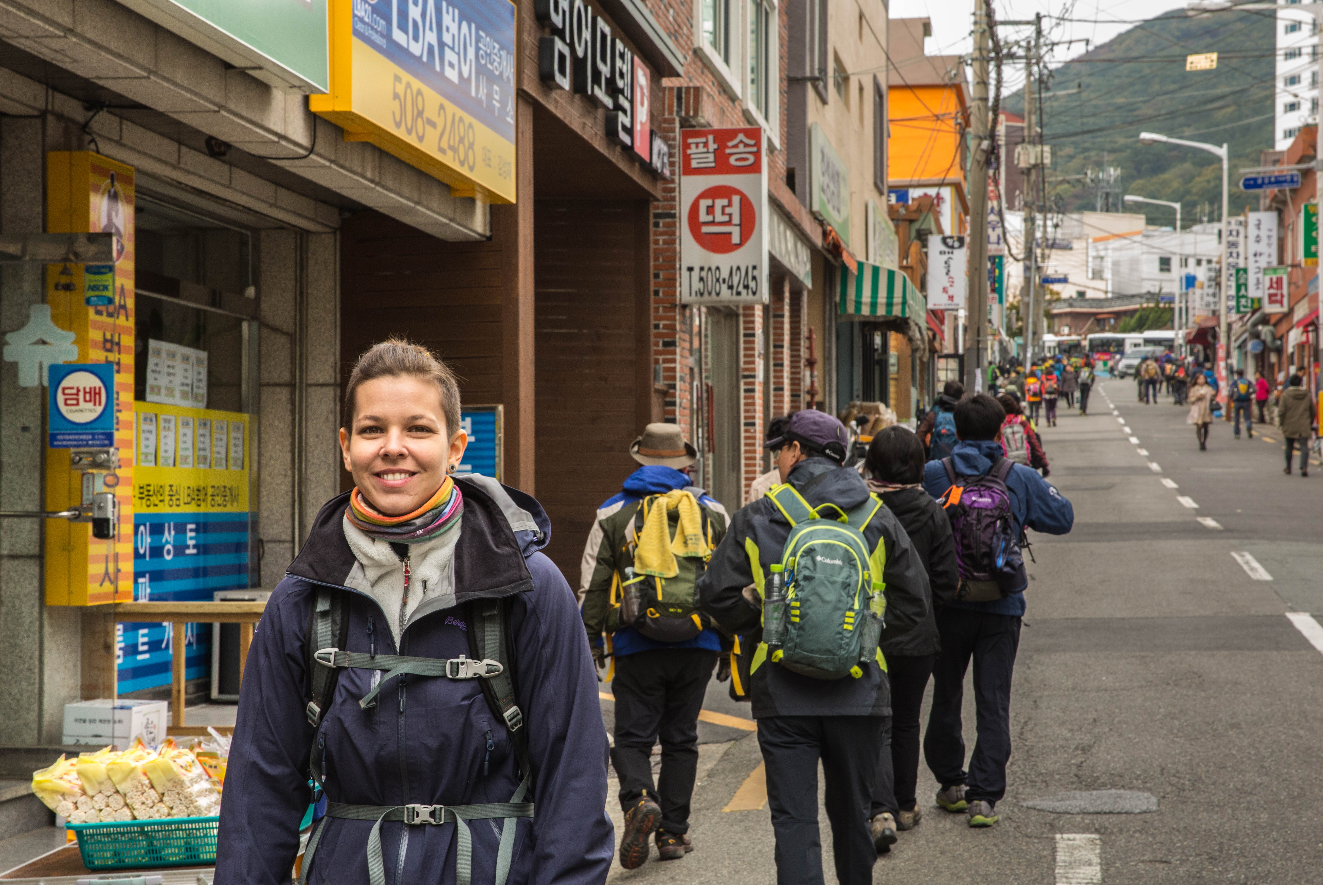
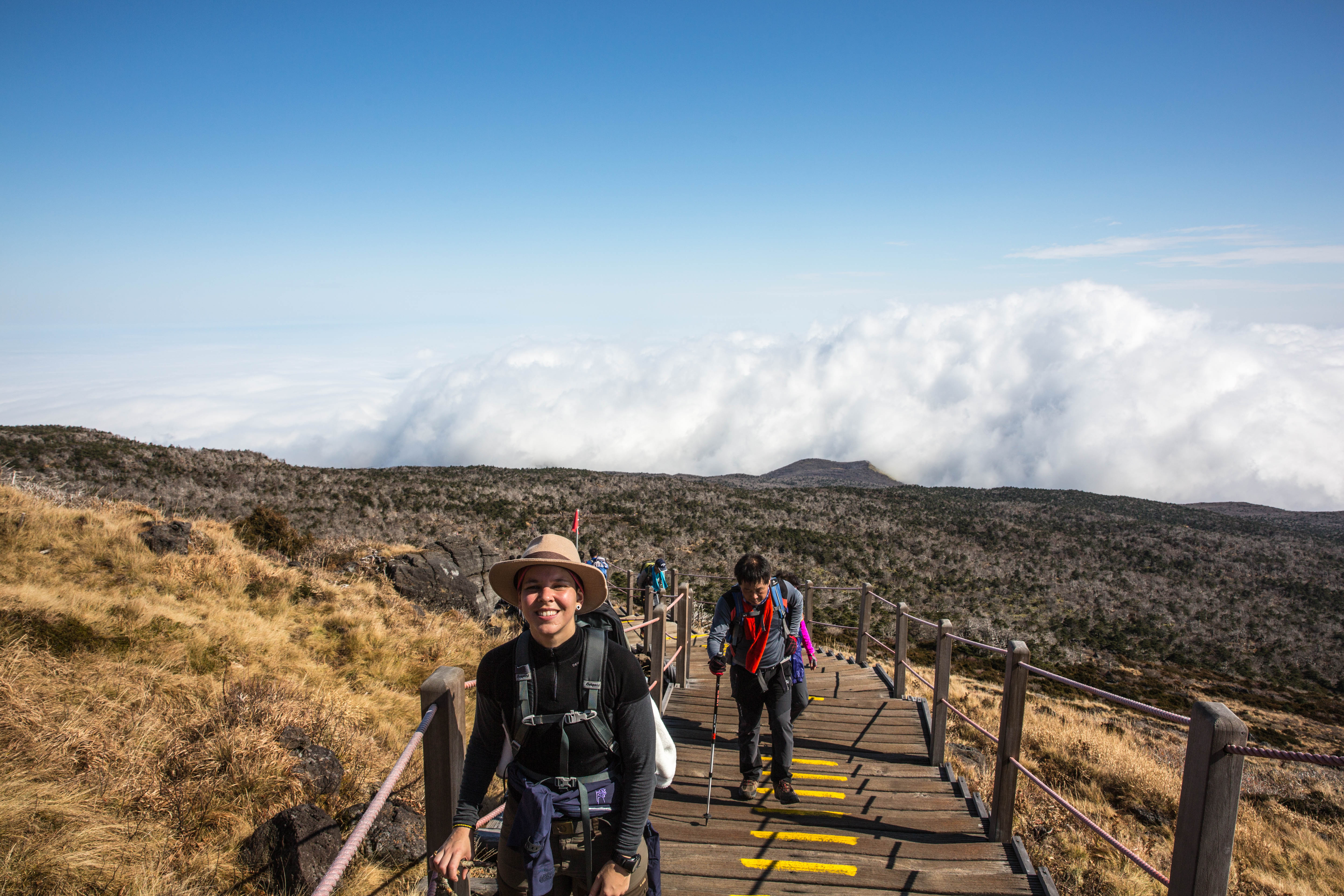
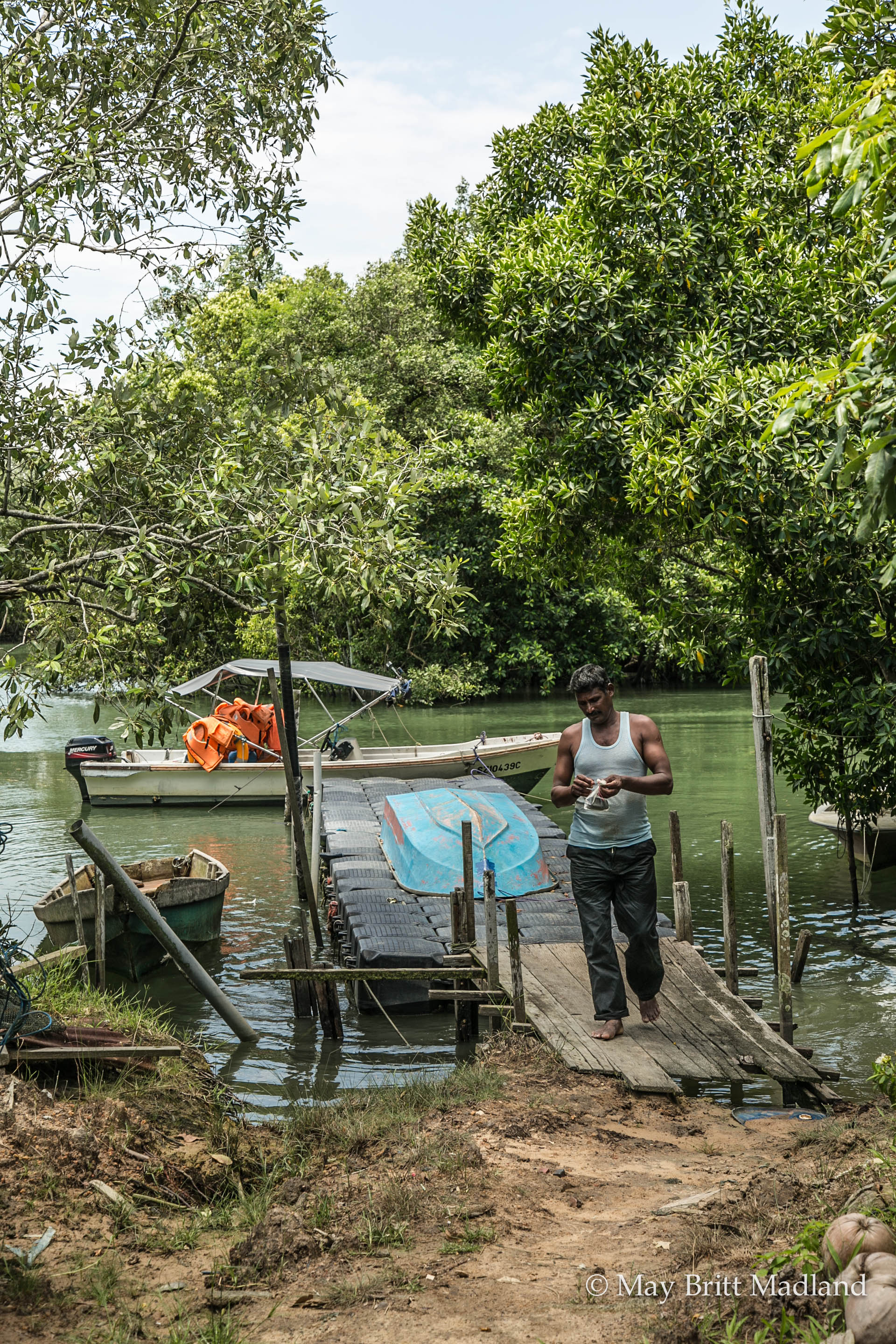
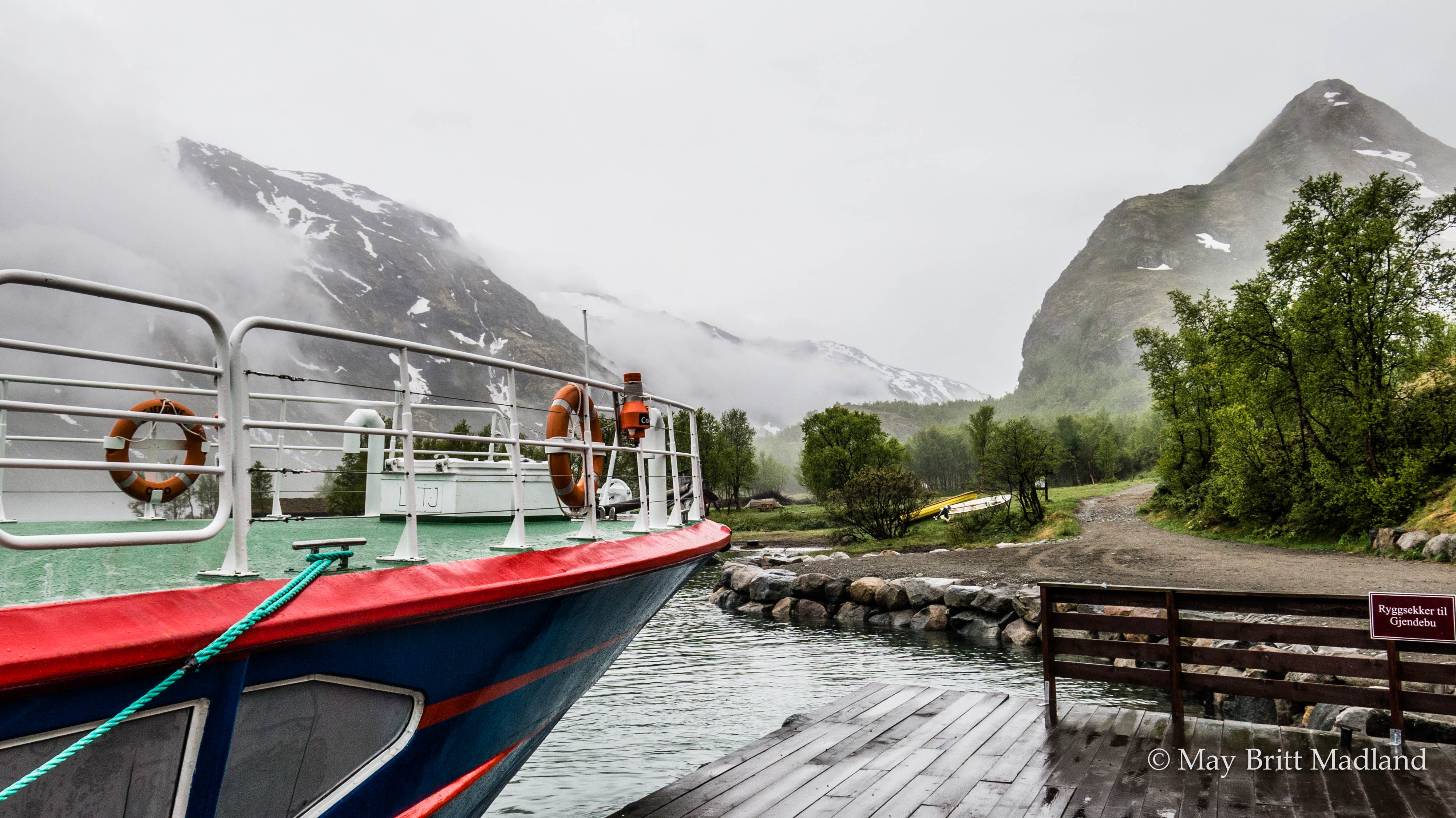
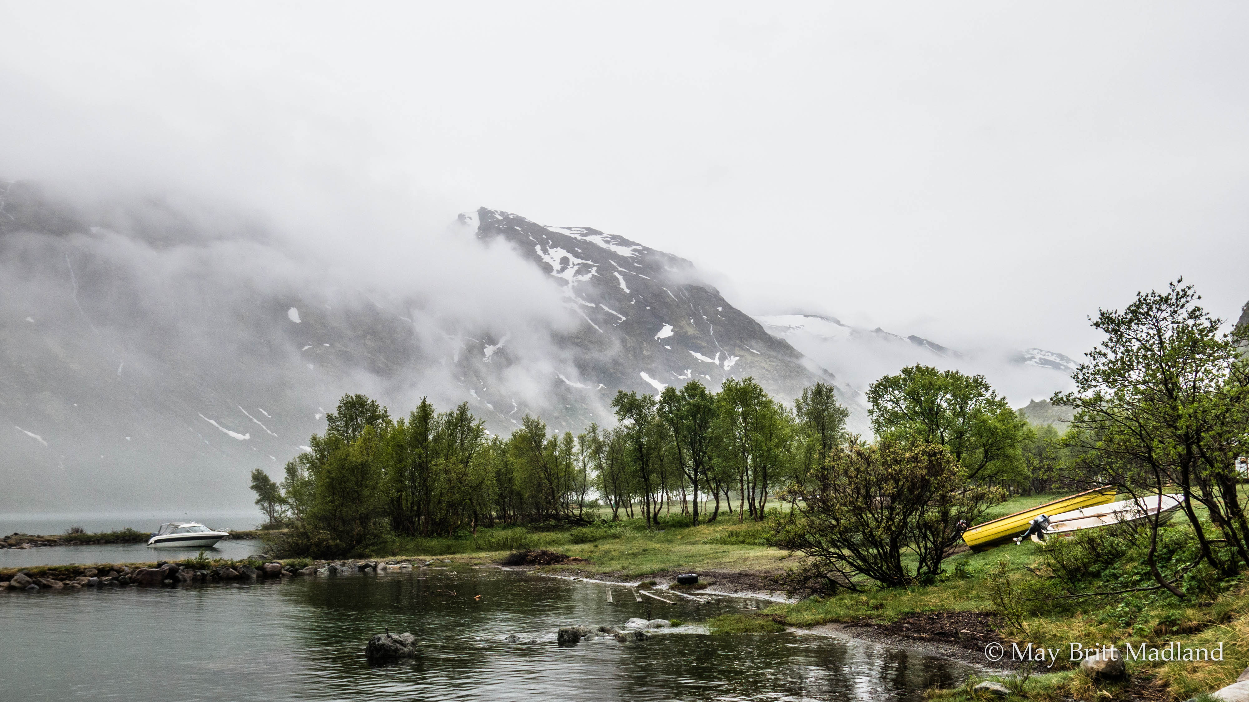
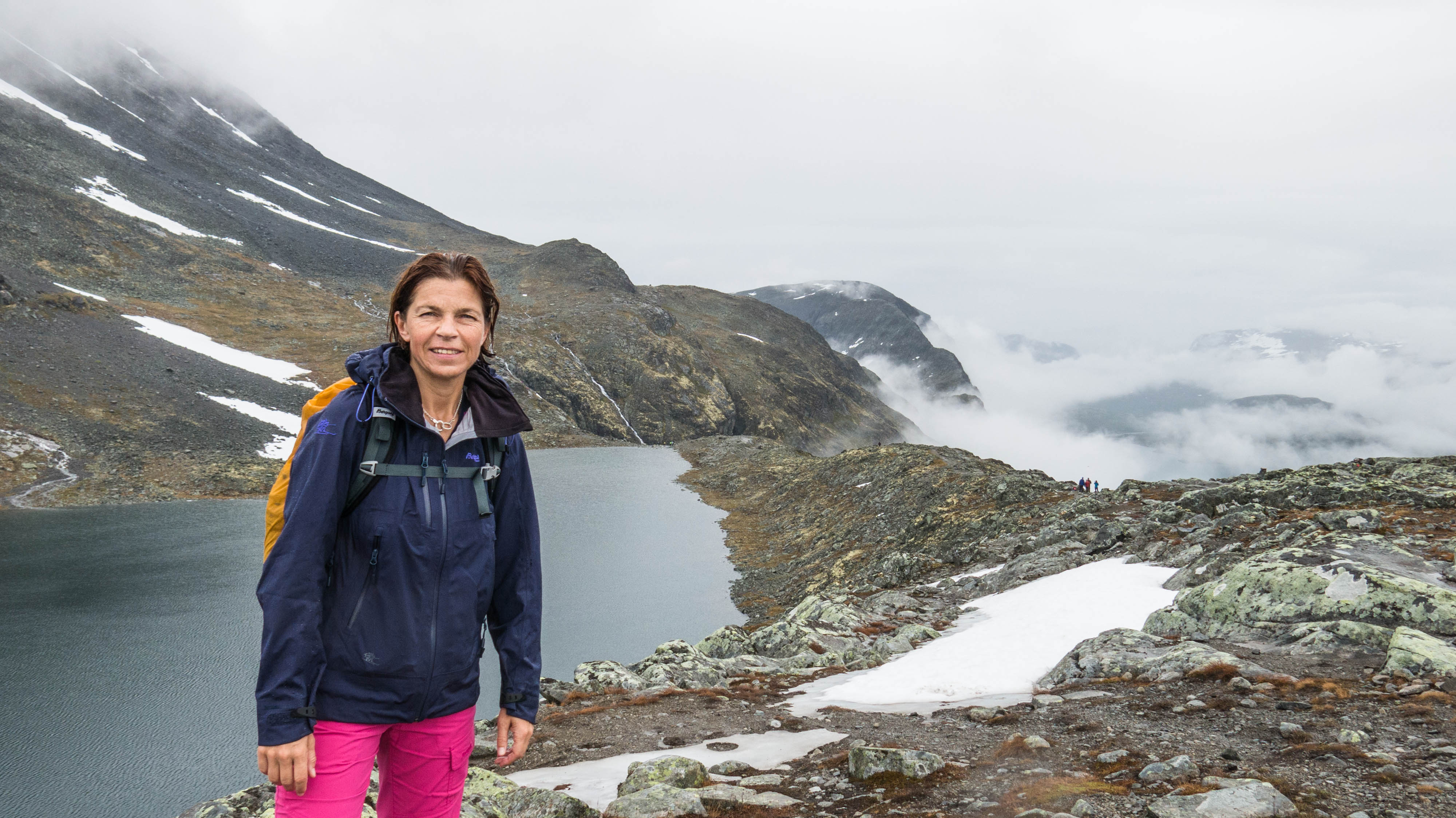
So here I was, just getting off the Ferry from Gjendesheim to Memurubu,  ready to hike the Besseggen Ridge, one of the most famous hiking destinations in Norway and a part of the Jotunheimen national park. Hiking Besseggen you have the option to start at Gjendesheim and do the hike to Memurubu and catch the boat back or do as I did, take the boat to Memurubu and hike back to Gjendesheim. I had been wanted to do this hiking for years so I had checked it out and was sure that the only option for me having fare of heights would be to hike it this way. The drawback hiking it this way is the crowd, as most people prefer hiking it this way. The ferry was crowded but as it was a rainy day and still early in the season, it still had capacity to take more people. The first part is uphill and quite steep so I stopped a few places on the way up to let the crowd pass me and took the the opportunity to take some nice photos and get a photo taken of myself.

IMG_0595  IMG_0601

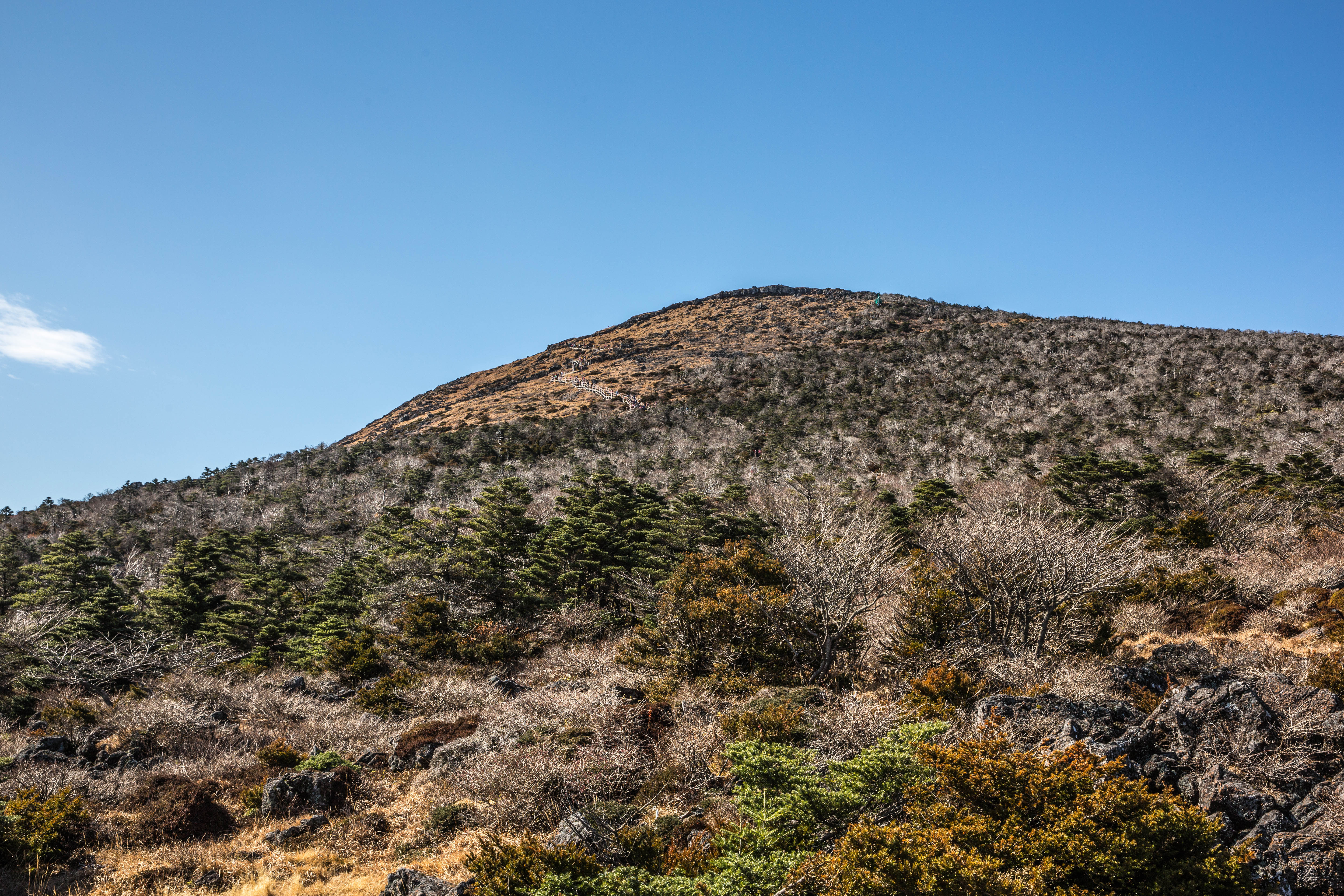
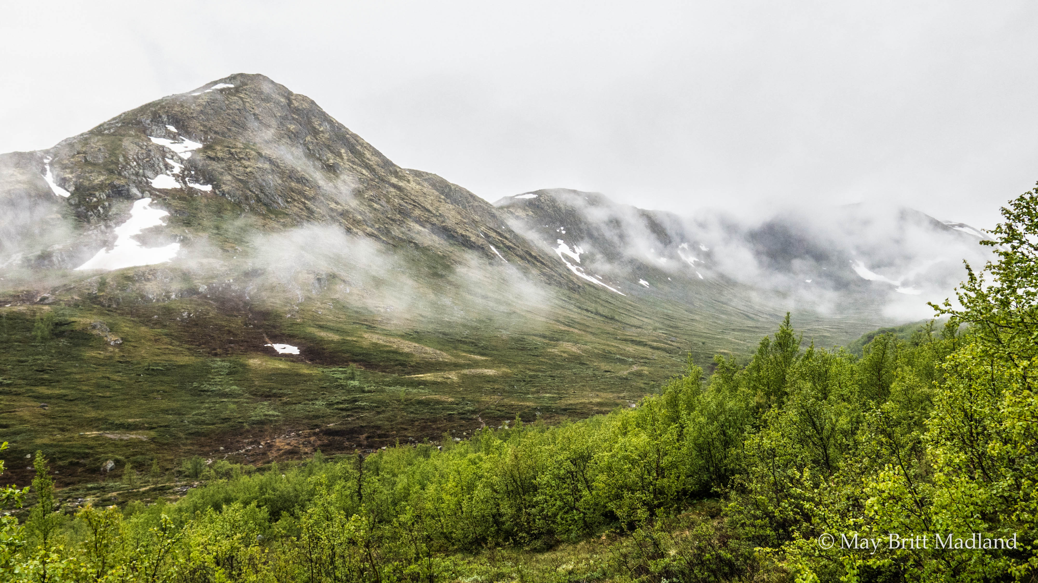
It was June so still snow on the mountain tops.

IMG_0608  IMG_0611

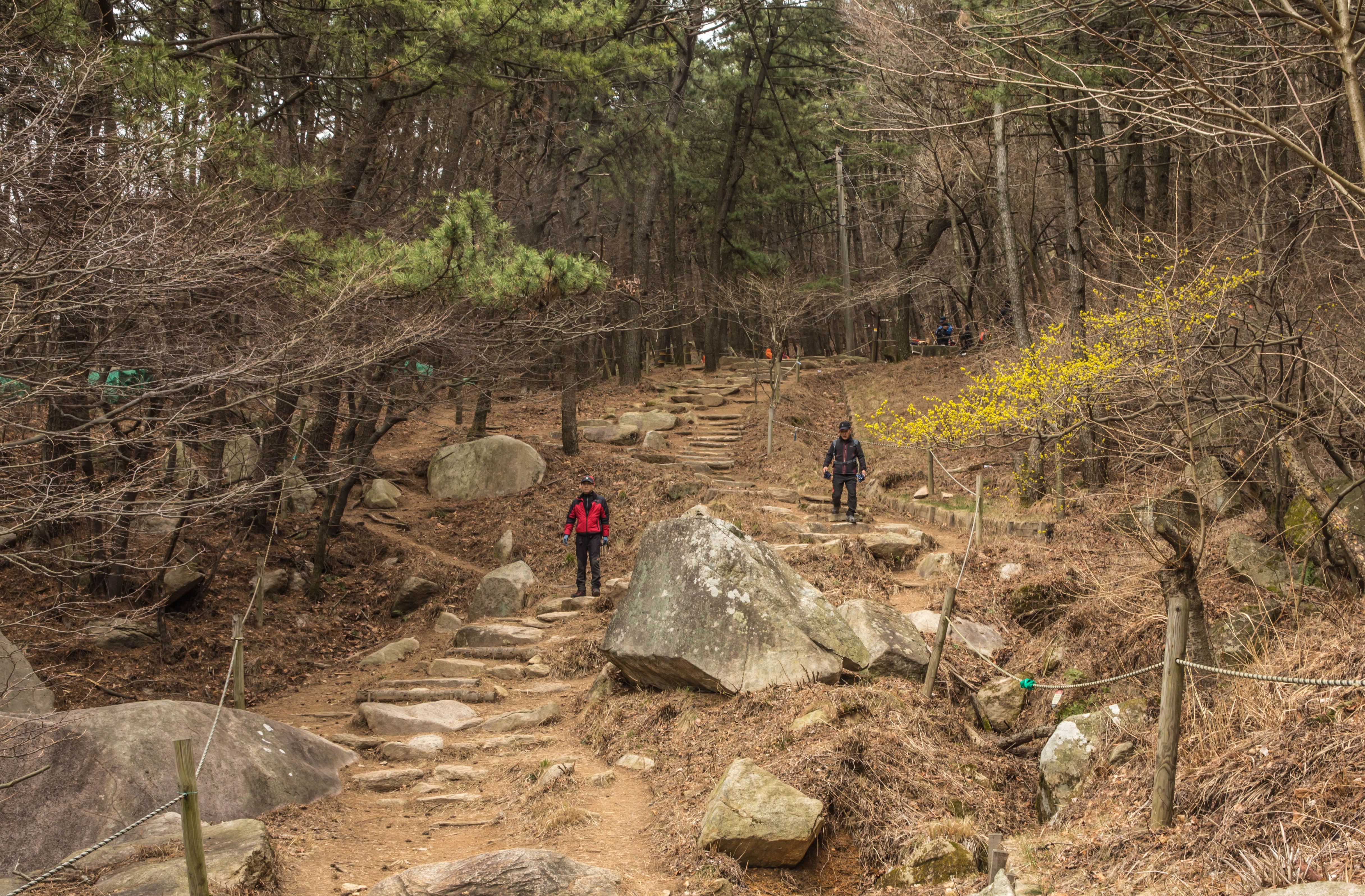
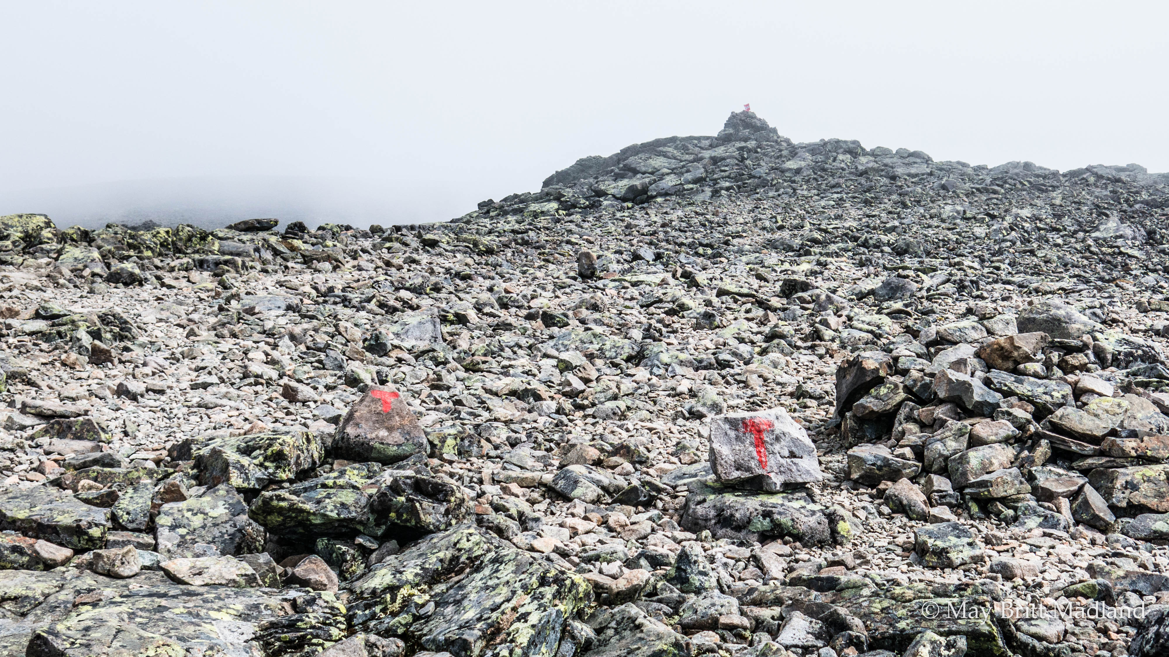
It was clearing up a bit but the fog kept coming and going. The marking of the trail is quite good but as I was hiking alone in this weather I was letting the crowd in front of me but stayed just behind them for the first part uphill. As most of the crowd was making a good effort of walking fast the first part they needed a break at the first top, so I passed them and walked for a long time by myself. I love walking in the mountains just surrounded by the beauty of the nature. So quiet and peaceful, so I kept walking for about an hour almost by myself. Then I could see some people far in front of me. They might have been walking in front of me without me notice it as it was still foggy and it was only when the fog cleared I could see them.

IMG_0618  IMG_0620

The group in front of me looked like being 2 couples so I just kept going in this tempo and stayed at a distance, but close enough to see them. It felt more comfortable as I know the Norwegian mountains and how fast the weather can change.

IMG_0621  IMG_0627

IMG_0628  IMG_0632

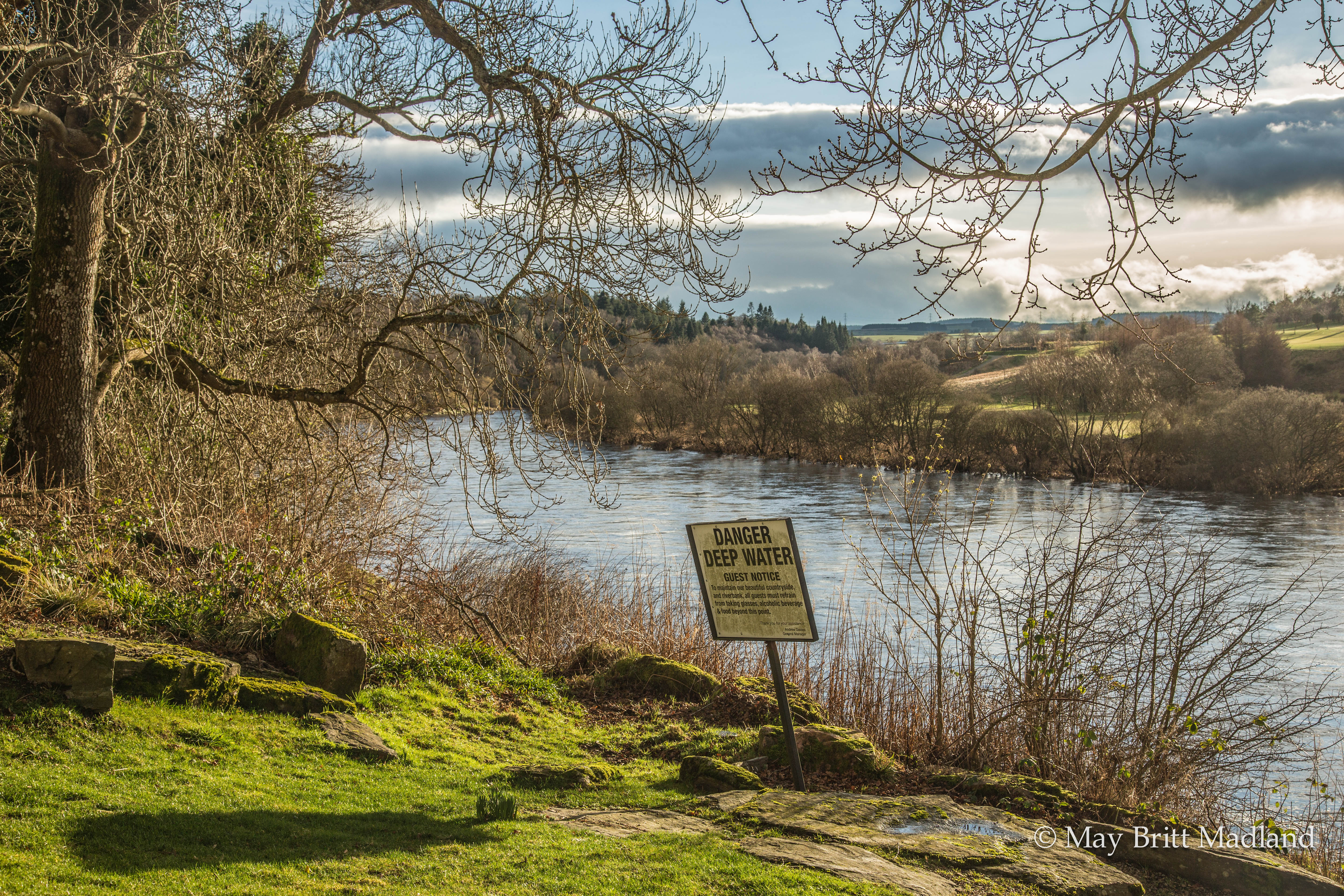
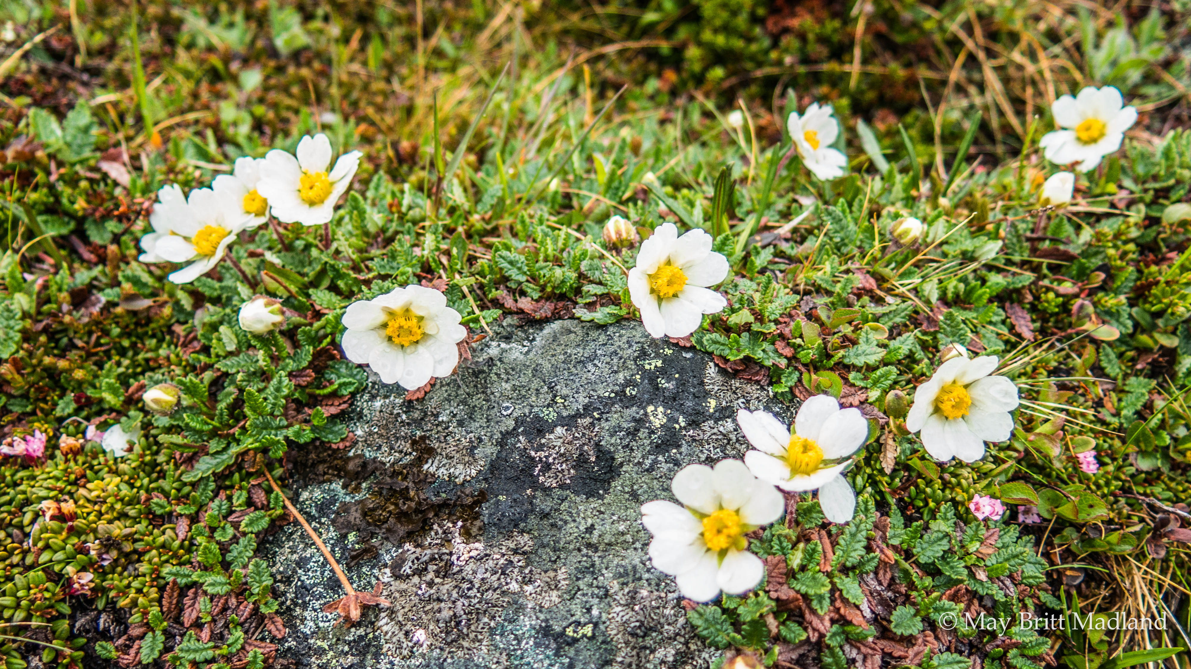
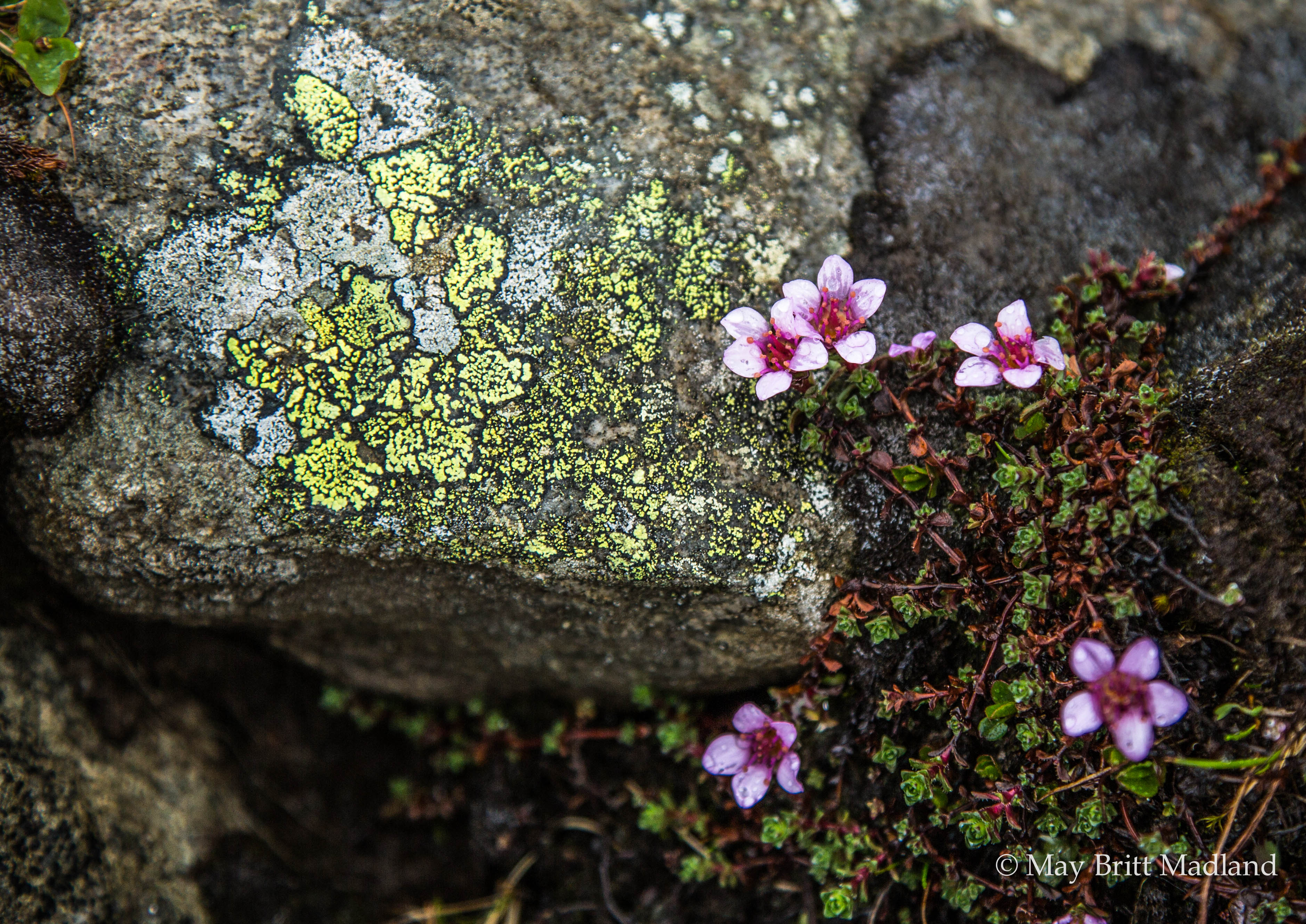
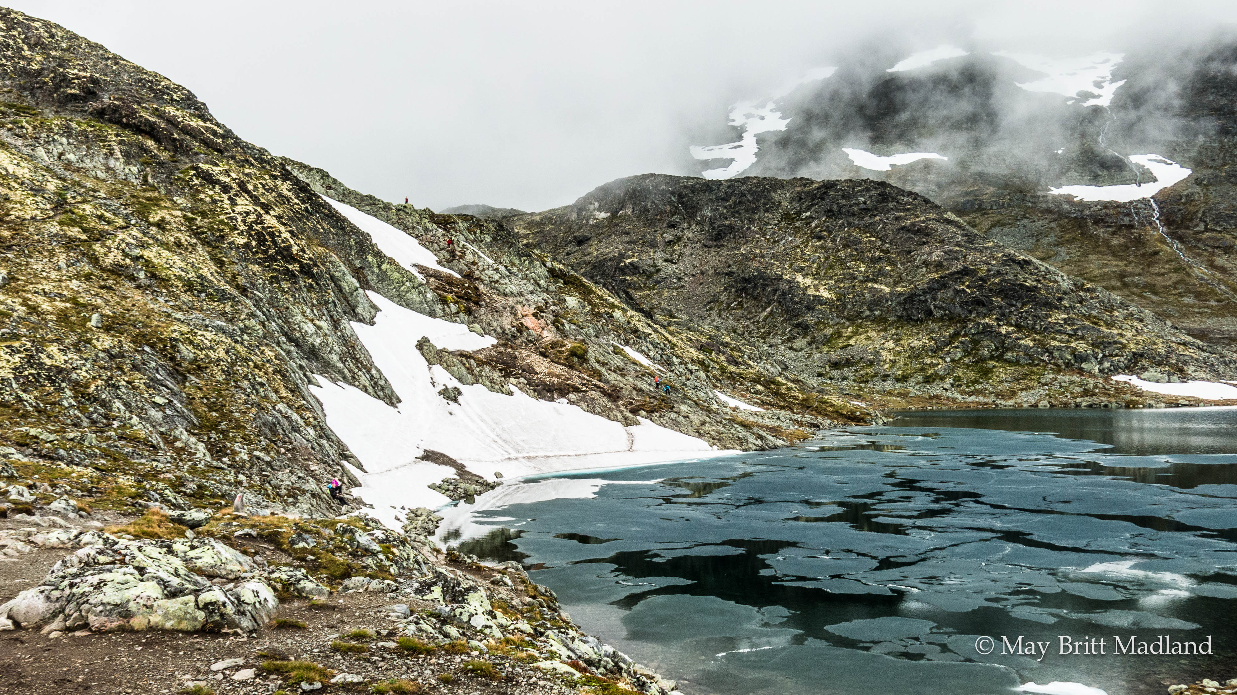
The snow had been melting so the level of the water was quite high, something I would experience later on the trail as well,  so at edge of the lake I had to balance on the stones for a part and managed quite well without getting wet on my shoes. I was enjoying the beauty of the nature around me and the amazing view.

_60A9728  IMG_0640

_60A9739   _60A9738

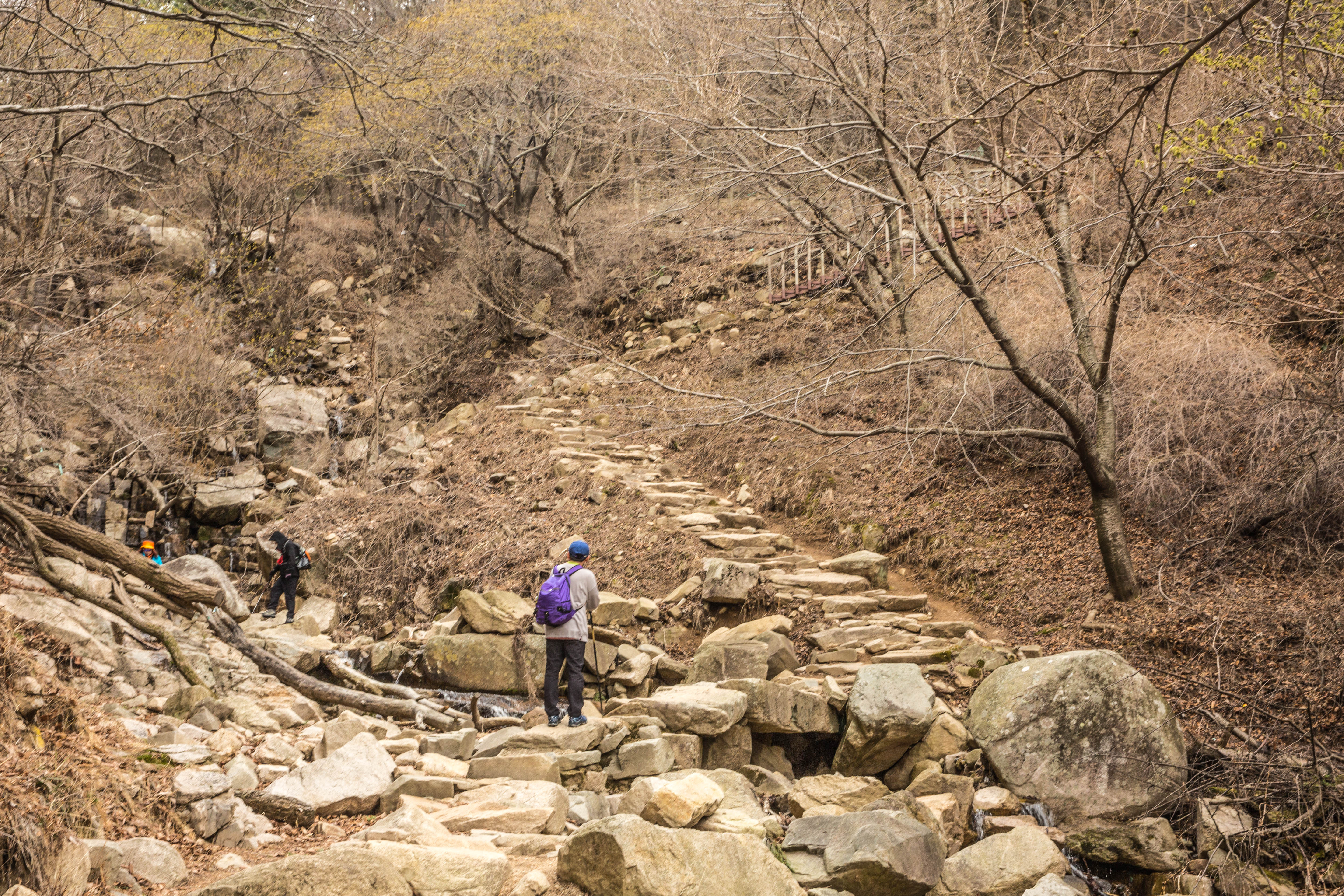
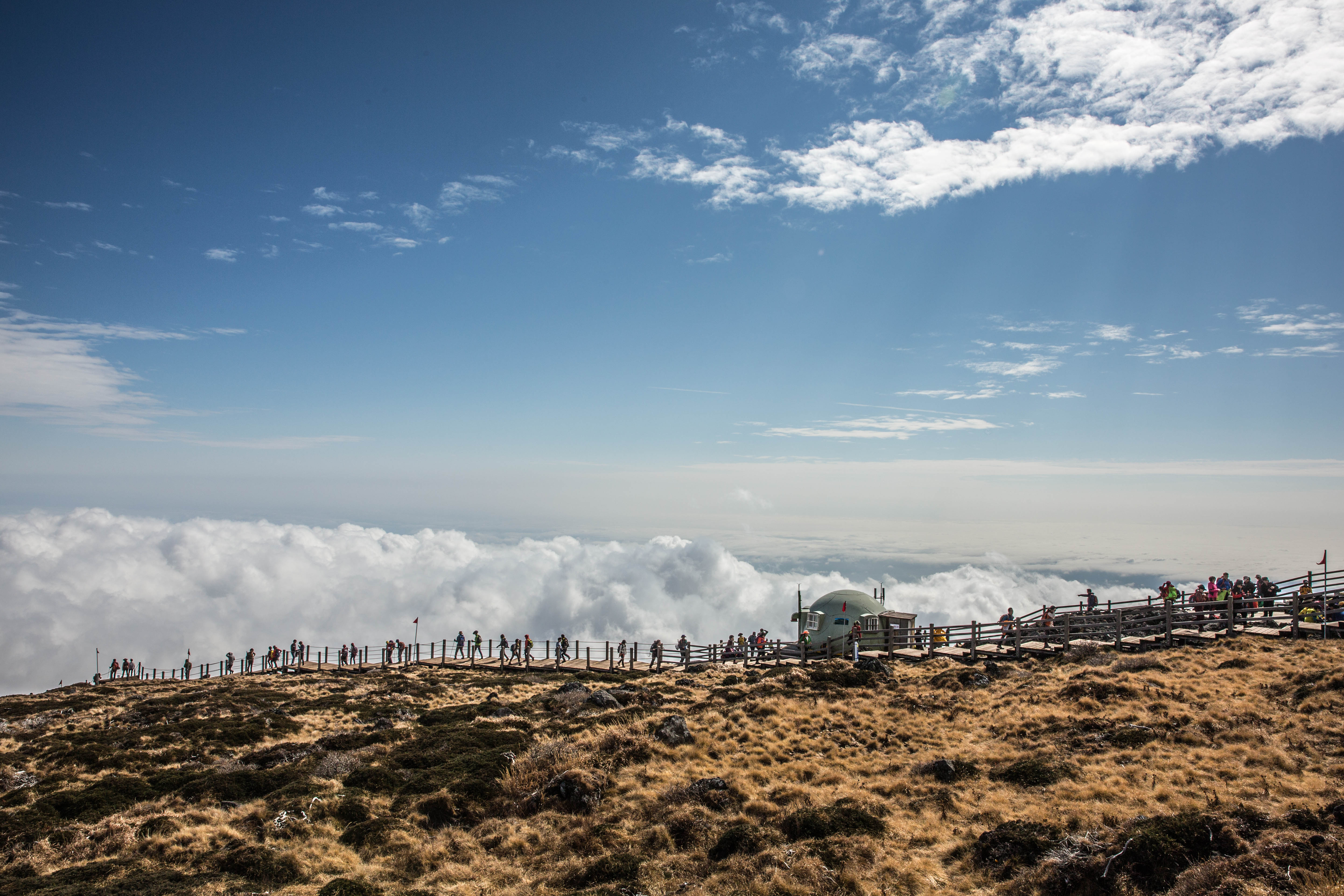
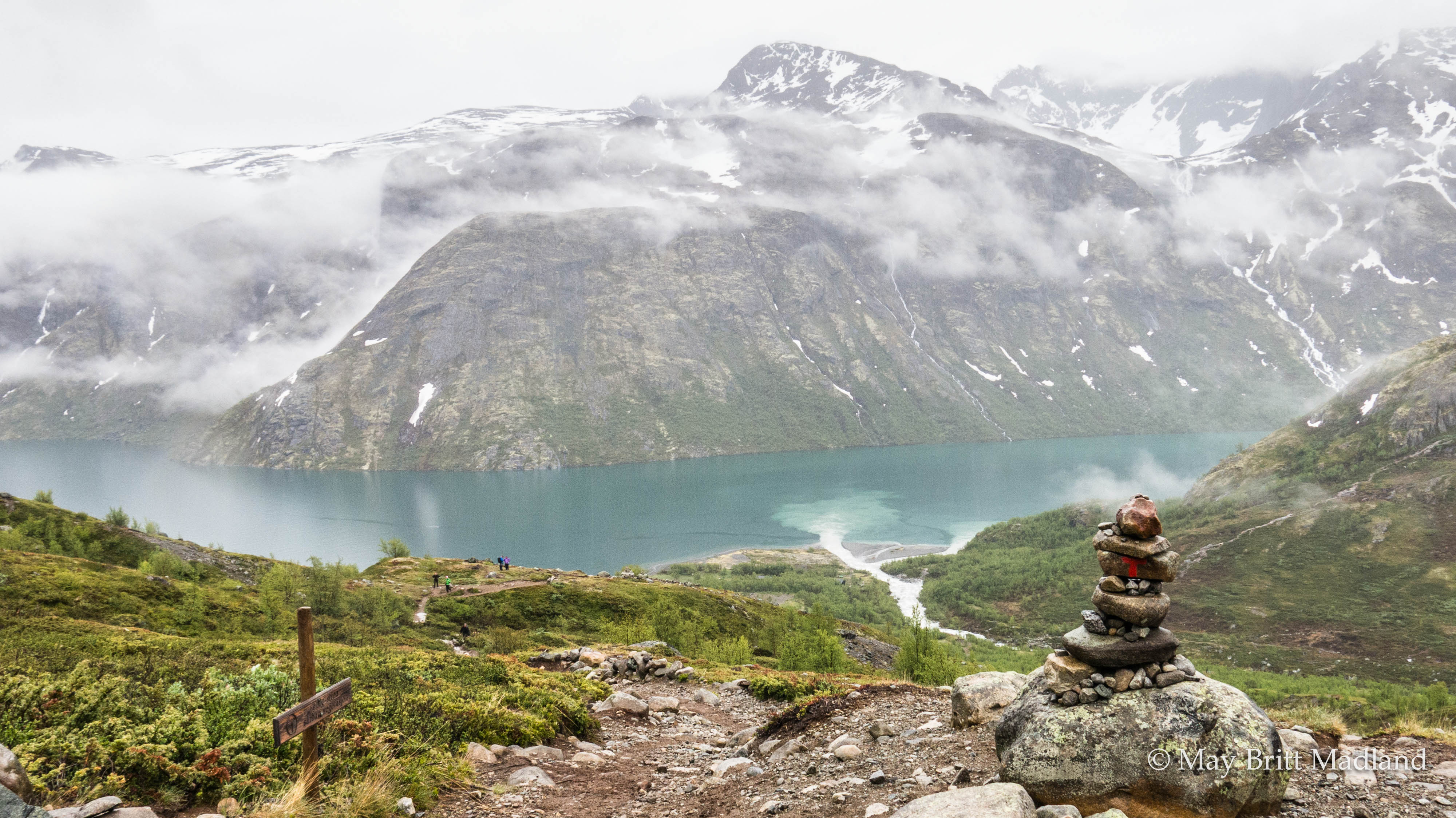
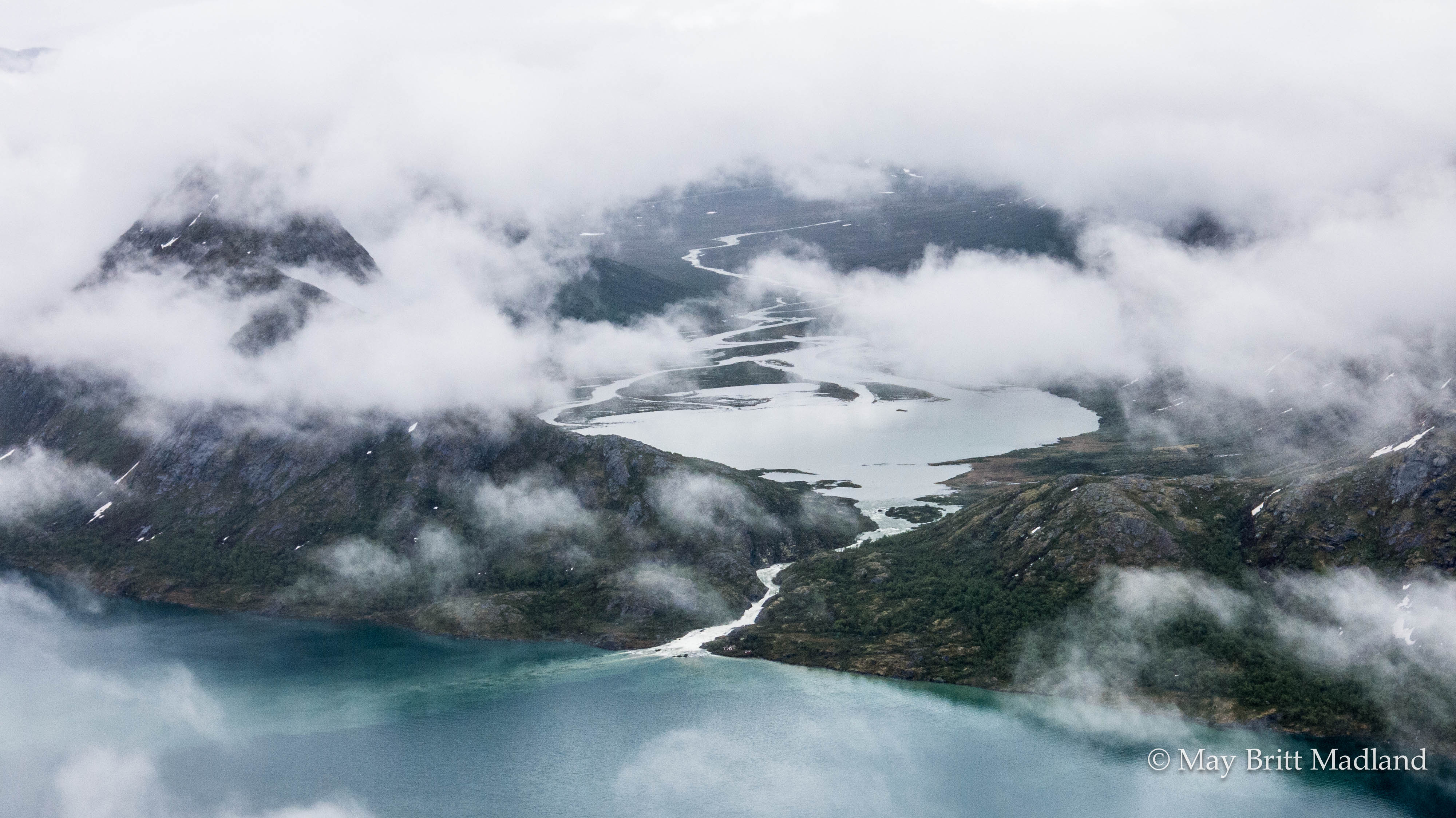
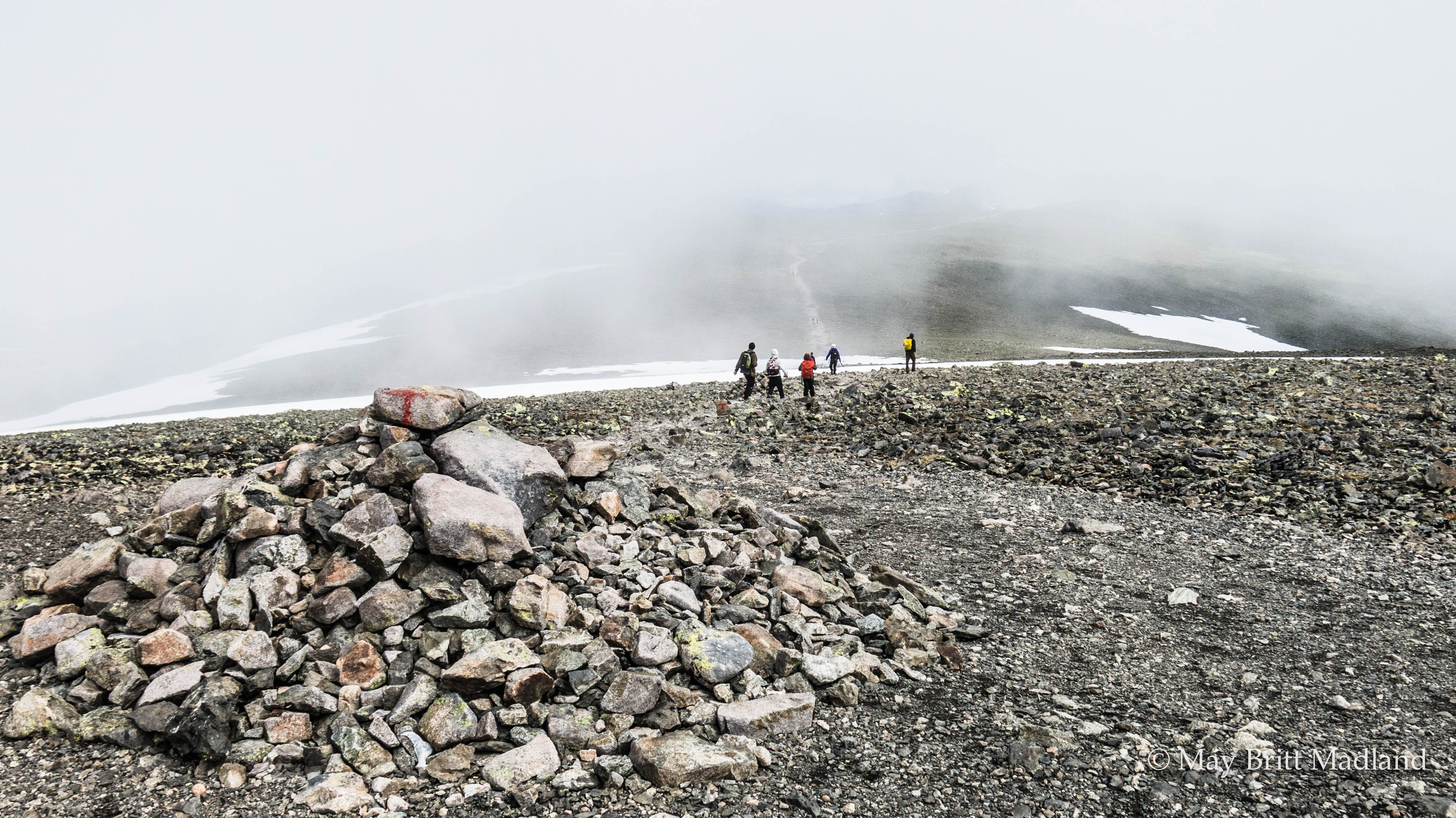
Arriving at Lake Bessvatnet it was still foggy but the rain had stopped. It is quite a challenge to get down this part but I just took it easy and tried to follow the people in front of me and when down there was a track in the snow to follow so it got easier.

IMG_0642  IMG_0643

IMG_0651  IMG_0648

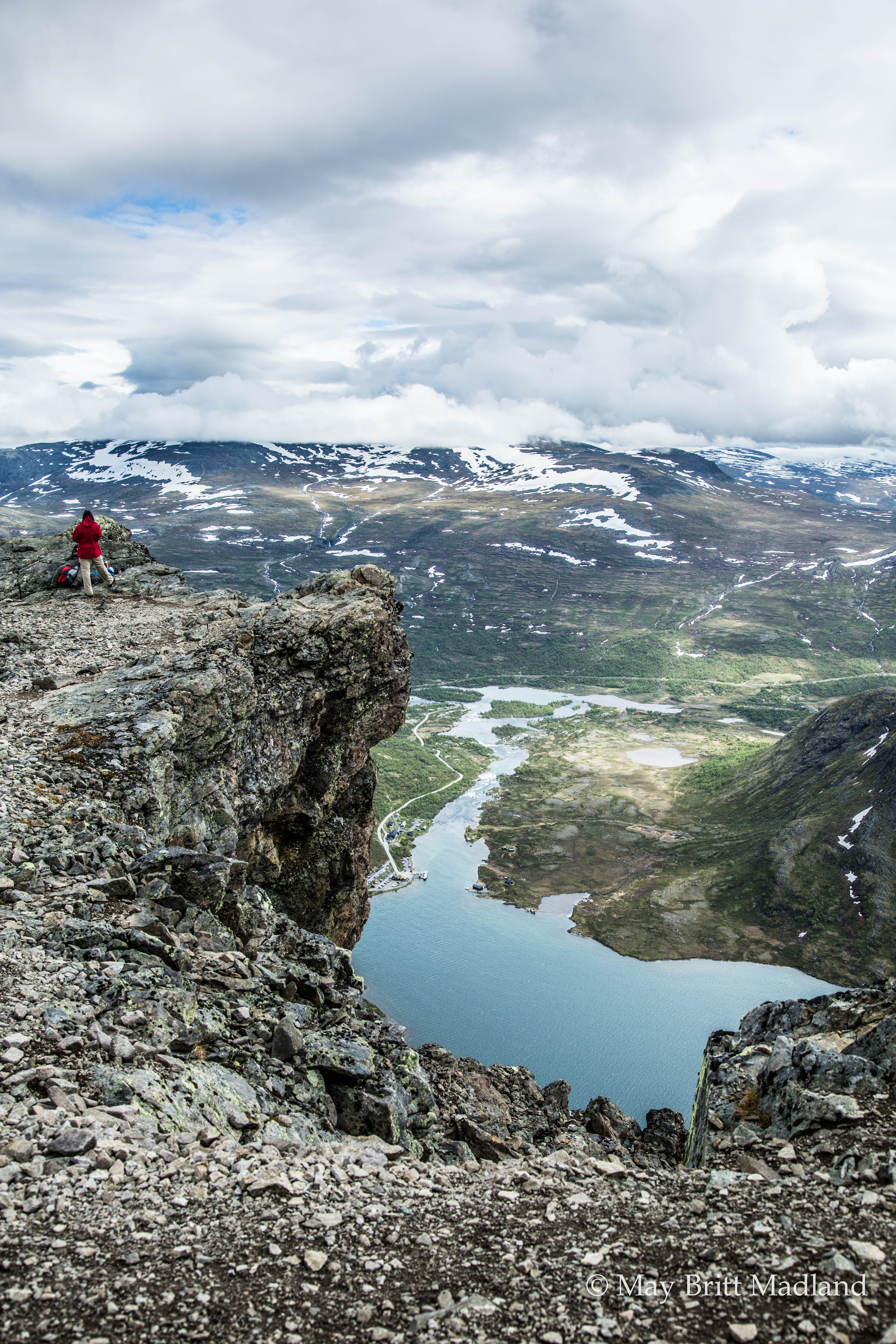
I reached the point of the trail where I had Bessvatnet at one side and Lake Gjende at the other side. So then I new I was about half way. Looking at the watch I had kept a good pace.  And now was the time where the most challenging part start. At least for me it was. Just looking up seeing people climbing made me dizzy and I started considering if I would be able to make it. Options would be going back and well that was not an option. Other option could be to follow the Bessvatnet and see if i could get up at some other point to avoid the steep climbing, but sitting having my lunch break and evaluating it I ended up with the challenging option to just follow the track and hope for the best.

IMG_0656  IMG_0659

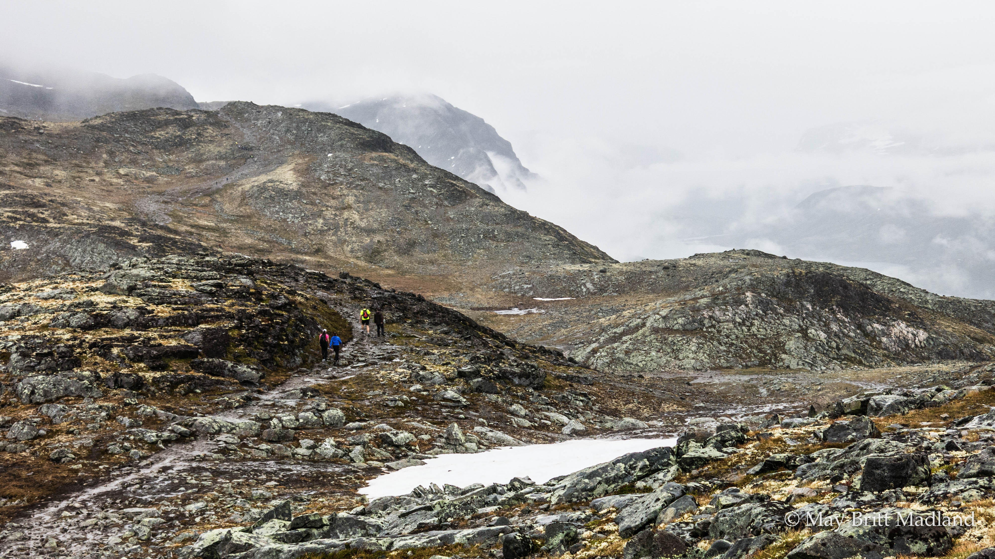
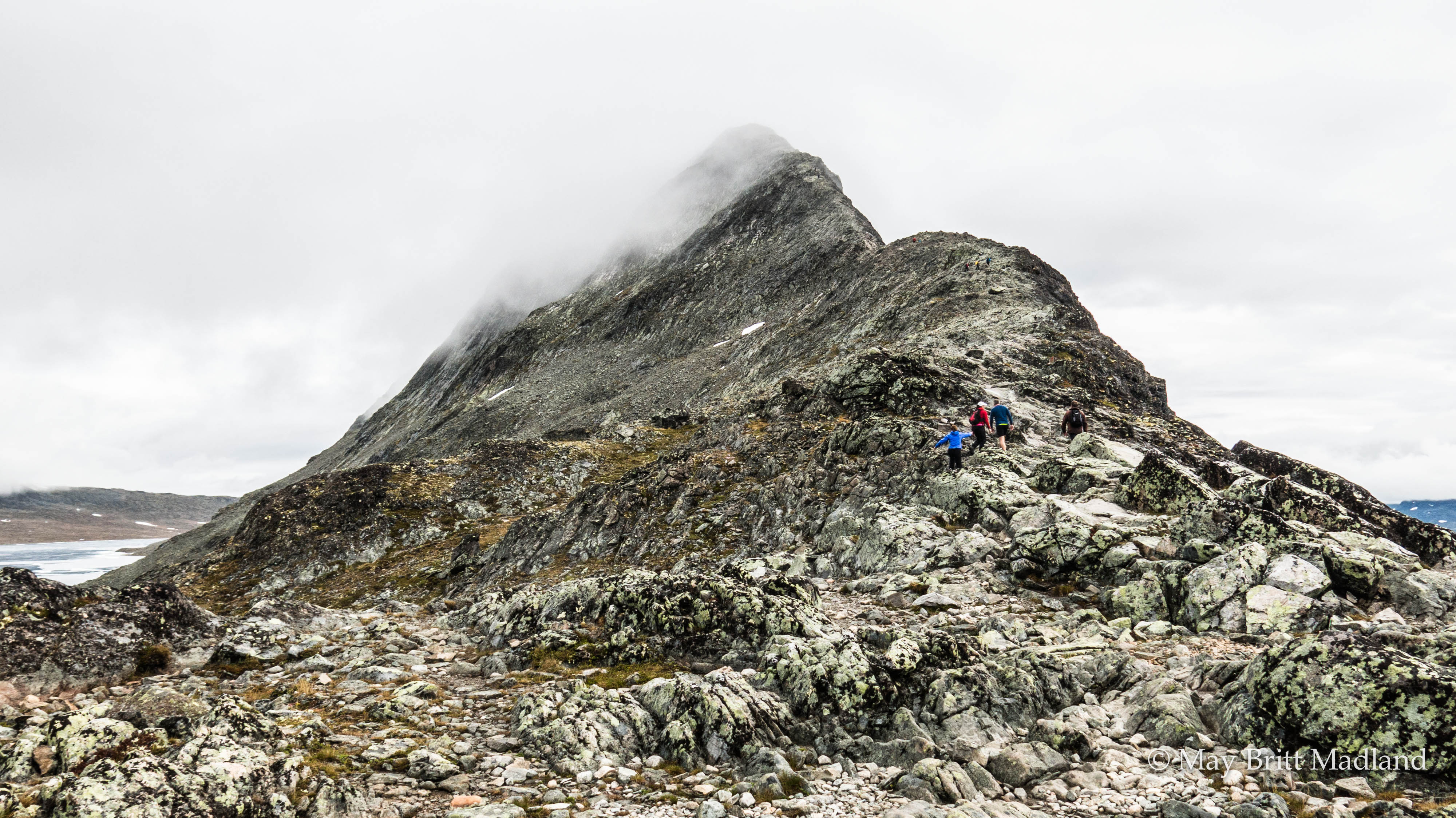
I was still a step behind the 2 couples that had been in front of me for the most of the trip. and at this stage I was consider this as being quite clever as now I could follow where they where climbing and hopefully they would choose the best route and make it easier for me. So I was thinking if they can do it then I can do it. And as long as i don’t look down before I feel i am on safe ground this will go well. One step at a time. Finding my grip, the right place to put my feet and push myself up. At one point I passed a couple climbing down. They where asking me if it was far and well for me it was difficult to say as I was not looking behind, at least trying my best not to, so looking up I told them that they where probably half way. The women almost started crying telling me she would never do this again. It was the most scary thing she had done and she was not sure she would make it. I tried my best to tell her that the part until here was not so bad and she seamed more relaxed. I continued climbing up, trying not to look down but at some parts I was just at the edge so difficult not to look down. I just took a deep breath and continued. So far so good. I even challenged myself to turn around a few times to take some photos.

IMG_0662 IMG_0663

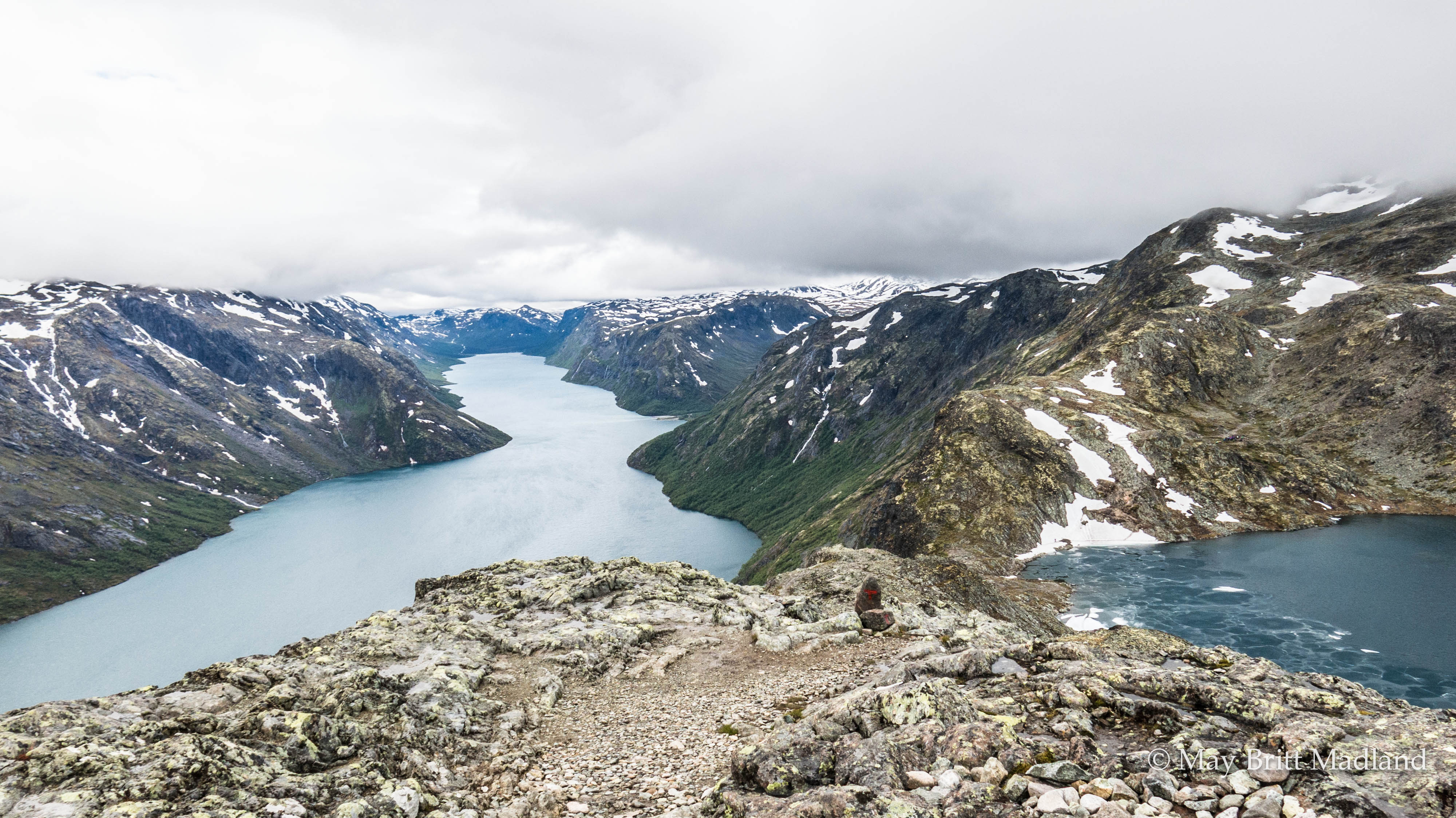
The 2 couples was still in front of me and I could see that one of them started to have some problems with the height as well. I was just next to them now and one of the girl told me she had problems with fare of height but had overcome it, but now it came back. But we all managed to reach the top and could finally look back en enjoy the beautiful view. They made a break at this point as one of the guy was not in the best shape and he told me this part was more challenging that he had imagined.

IMG_0664

I took some photos and enjoyed the view and continued my way back to the starting point where I had taken the boat this morning. The rest of the trip was easy walking as most was flat or downhill.

IMG_0672  IMG_0669

IMG_0676  IMG_0675

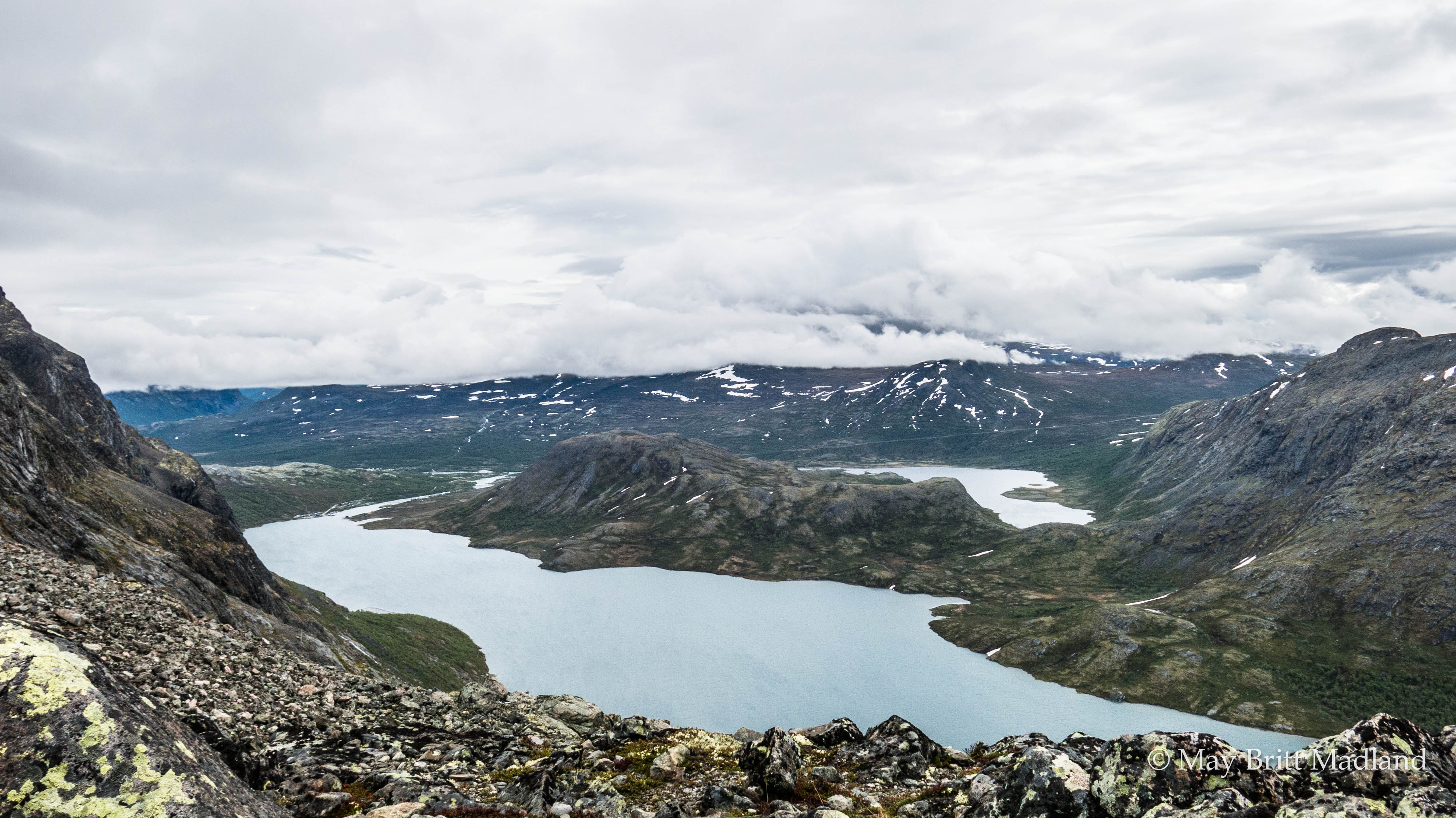
As I kept walking I started to get the view down to the Gjendeheim where I had slept the night before. I stopped took some photos and just enjoyed the view.

_60A9761  _60A9787

_60A9757

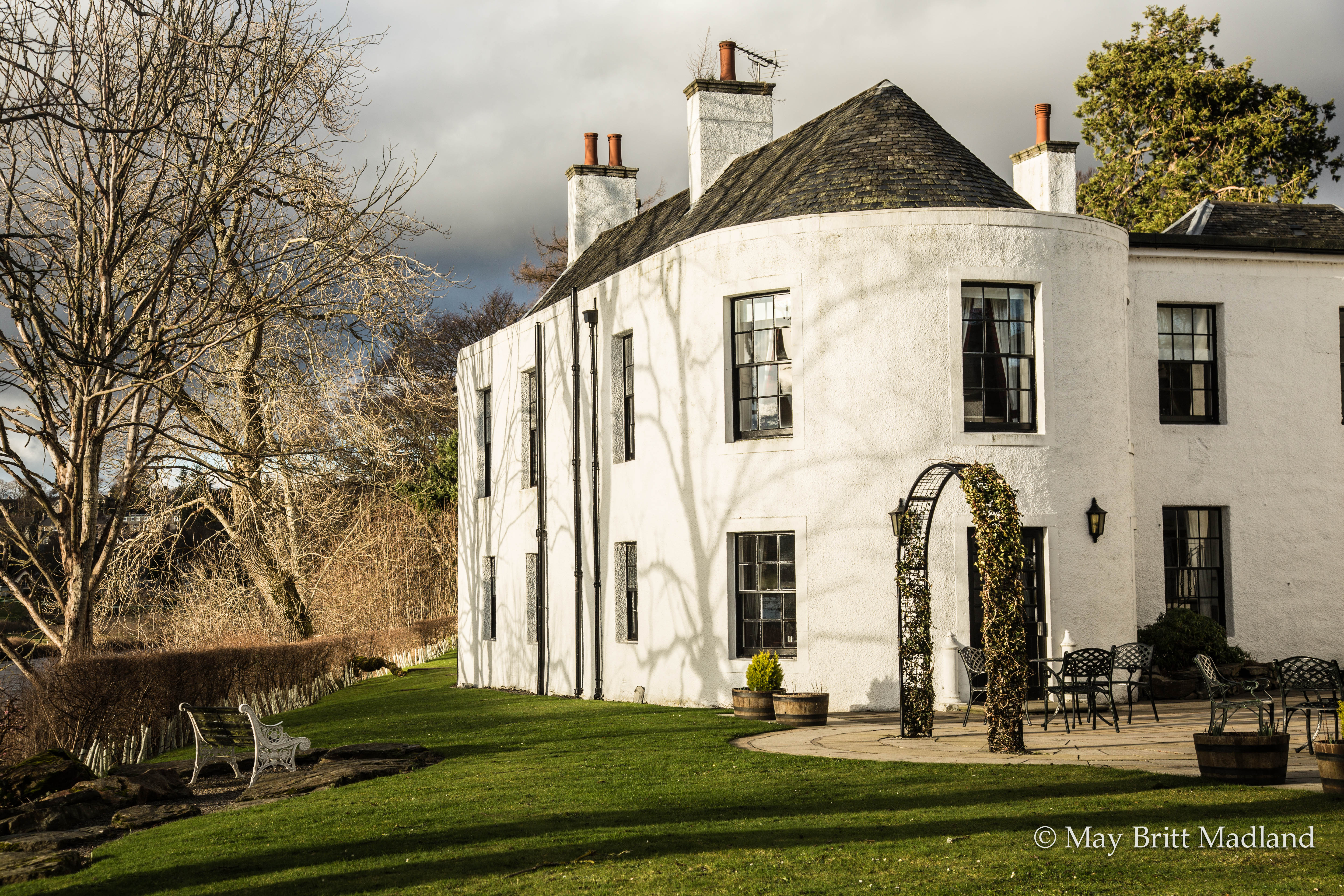
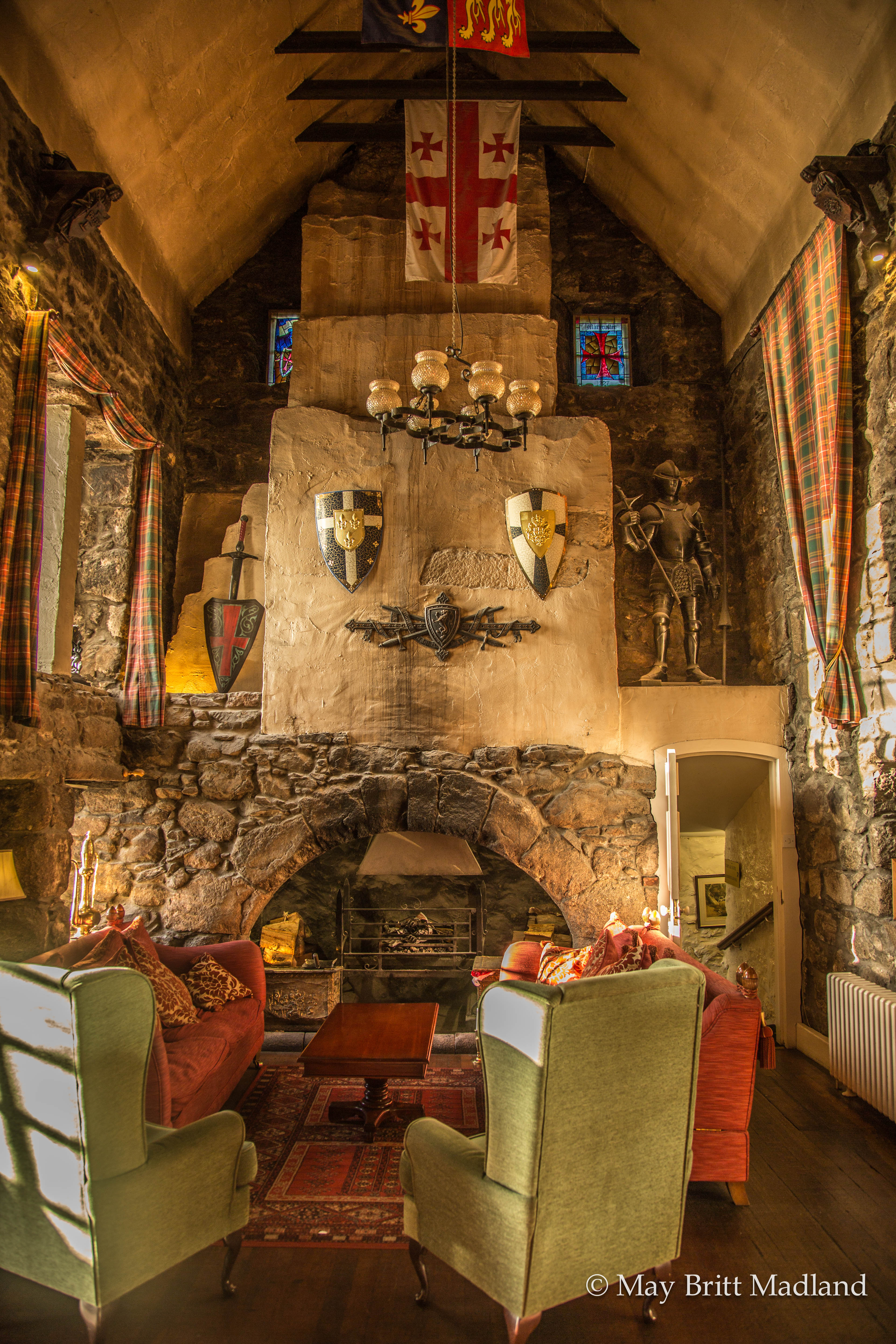
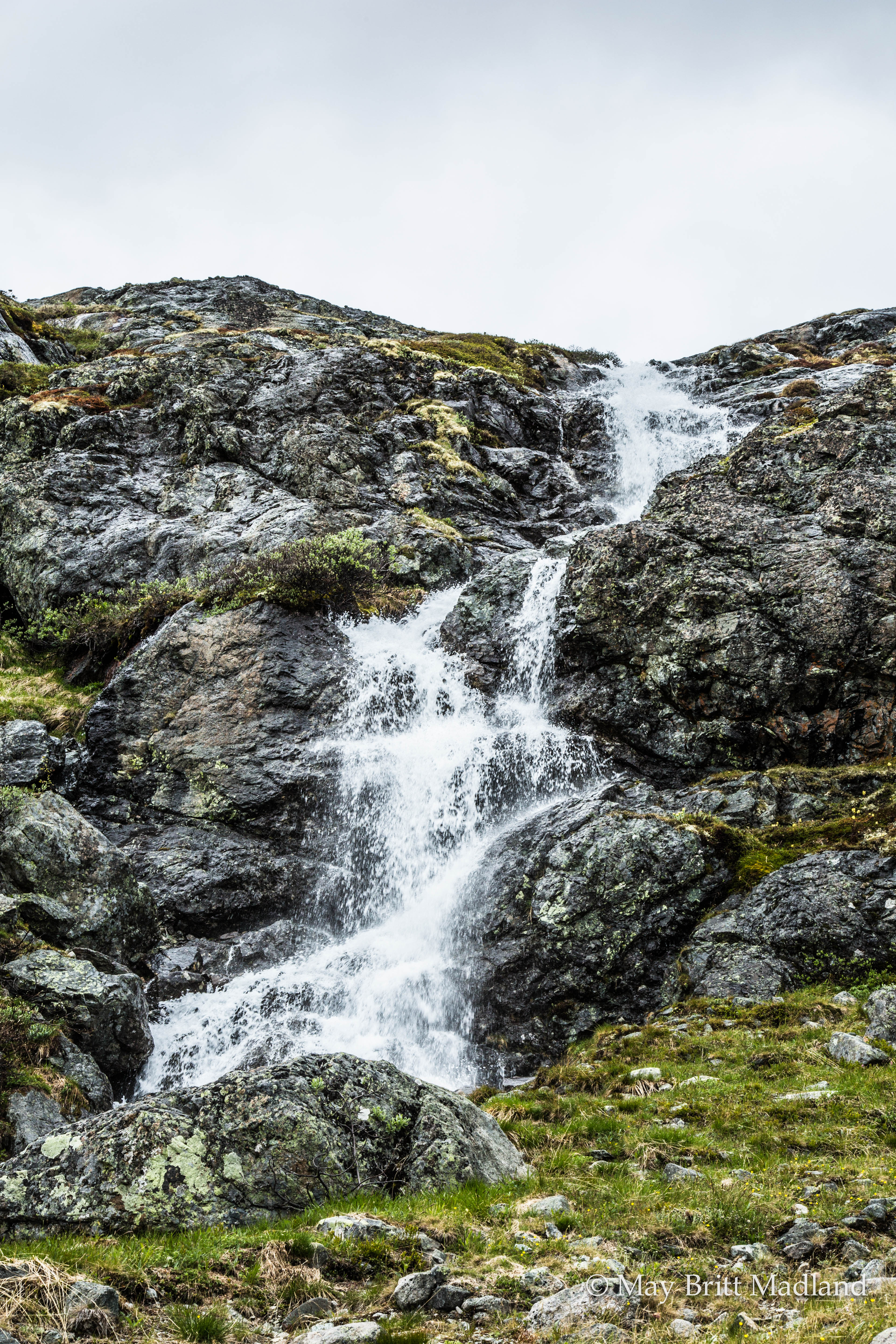
At a few places going down I had to watch out. At one point the waterfall was quite heavy and had taken away a part of the trail so was difficult to cross and I was trying not to get my shoes under the water. I was close to  Gjendesheim and could see it at a short distance and I was thinking wow I did it and now I could understand why it is one of the most popular hiking destinations in Norway. I got down, picked up my car, feeling tired but in a good way and was happy I did the hike even if the weather was not the best. Looking at the watch I had spent about 5 hours from I got of the boat and reaching back to Gjendesheim. Not bad at all and now being tired and hungry I was looking forward to reaching my next destination that would be the Elveseter hotel, enjoying a good dinner with some good wine before my next hiking adventure the next day before heading back to Oslo.

IMG_0683

To get to Gjendeheim I rented a car in Oslo. I stayed over at Gjendesheim so a good thing is to book in front to make sure to get a room. It can be quite busy during the peak season.

When to go:
The main summer season in the Norwegian mountains is July and August.  These months will be your best bet for sunny, warm days, but be prepared for all kind of weather.

Getting there:
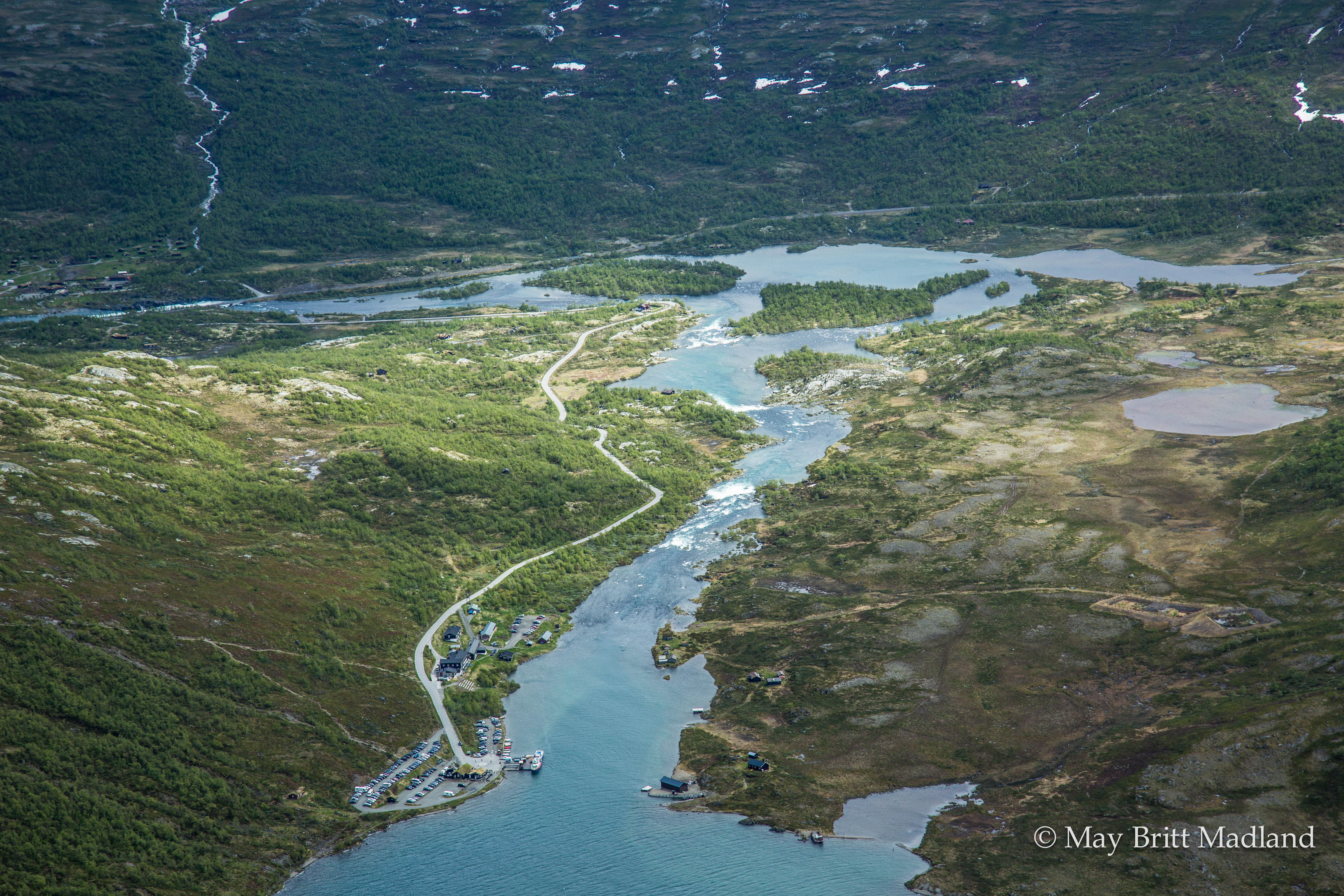
The start or finish of the Besseggen ridge is located at Gjendesheim, on the eastern end of lake Gjende and Jotunheimen national park itself.  Here you’ll find a full service DNT hut, a small shop/cafe, toilets, the ferry boat, and parking area.

By Bus:
Several busses travel to Gjendesheim daily.  The two options are to travel via Fagernes (to/from Oslo) in the south.  To the north the bus travels to Vagamo where one can transfer east to Otta and the train, or continue west through the fjords.

By Train:
There is no direct train link to Jotunheimen national park.  If traveling by train, say from Trondheim in the north, exit at Otta, where you will have to take the bus to Vagamo, then on to Gjendesheim.  The bus/train does not always meet at a convenient time, so be sure to check schedules.

Transportation links:
https://www.nsb.no/ – Train info
http://www.nor-way.no/ – Bus info
http://www.ruteinfo.no/ – Local bus info
http://gjende.no/ – Ferry boat info

Other Useful links:
http://www.turistforeningen.no/ – The Norwegian trekking association
http://www.yr.no/ – Norwegian weather