nature

Seokbulsa Temple

While searching for places to hike in Busan, I ended up with Seokbulsa Temple, so Sunday morning i put on my hiking boots and set out to find this Buddhist temple.

_60A1868  _60A1862

As for most things in Korea it is difficult to find any info on how to get to the different places so after trying to search online not finding much of what i was looking for I checked at the hotel lobby and got them to write the name of the temple down in Korean for me. It usually comes in handy when you need to ask people for direction and I was sure I would need to ask along the way.

_60A1816  _60A1819

_60A1822  _60A1825

Starting at Geumgang Park I took the cable car up the mountain and found my way to the Fortress South Gate. It was a cloudy day and still cold in the air but quite a lot of hikers out on the trails.

_60A1829  _60A1832

From the south gate I turned left and headed downhill passing through a mountain Village.

_60A1828 _60A1833 _60A1848

_60A1839  _60A1835

At this point i had to ask for the direction as there were different paths leading in different directions. The locals are friendly and always willing to help so they pointed out the direction and I continued downhill.

_60A1838  _60A1845

_60A1851  _60A1858

Entering the paved road I was not to sure what direction to go as the road was leading in both directions so I had to choose to go uphill or downhill. I choose to head uphill as I assumed the temple would be somewhere up in the mountain and along the way i meet some people that confirmed i was heading in the right direction and about 20 min later I  reached the gate of the temple.

_60A1854  _60A1864

Carved into rock, Seokbulsa includes massive etched Buddhist images and is a truly powerful experience. It must be one of Korea’s best kept secrets.

_60A1867  _60A1871

While other temples such as Beomeosa that is over crowded with visitors this temple only had a few visitors at the time I was there. Seokbulsa literally means “Stone Buddha Temple”. From the front it looks like a typical Korean temple, but as soon as you head behind the front row of buildings, you will find one of the most majestic sights.

_60A1873  _60A1875 _60A1881

As you walk between the buildings, the sight before you is simple breathtaking as tall carvings tower over you in the u-shaped crevice in front of you. The carvings, which are several hundred years old, are impressive.

_60A1880  _60A1891

_60A1890  _60A1893

Climbing up the stairs between the mountains you get a stunning view overlooking Busan city.

_60A1887  _60A1897

_60A1883  _60A1888

I spent some time at the temple watching the few people visiting it and I really enjoyed the peace and quietness.

IMG_8504  IMG_8500

I decided to head back the same way as I came so I followed the paved road until I reached the same sign as when I entered the road and hiked up the side of Geumjeongsan back to the South Gate.

_60A1903  _60A1905

_60A1906  _60A1907

Passing the village again it started to be quite crowded with people stopping for lunch, some playing games and others just passing by like myself on the way up or down the mountain.

_60A1908  _60A1911

_60A1913  _60A1914

Back at the South Gate I stopped for a rest and some snack before I found my way back to the cable car.

_60A1918  _60A1919

_60A1915  _60A1916

It was well worth the hike finding the temple and I enjoyed my Sunday to the fullest.

_60A1920  _60A1921

I visited the temple in March 2016.


Hiking Geumjeong-san

Autumn leaves was falling from the trees on this cloudy November day. With the shift of seasons the temperature had dropped and the temperature this Sunday morning was showing 5 deg C. But the low temperature did not seem to have scared off the locals from finding the way out in the nature. The trail was packed with Korean hikers sporting the very latest in alpine fashion, heading up the mountain.

_60A9519  _60A9505

We picked the Geumjong fortress as our hiking destination for the day. It is one of Korea’s Historical sites and is known for some of the city’s best hiking with spectacular view overlooking the city of Busan.

_60A9493 _60A9489 _60A9495

_60A9482  _60A9487

We took the subway to Beomeosa station and a short bus ride to Beomeosa temple that was our starting point for the hike. It was easy to find the bus to take as it was just to follow all the other hikers heading in the same direction. The bus was packed and sins we did not have any idea of where to get off the bus we just went off where most of the other people went off.

_60A9490  _60A9497

_60A9498  _60A9499

Well off the bus we tried to look for any sign in English on where to go next, but there are no sign. And we did not find any showing the way to the temple so we walked up some stairs and at this point we passed a small building and spotted that it said information. We went in and asked what direction to take and if they had any maps showing the area and they had. And surprisingly they gave us one in  English. The women pointed out the direction for us to continue uphill and told us to keep on the left side of the temple.

_60A9506  _60A9517

_60A9511  _60A9518

From Beomeosa temple we followed the river course uphill on a rocky path and ascended relatively steadily. It took us about 40 min to reach the North Gate. At this point we needed a short break and something to eat. It was quite cold with a bit of wind so all the clothes taken off during or uphill climb had to get back on to try to stay warm when not moving.

_60A9525  _60A9531

_60A9521  _60A9529

The mountain contains a network of hiking trails and at the North gate the trails goes in different direction and this is when the map came in handy. Looking at the map we decided to follow the fortress wall to the south gate and from there descend by the cable car.

_60A9514 _60A9535 _60A9533

_60A9540  _60A9543

From the North gate it was again steep uphill for a short part and from there a mix of uphill and downhill, so quite pleasant hiking. We passed several watchtowers with some spectacular view of the city along the way.

_60A9545  _60A9556

_60A9568  _60A9571

Arriving at the different watchtower we checked on the map to located our self to make sure we were heading in the right direction.

_60A9586  _60A9602

_60A9591  _60A9592

Geumjeong Fortress is the largest mountain fortress in South Korea and was built in 1703 by King Sukjong in response to previous Japanese and Manchu invasions. The gates and 17km of walls have been mostly restored after destruction during the Japanese occupation (1910-45). The fortified area is immense and not particularly fertile thus it has fallen into disrepair several times throughout history.

_60A9595  _60A9593

_60A9603  _60A9599

Arriving at the South gate we followed the path to the gondola to return down from the mountain. It’s possible to walk down from the different gates but for us after hours of hiking we choose the easy way down.

_60A9610  _60A9611

_60A9600  _60A9615

Well down we walked to the Oncheonjang Station and from there took the subway back to our hotel.

_60A9621

To get to Beomeosa temple:

Take subway line 1 to Beomeosa Station. Walk to the Open air bus terminal and take Bus 90 to Beomeosa temple.

Jangsan mountain‏ in autumn colors

The path wound its way along the river,  covered in leaves. It’s Autumn with winter just around the corner. The air is fresh with the sun trying to find its opening in the clouds. Nice temperature for a Sunday hike and a few hours surrounded by nature.

_60A9944  _60A9947

Just what we needed after a Saturday evening out.

_60A9940  _60A9937

My first visit to Jangsan Mountain was a few weeks earlier, so i new where to go this time. First time around was a bit tricky and along the way I had to ask for the right path taking me to the top as all signs was in Korean. Some spoke a bit English but others not that much, but with some body language and a picture taken at the entrance from one of the maps I managed to reach to the view point and from there found my way up to the top.

_60A9300  _60A9319

The only sign in English is at the entrance of the park were it show the way to the physical park and Peak.

_60A9945 _60A9952 _60A9953

Maybe it was the winter getting closer or maybe it was that it was later in the afternoon, but this Sunday the trail was less crowded. We went up the mountain the same way as i had done the first time, just to make sure we did not get lost.

_60A9313  _60A9317

People were doing some exercise in the physical park, sitting around chatting at the same time and some had stopped for lunch along the way. Along the river there are wooden platforms that you can sit down on and enjoy some quality time with a good meal and at the same time enjoy being in the nature.

_60A9955  _60A9956

We continued our way uphill until we came to a junction. At this point we choose the easy path around the mountain to get a bit of a break before the next steep uphill until reaching the view point.

_60A9962 _60A9961 _60A9979

A bit of a rest here and there was needed this day, so we stopped to enjoy the nice view of the mountain showing off the beautiful autumn colors.

_60A9958  _60A9981

_60A9980  _60A9957

Reaching the viewing platform the view is stunning and you have view overlooking the city of Busan. Haeundae District with the famous Haeundae beach in one direction and Gwangandaegyo Bridge with Gwangalli beach close by.

_60A9341  _60A9343

_60A9348  _60A9967

From the viewing platform you can see the peak. The path leading up to the peak it’s steep uphill. The top of the mountain is fenced off, but you can walk around and there are different trails that leads back to the viewing platform.

_60A9340  _60A9969

_60A9349 _60A9355

At one part of the mountain there is still land minds buried from the Korean war, so arriving at this area it’s all fenced off  with warning signs all over to keep people away from entering in to these areas.

_60A9368  _60A9369

Most people are walking on the trails, but the easy trails can be done by bike and some people passed us on bikes on the very steep part down along the river. I think they regretted taken that way as they were struggling quite a lot having to carry the bike most of the way.

_60A9377  _60A9372

On our return we were quite happy having done the hike even do it was quite challenging in the beginning after a late Saturday night out.

_60A9983  _60A9990

And it must have been the fresh mountain air that gave some energy to fling around in the trees.

_60A9986  _60A9345

As most of the parks in Korea this also have a station with air blowers to clean off the dry dirt and dust from your shoes and pants before heading back home.

_60A9304

Some info about the mountain:

Jangsan is a Mountain located in Haeundae-gu in Busan with an elevation of 643 Meter above sea level. Signs posted indicate that an active land mine field is located on the mountain.

To get to Jangsan mountain exit the subway at the Jangsan station that is the end station on the green line. Take exit 10 and just follow the road to Daecheon park and from there it’s just to find your way to the peak.  

Hiking Mt. Hallasan

Arriving at the entrance of the Seongpanak trail the temperature was quite nice to be early November and entering the trail, autumn colours where showing off everywhere. It was early morning so still quiet with a few other hikers in front of us and some Crows flying above our heads. It was almost a magical atmosphere with the trees still covered in mist from the morning rain.

_60A9698  _60A9708

_60A9724  _60A9728

In Norway we have a saying, there is no bad weather just bad clothing. So we were well prepared for a day of rain as weather forecast for the day was heavy rain. But the weather gods were on our side so the heavy rain ended up being a nice and sunny day.

_60A9714  _60A9818 _60A9835  _60A9727

The trail started with light uphill, winding its way through the forest. The first 4 km until we passed the Sokbat shelter, was quite pleasant and easy hiking.

_60A9726  _60A9718

From Sokbat shelter to Jindallaebat shelter the trail started to be more challenging due to the heavy rain the day before. So the next kilometres climbing uphill on wet rocks our focus was to keep a nice pace and put our feet in the right place to not slip on the wet rocks.

_60A9749  _60A9748

_60A9746  _60A9751

We had to pass the Jindallaebat shelter before noon to be able to continue to the summit. If you arrive after this time you will not be able to continue as they want to make sure people have time to get back down before the sun goes down. This timing changes depending on the seasons so good to check up front.

_60A9739  _60A9760   _60A9767

After a short rest at Jindallaebat shelter we continued uphill were we changed from walking in terrain of thick forest to enter out to more open landscape as we were getting above the tree limit. At this point we could see the summit at a distance. It looked so close but with a steep uphill it was the hardest part of the trek. The trail changed from slippery rocks to man made wooden stairs with a quite crowded trail at this point. Some going up and some coming down.

_60A9761  _60A9774

_60A9763  _60A9785

About 4.5 hours later, with backpacks much lighter due to a few stops along the way to fuel our body to get some energy, we were standing at the top of Mt Hallasan, South Korea’s tallest mountain with an altitude of 1950m above sea level.

_60A9778  _60A9780

The summit is known to spend most of the days surrounded by clouds and today was one of those days with only a few openings here and there.

_60A9794  _60A9810

_60A9769  _60A9795

The size and depth of the Baengnokdam crater lake varies according to the season and at this time it was almost dry. Baengnokdam means white deer lake. Its from the legend attributing the name of the lake to otherworldly men who descend from heaven to play with the white deer. 

_60A9789  _60A9797

It was crowded at the summit and people were queuing up to take photos next to the stone with inscriptions in Korean. The wind was strong at the top so after taking in the view we found a place sheltered from the wind to enjoy our lunch and hot chocolate. We needed a good rest before our return down again.

_60A9808  _60A9799

Hallasan mountain have different trail and two of them are going to the summit. The Seongpanak trail that we went and the Gwaneumsa Trail that we were planning to return down from. Due to blockage of the Gwaneumsa Trail we had to return down the same trail as we came from. The Gwaneumsa trail supposed to be more strenuous with fantastic sceneries.

_60A9798  _60A9788

On our way down we stopped again at the Jindallaebat shelter for a rest as we were struggling on our way down to put our feet at the right place on the slippery rocks. So with one of us having problem with the knees we decided it was better to take it slow.

 _60A9738  _60A9817

Back inside the forest the mist was quite thick so with water drops falling from the trees it almost felt like it was raining.

_60A9824  _60A9826

Happy to have made it back to the car park our plan was to find a bus to take us back to the resort, but when a free taxi turned in to the car park we change our decision and returned by taxi. Tired and hungry we were looking forward to getting back to the hotel.

_60A9823   _60A9821

Well back at the hotel, showered and sitting in the restaurant with a good meal and some wine, looking back at the day and the hike, we were thinking, it was tough, but we loved it.

_60A9837  _60A9839

Getting to the entrance of the trail you can take the bus, drive or take a taxi.

There are five hiking trails on Hallasan. They are:

  • Gwaneumsa Trail – 8.7 km
  • Eorimok Trail – 4.7 km
  • Seongpanak Trail – 9.6 km
  • Yeongsil Trail – 3.7 km
  • Donnaeko Trail – 9.1 km

Only the Gwaneumsa and Seongpanak trails lead to the summit.

We hiked Mt. Hallasan November 2015


A week on ski at 78 Deg North, from East to West of Spitsbergen

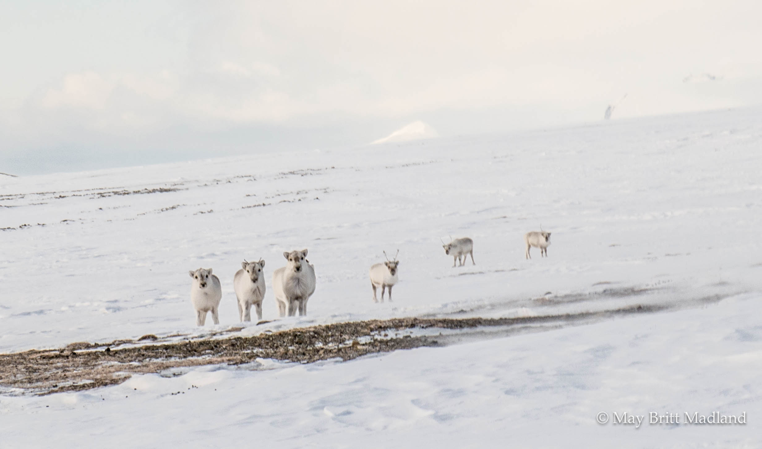
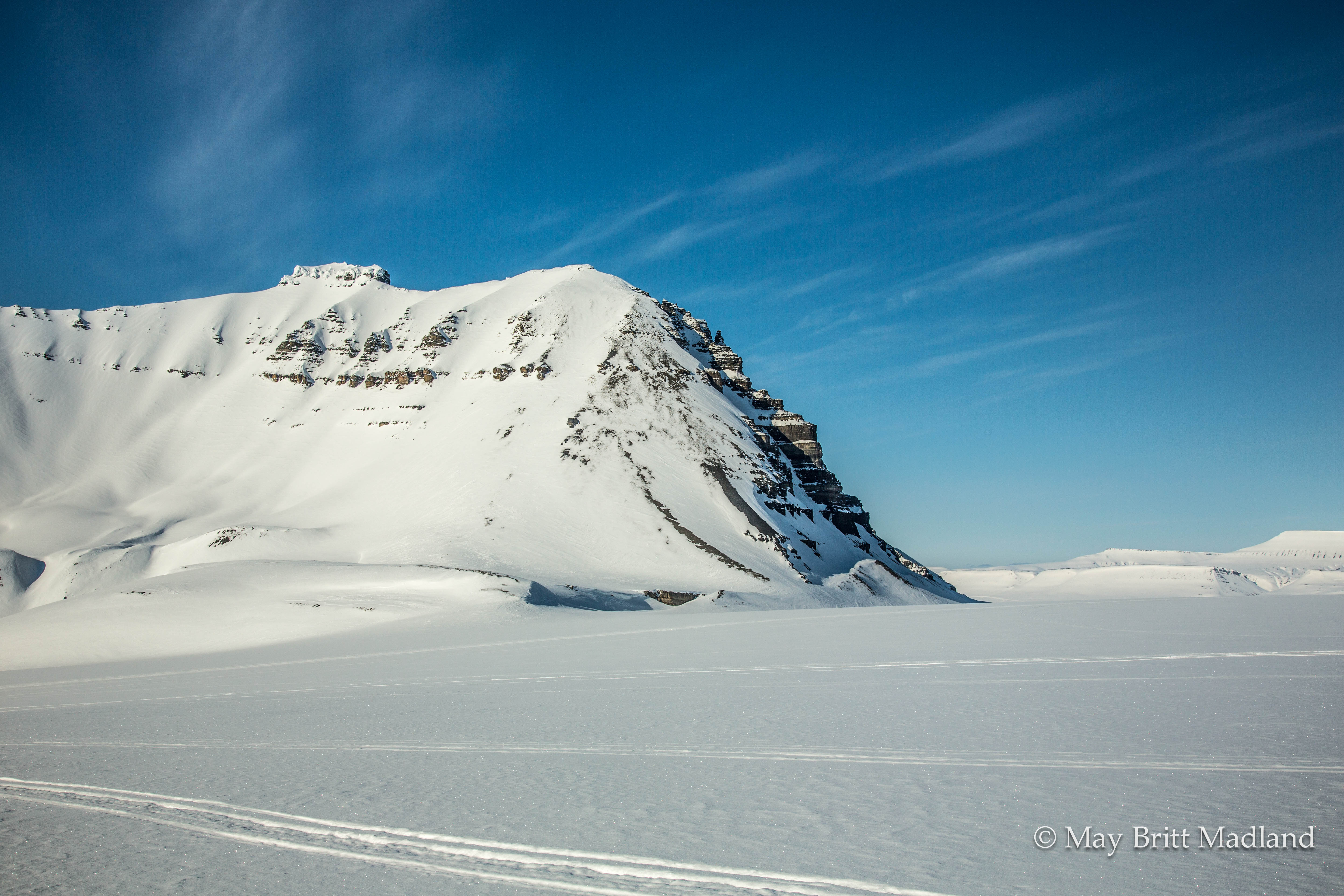
Some reindeer were passing just in front of us as we were reaching Isfjord Radio. The wind was picking up, with a bit of snow in the air. We had completed 160 km on ski, across valleys & Glaciers, from East to West of Spitsbergen/Svalbard, in the Norwegian Arctic. It had been an adventurous week, learning new things along the way.

_60A5700  _60A5698

A week ago we arrived in Longyearbyen and found our way to the Trapper’s hotel where we spent our first night. Information meeting was held at the hotel, last check and packing of the equipment done, a few things to buy at the local shops and a get to know each other dinner at restaurant “Kroa” just next door.

_60A4882  _60A4887

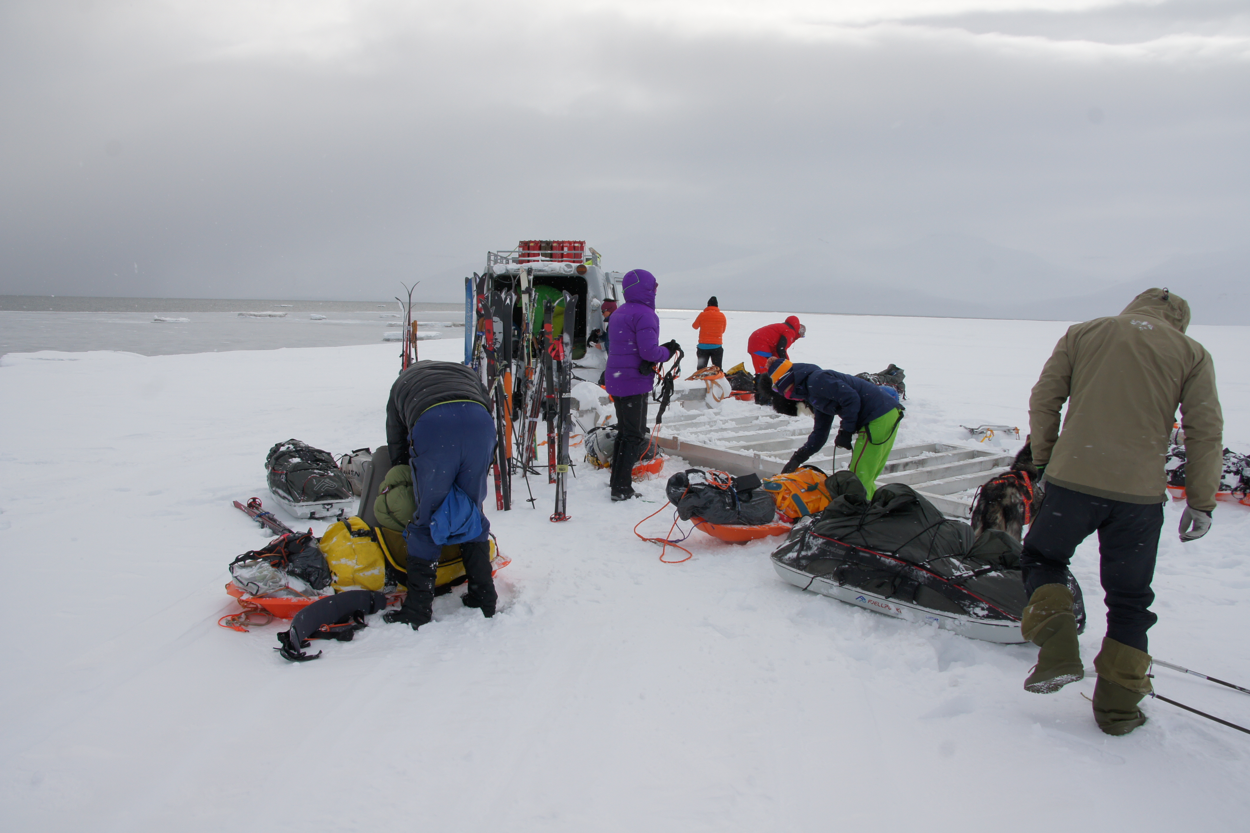
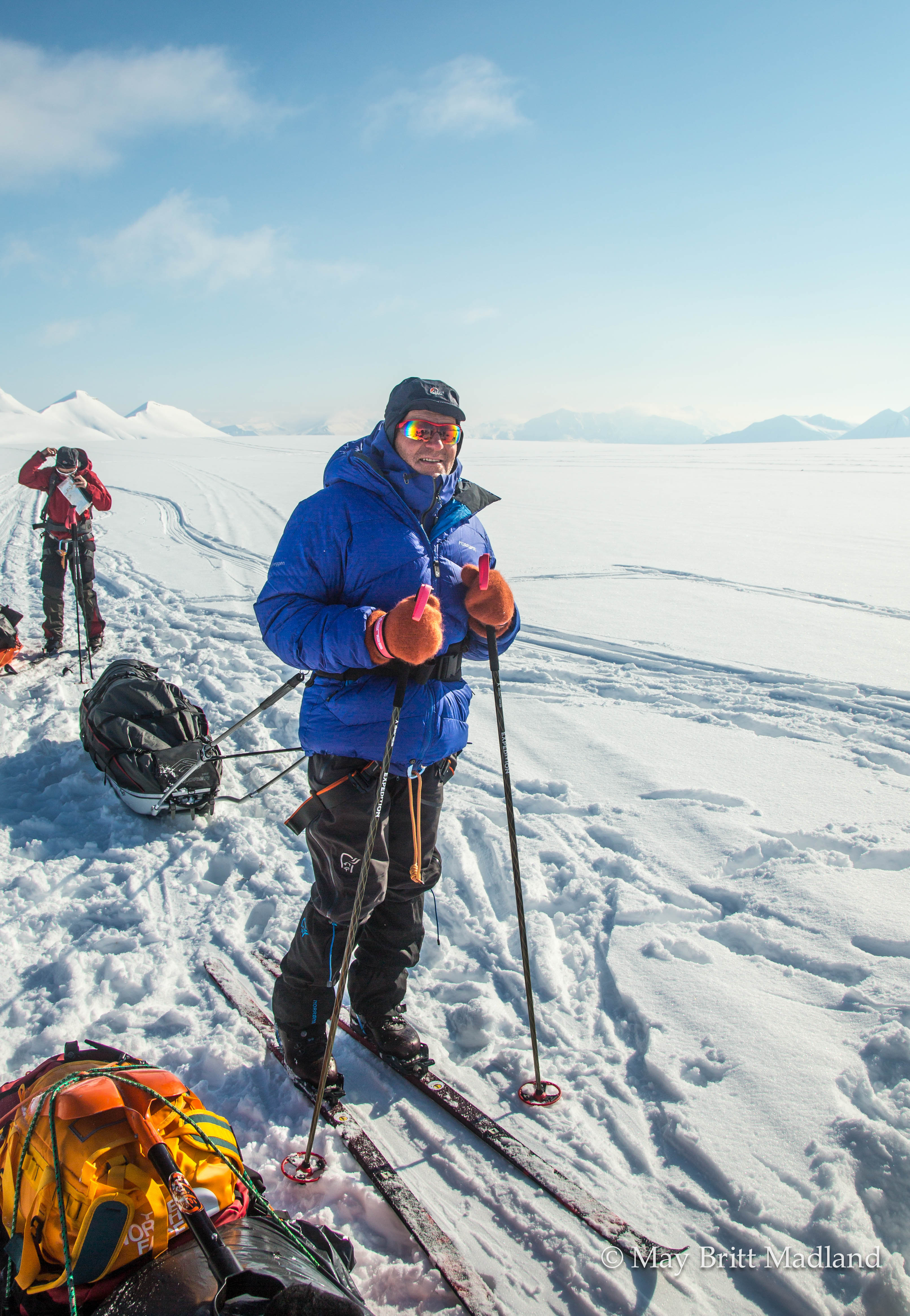
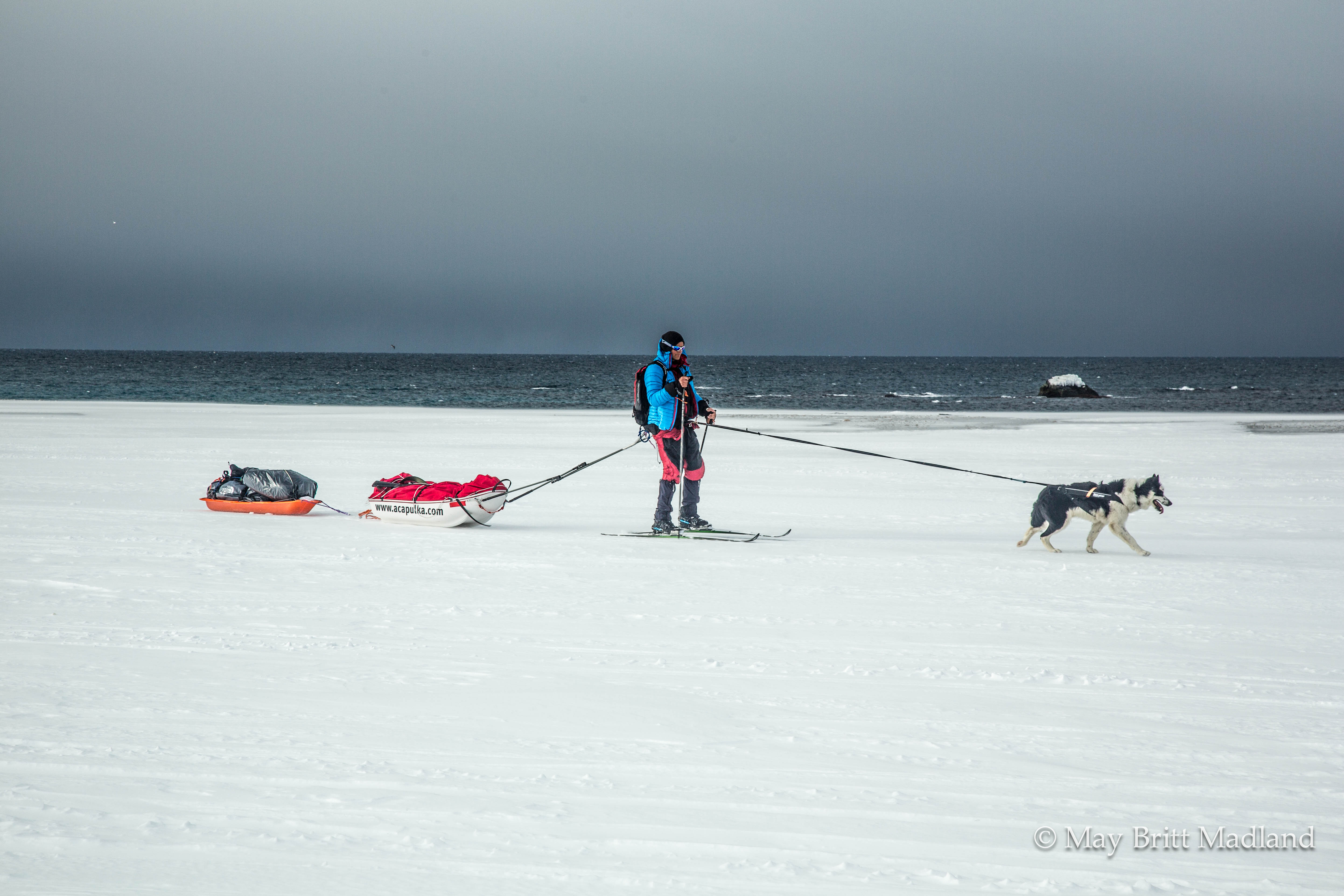
I woke up early next morning, exited to get started on this week of adventure, not really knowing what to expect. It was my first time camping in a tent surrounded by snow, also knowing we had to play hide & seek with polar bears. We started our skiing from Agardhbukta, so transport by a vehicle was arranged to get us there. It was a Bandvagn 206 (BV 206), a tracked articulated, all-terrain carrier. 3 guides, 2 dogs and driver in  the front and our group of 12 squeezed in to the back. Quite the interesting experience, but not very comfortable. Knowing it would take at least 6 hours to get to the east coast it was just to start thinking about something else and get used to the bumping up and down.

_60A4910  _60A4918

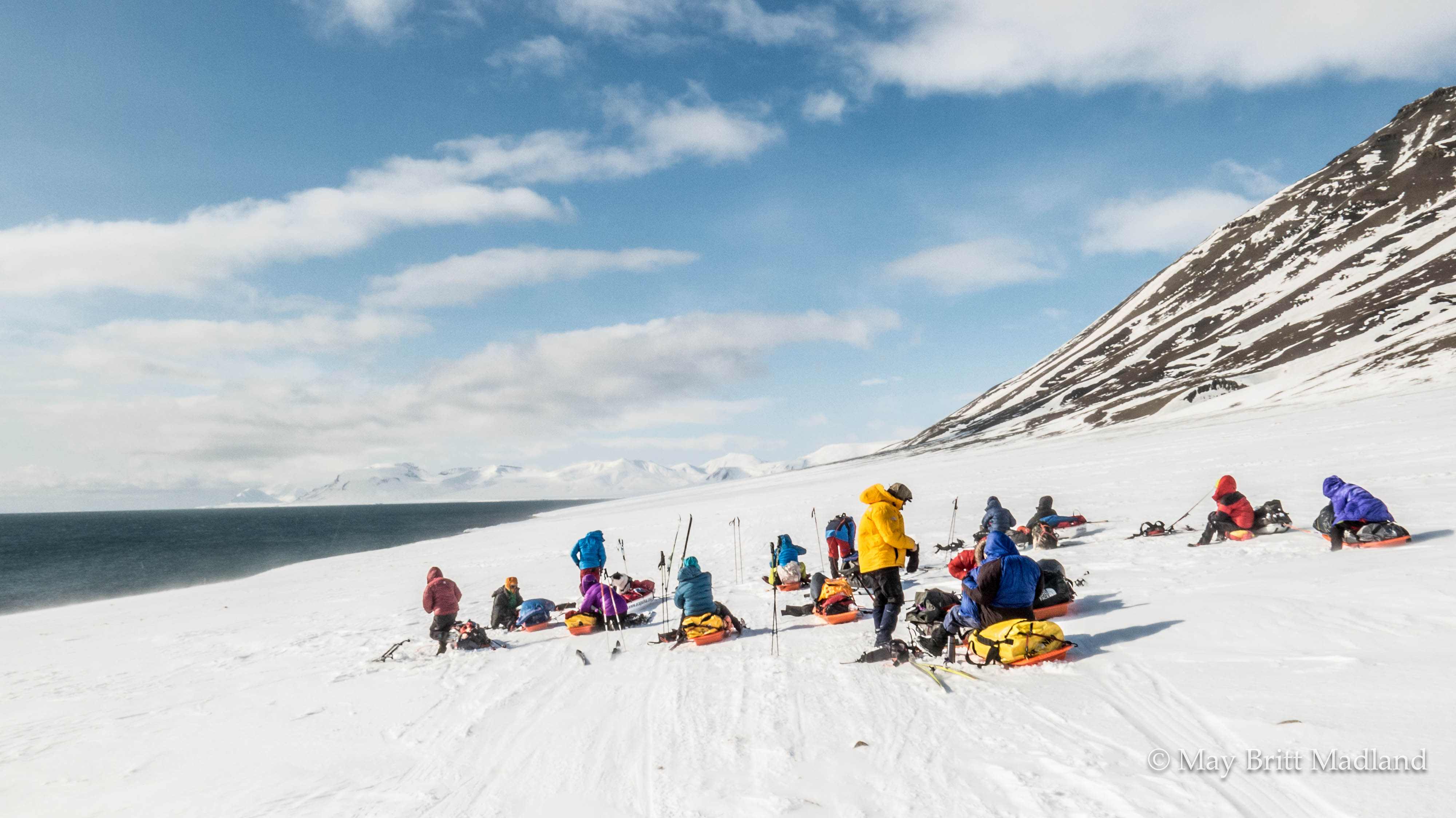
Arriving at the east coast I was happy to get out of the car and move my legs again. We organized our gear, got our skies on and were ready to start. It was windy and a bit snow in the air, so I was eager to get going.

SONY DSC  _60A4923

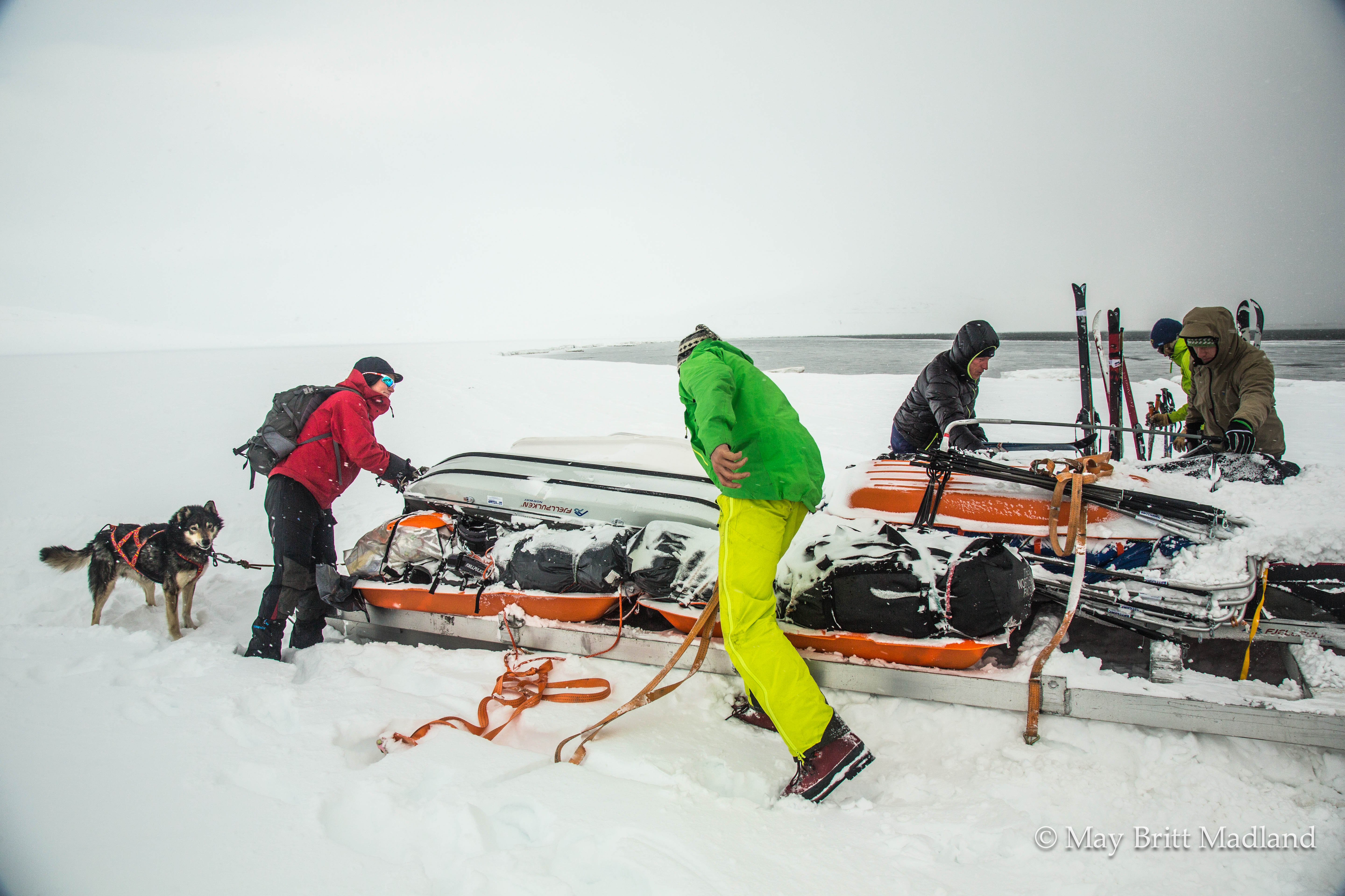
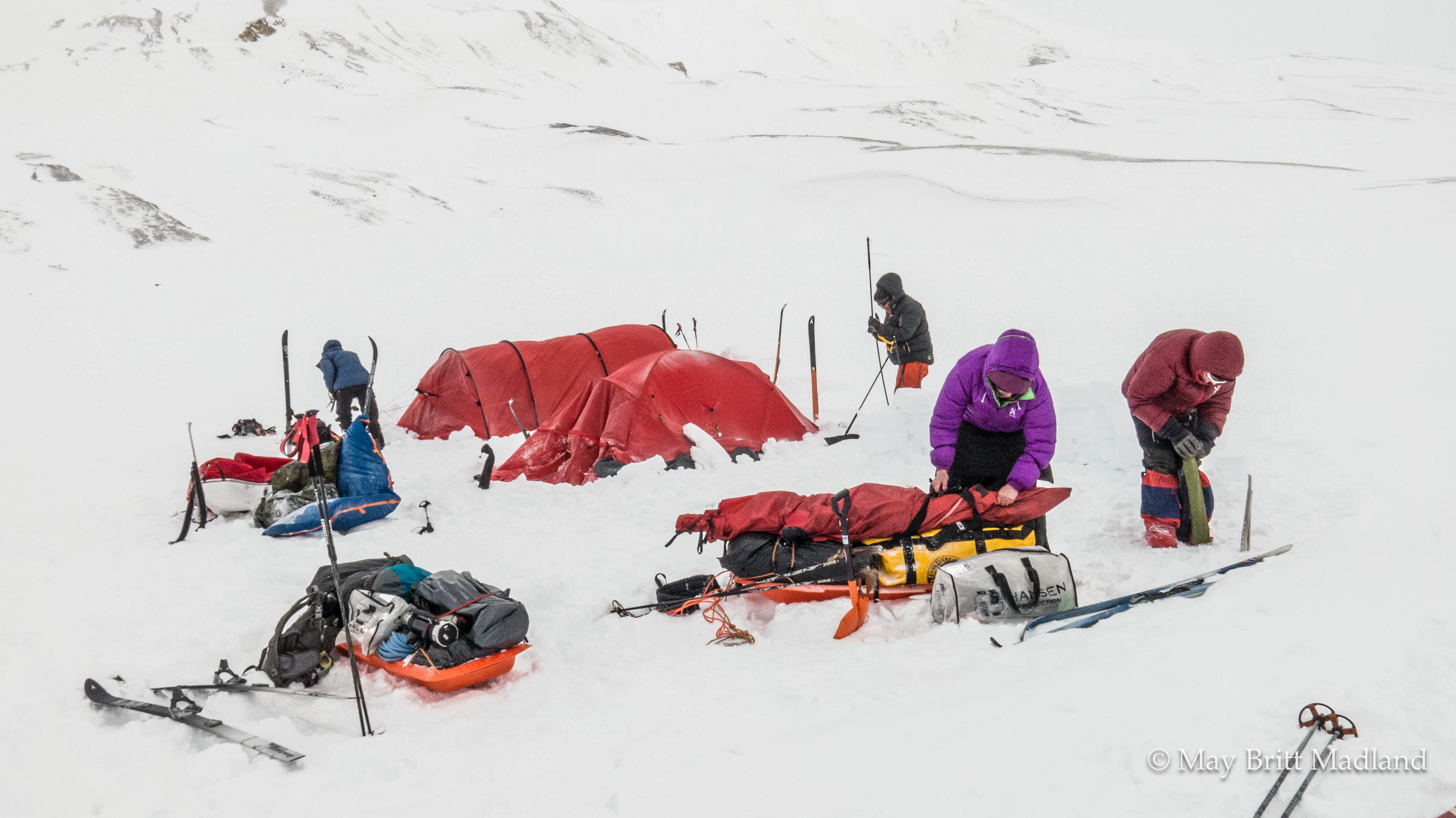
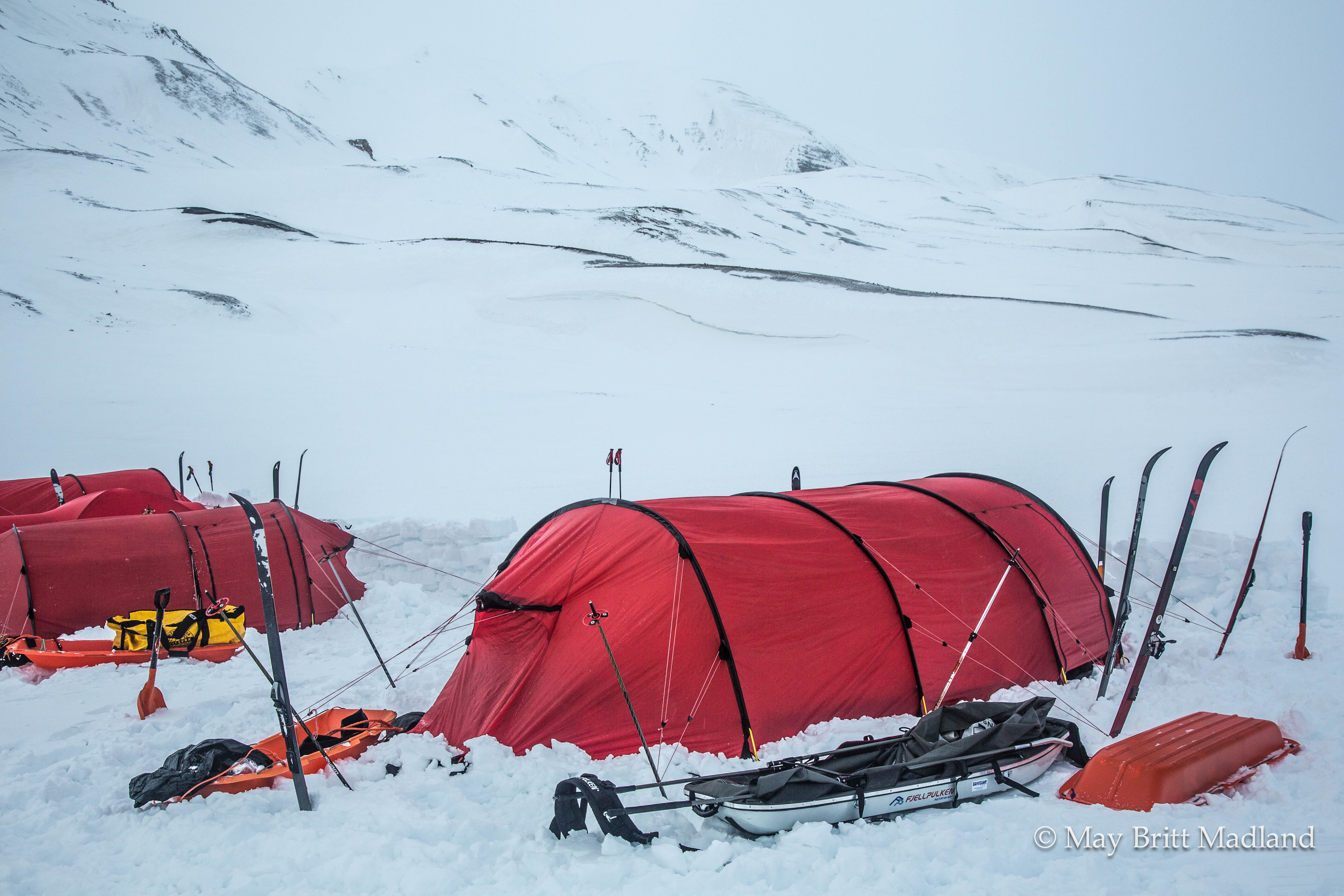
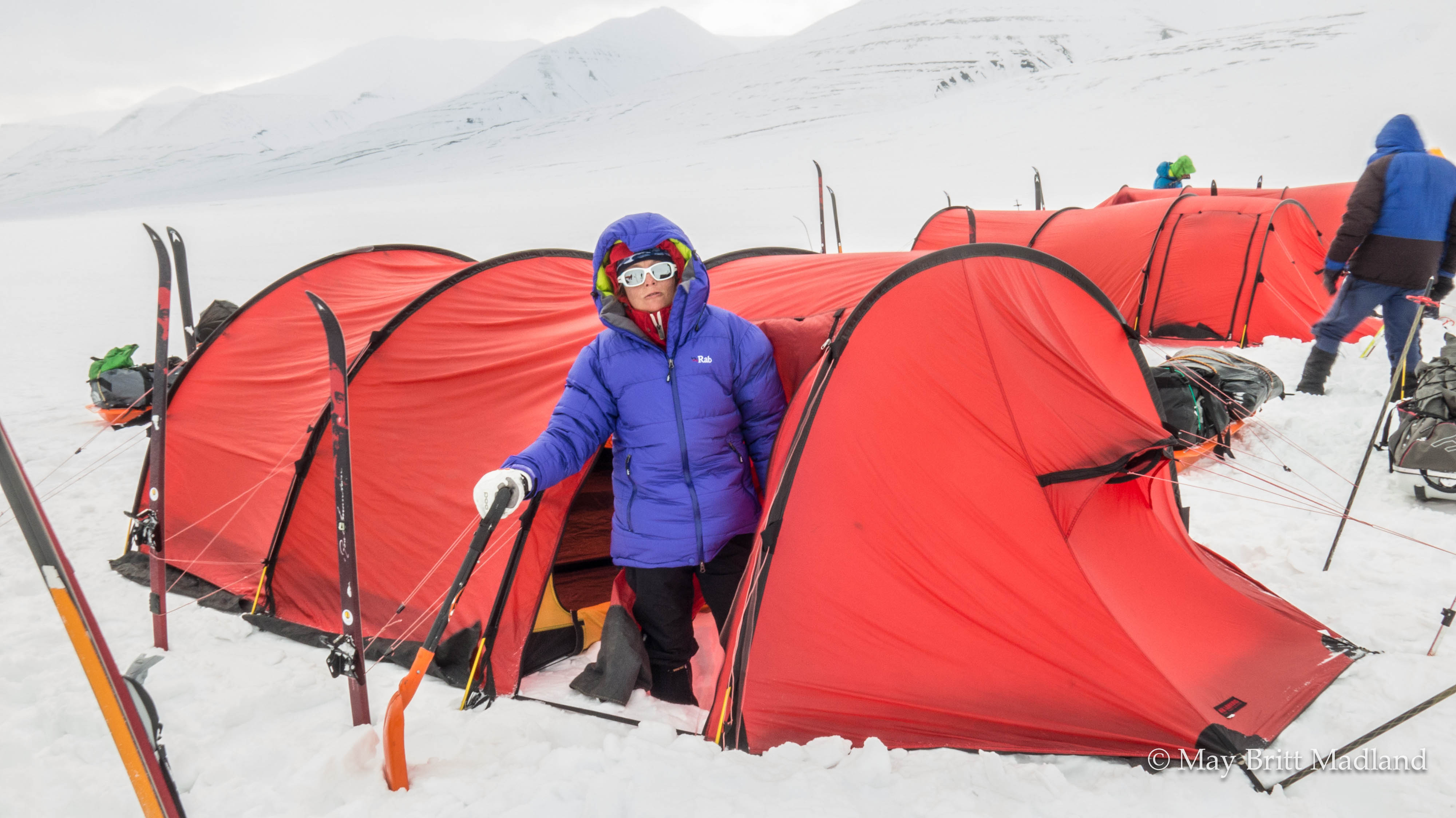
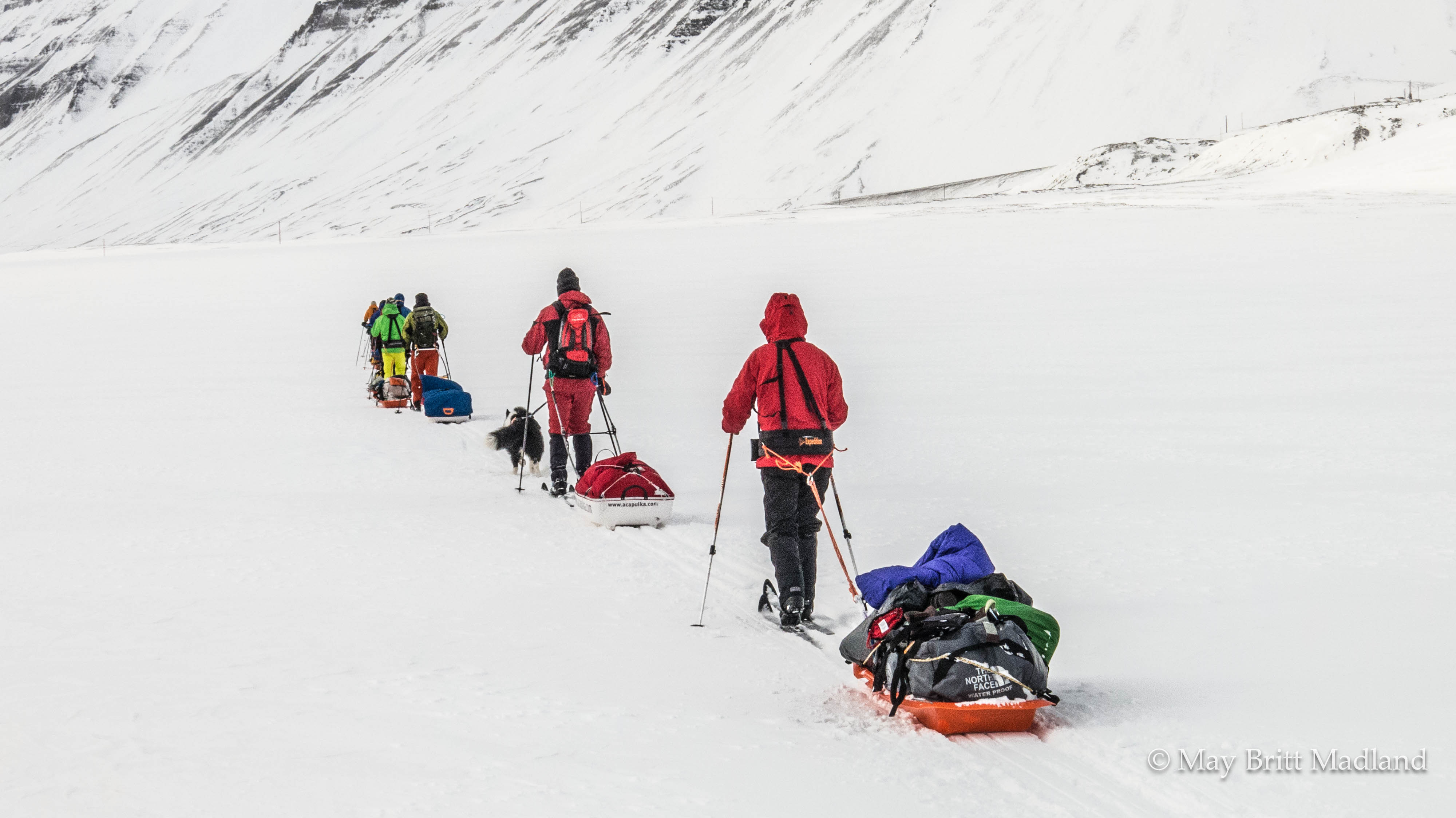
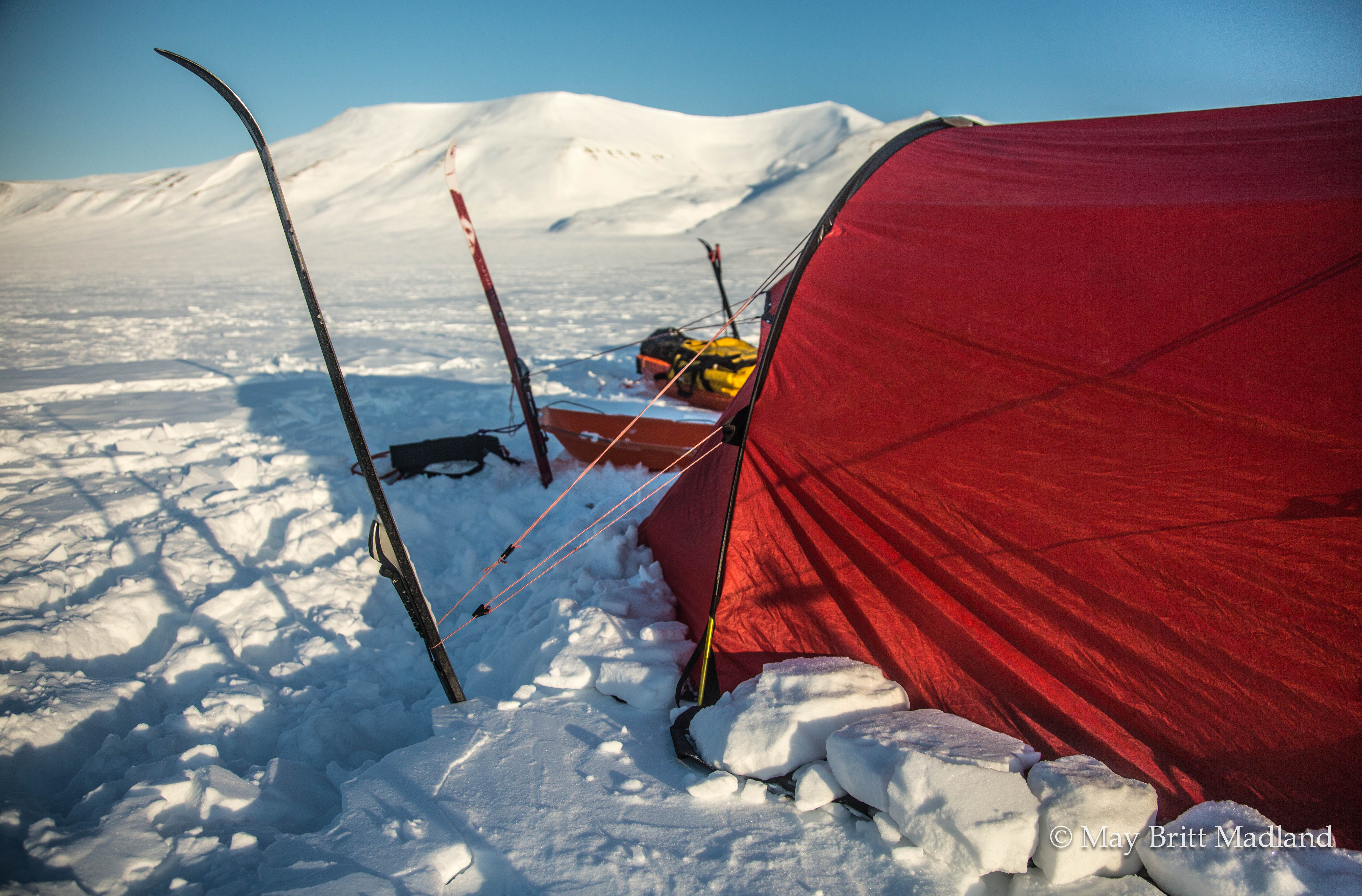
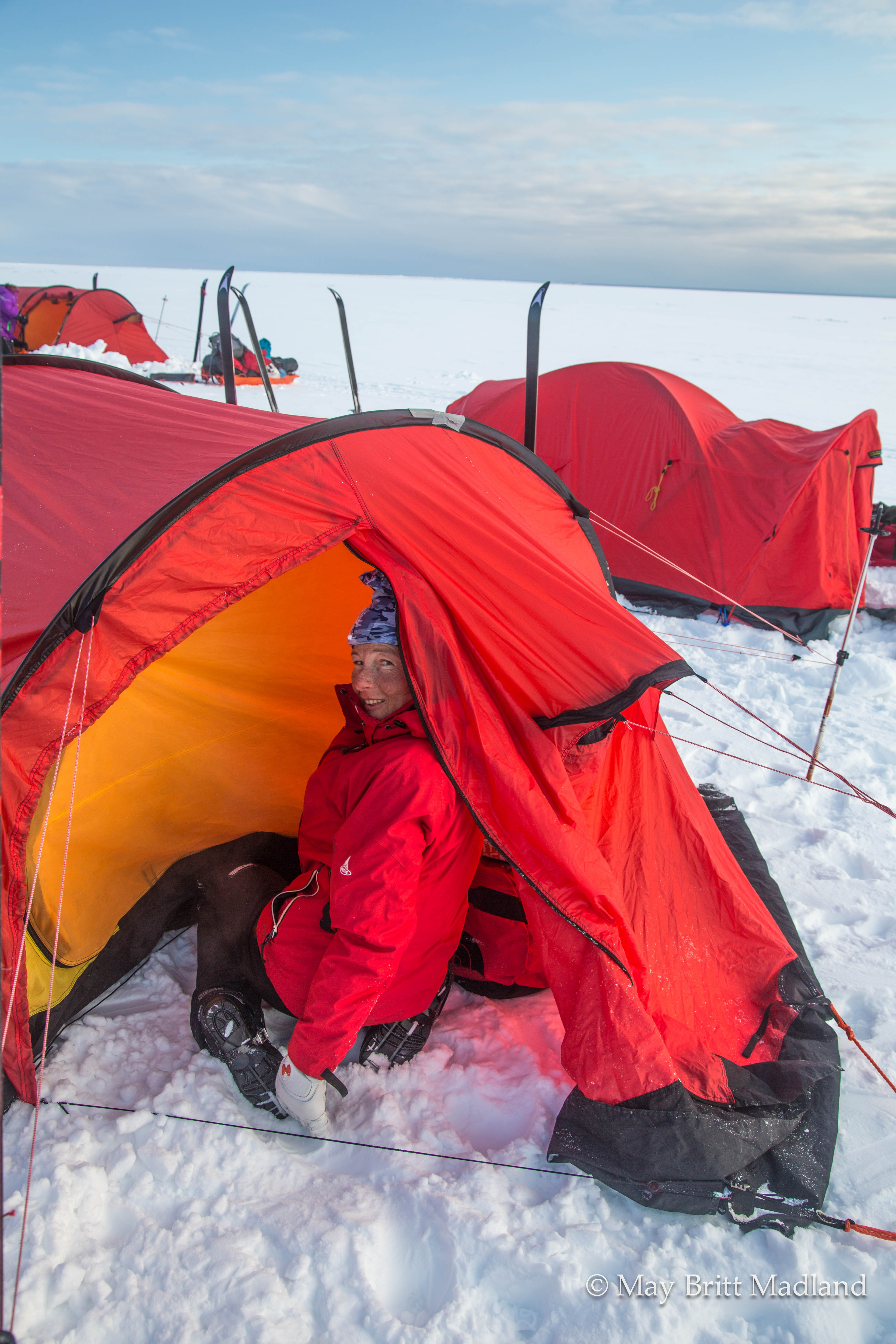
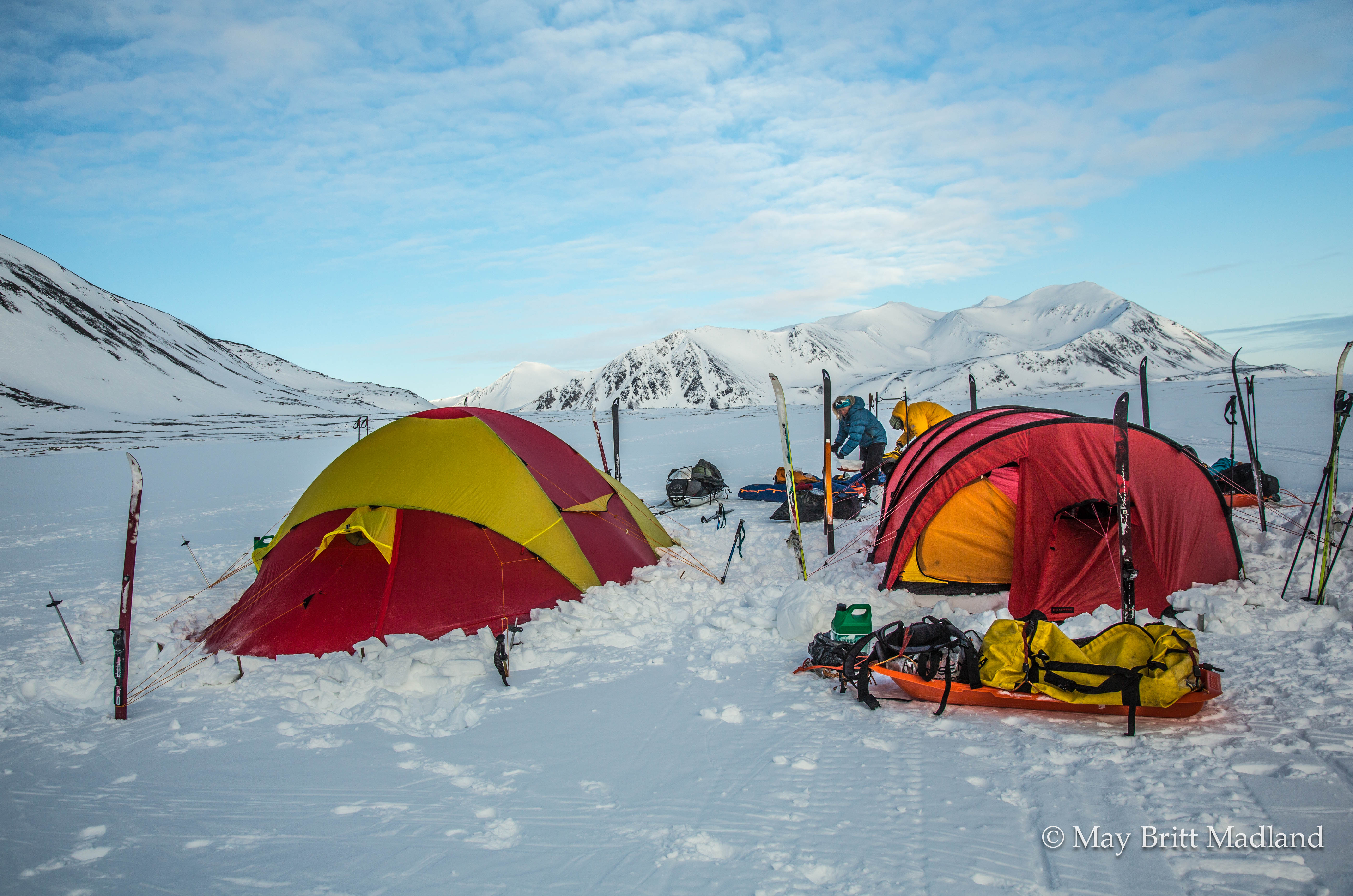
It was my first time skiing with a sledge, but it went well the first day as there was not much up and down. Arriving at the campsite, the next step was to put up our tent. We got some tips from our guides, to use the ski to prepare the ground to be as flat as possible, make sure to secure the tent before starting to put it up for it not to be blown away with the wind, dig a hole inside the outer tent to have head room to stand and make a wall in front of the tent in the wind direction to avoid snow to blow and get stored on the tent. Quite a lot to think about but after a few days it got easier. We also learned the trick of using our ski and poles as tent plugs.

IMG_5530  _60A4932

IMG_5674  IMG_5673

It was agreed that we would sit up during the night on shift to watch out for the polar bear, so with 2 groups we would have to sit for an hour each every 2nd night. An introduction how to use the signal gun was done. I think we were all exited about the fact that it could happen that we would spot a polar bear. We had to look out for something moving and in case a Polar Bear would come and we had to use the signal gun to scare the Bear and wake up the guides. Sitting up for an hour during the night was like being out during the day as the midnight sun makes the night as bright as day.

IMG_5678  IMG_5680

I shared the tent with my 2 friends, Arne and Eva. Arriving at the campsite with wind and cold, we spent the evening inside the tent, eating our dinner, a snaps glass with cognac to make a toast for the day and get our sleeping bags ready for a good night of sleep after a long day skiing.

IMG_5473  IMG_5477

_60A4952  SONY DSC

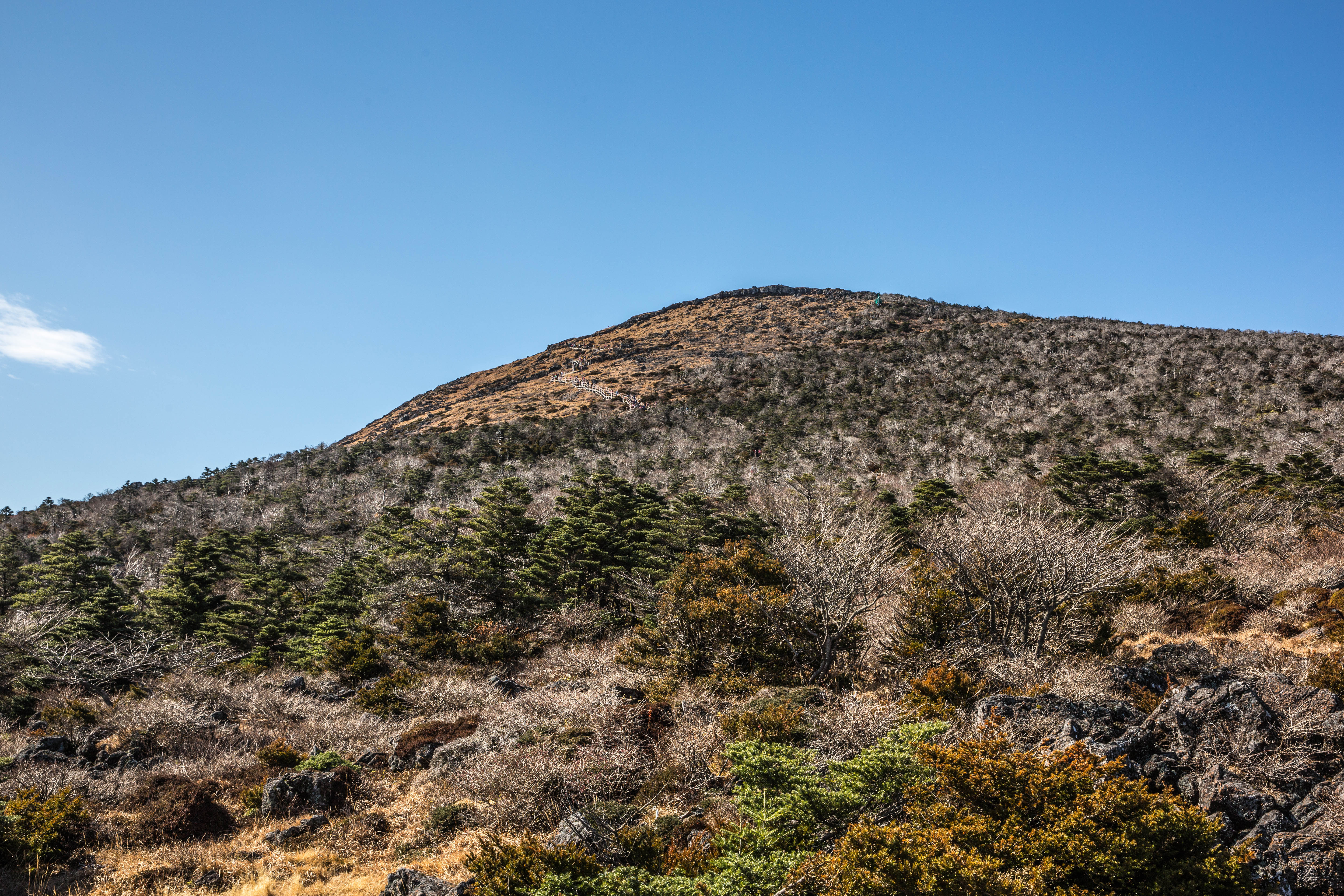
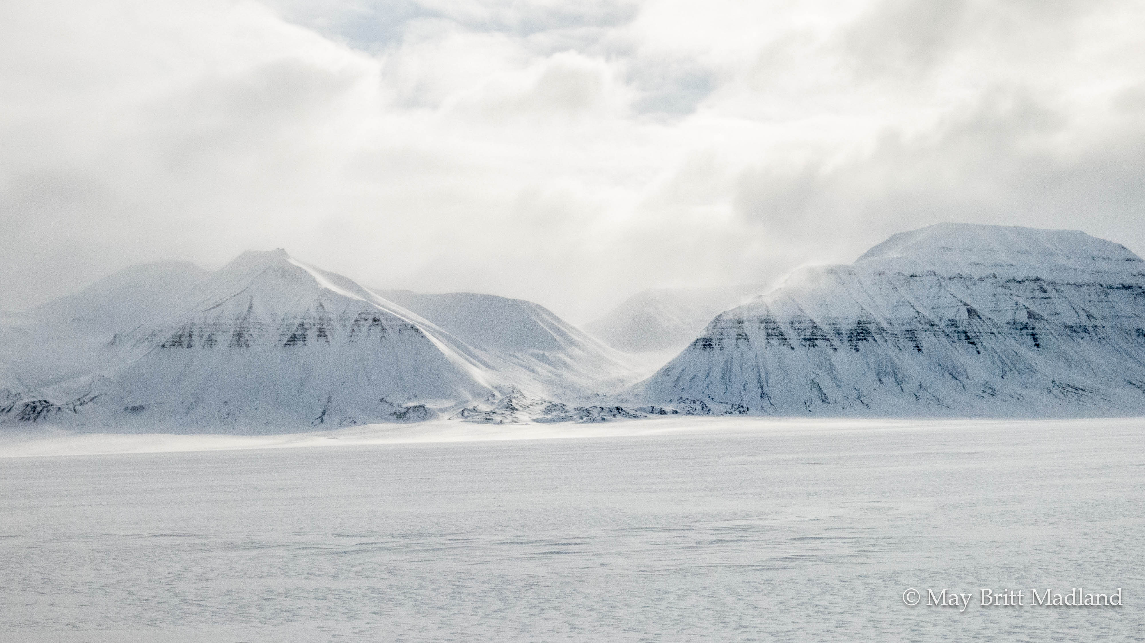
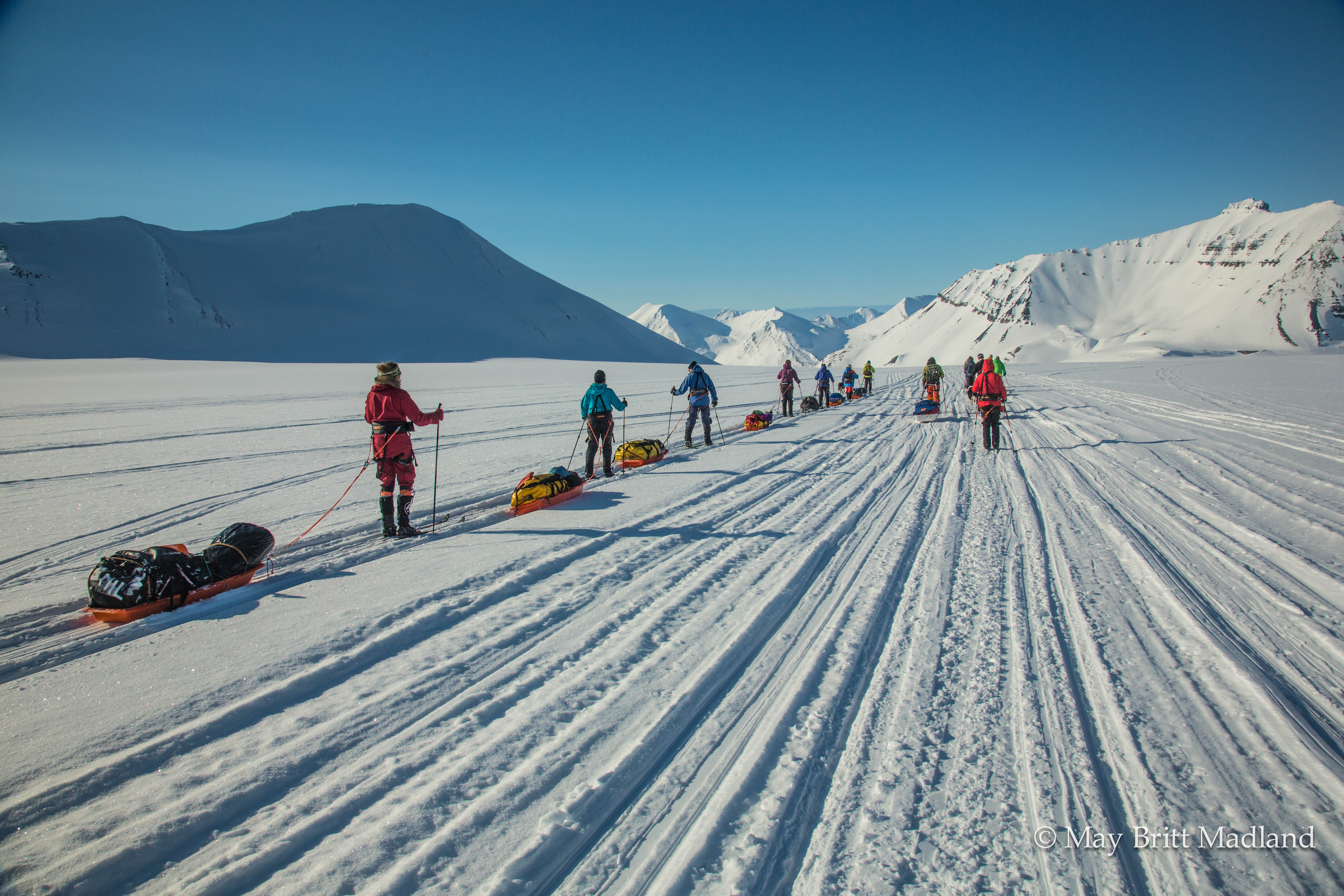
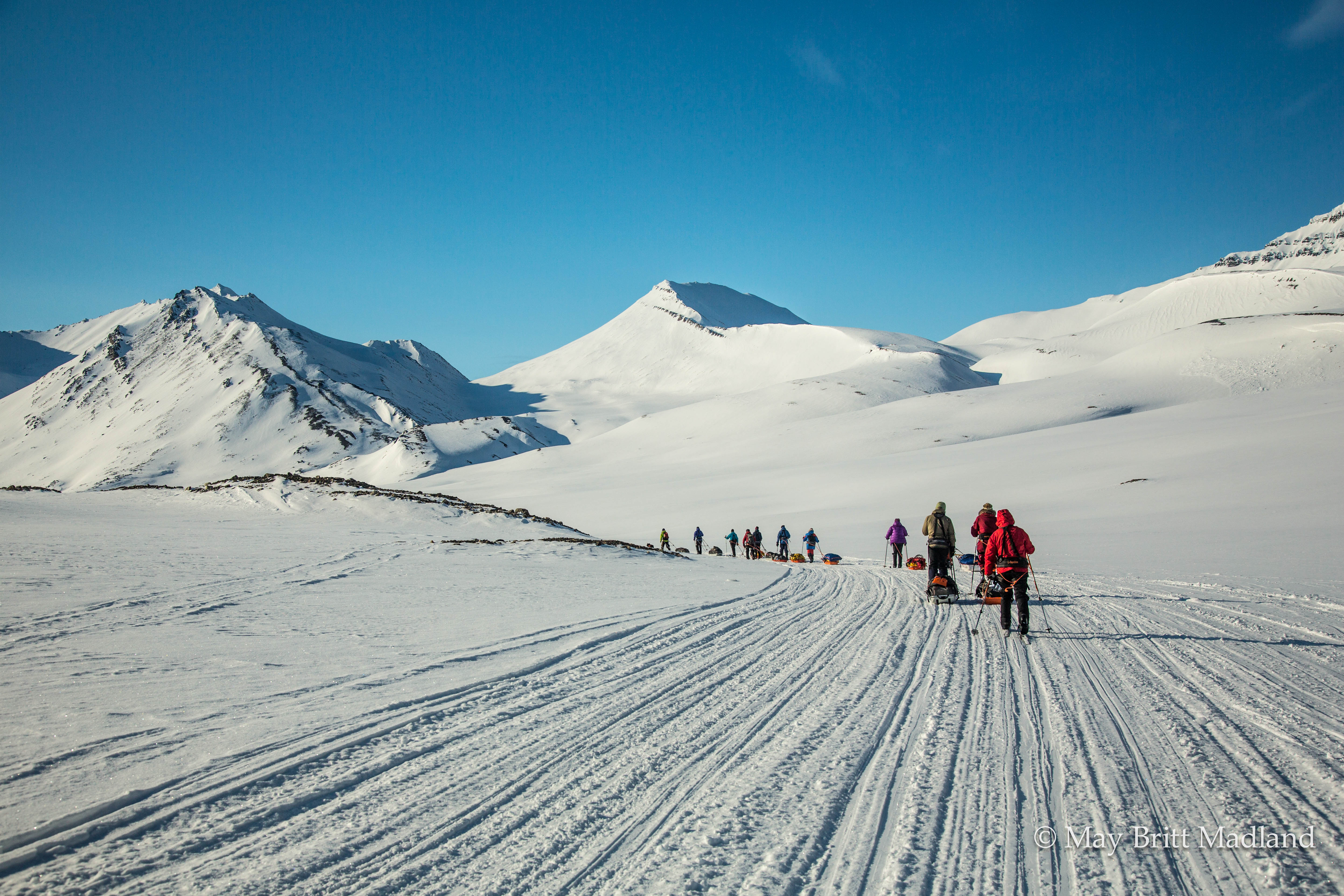
The wind was blowing quite strong during the night. We had our breakfast, Rice porridge with Cinnamon and Sugar and some raisins or nuts added to it. Then it was down with the tent, packing the sledge and get ready for a new day. We crossed over the glacier, Passbreen, down Kjellsromsdalen, passing the mining town, Sveagruva, and put up our 3rd campsite at the end of Gustavdalen. The days continued with wind and not much to see as it was all white around us. We kept walking, with a 10 min break every 50 min, to fuel up on some chocolate and snacks.

IMG_5579  IMG_5550

IMG_5596  IMG_5602

IMG_5544  IMG_5627

At lunch we had our daily supply of “drytech Real turmat”. Just put hot water, shake the pack and wait for 5 min and it was ready to eat.

IMG_5558  IMG_5573  IMG_5626

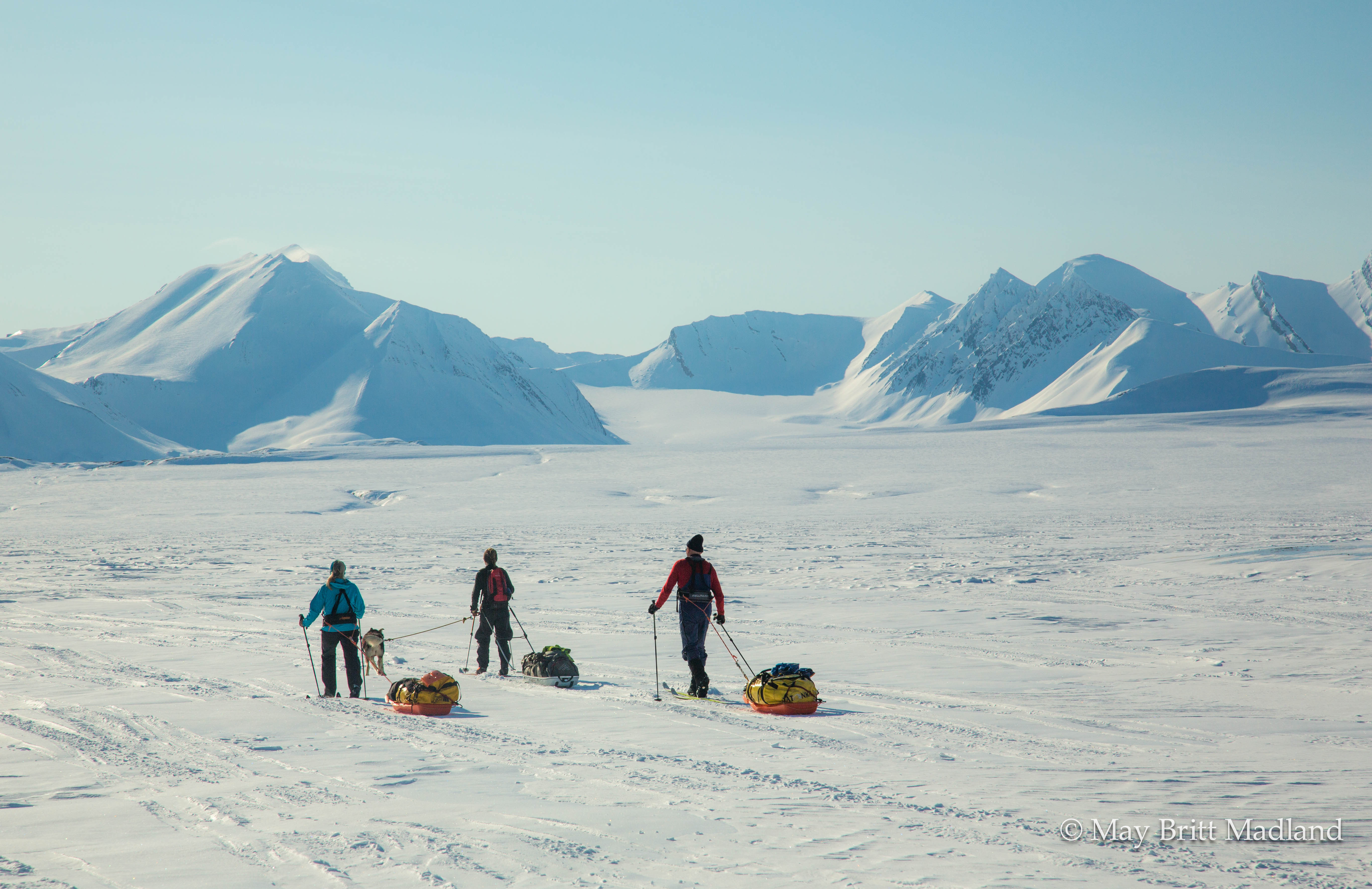
Being all white around me and not much to see, I just keep skiing, following the group, most of the time in my own thoughts, thinking about everything and nothing. I got a sense of peace being surrounded by nature. Just skiing listening to the poles touching the snow. Like a kind of meditation.

IMG_5656  IMG_5671

IMG_5795  IMG_5802

At day 4, Arriving at Stormyra the wind stopped. It had been a hard day as most of the day had been skied with a slight slope down on one side as we where skiing along the mountain side. It was difficult to control the sledge not tipping over as it was sliding on the side of me, so I had to try to get a pace that would allow the sledge to follow but not slide down and stop as then it would tip. As we where turning around the mountain we where facing a quite steep uphill followed by a steep downhill before entering down at Stormyra. One of the guide fell and cut his hand on a stone so urgent attention was put to that to see that he was fine to continue. Then it was the challenge to ski down with the sledge as it was sloping both down and to the side, so I chose as some of the others to take the ski off and carry them down. Better be on the safe side to avoid ending up in the fjord and the ice cold water.

IMG_5781  IMG_5807

IMG_5825  IMG_5828

IMG_5844  IMG_5855

The first part of Stormyra went quite easy and as the wind had stopped and the sun started to show itself between the clouds, so I enjoyed it and just kept walking. Around half way across the ice it became more difficult as the snow started to be more wet and it was like the snow was sucking me down. Every step was heavy, so when we finally stopped at the other side having a break and the guides decided we would camp, it was the best message I could have had. We still had to put up the tent and get organized with our things so when that was done I just sat down in my sledge, found my coffee, having a moment of rest. Totally exhausted.

IMG_5909  IMG_5519

Being in the middle of a dream, I heard the words, breakfast in 5 min. Opening my eyes I realized i must have dozed off after my watch during the night. I heard people talking outside in a joy full tone, enjoying the nice weather. I could see when I was up during the night that the weather would be good as it was no wind, just a few clouds on the sky and cold. Showing -9 Deg C on the Thermometer. I had experienced and learned a few things during the first days. Keep everything you want to not be frozen inside your sleeping bag during the night. So wet napkins, my bottle of milk for my coffee (Had to bring a bottle of milk as they where sold out for milk powder in Longyearbyen), my clothes to change for next day, and any other things I wanted to stay warm.

_60A4970  _60A4989

_60A5003 _60A5011

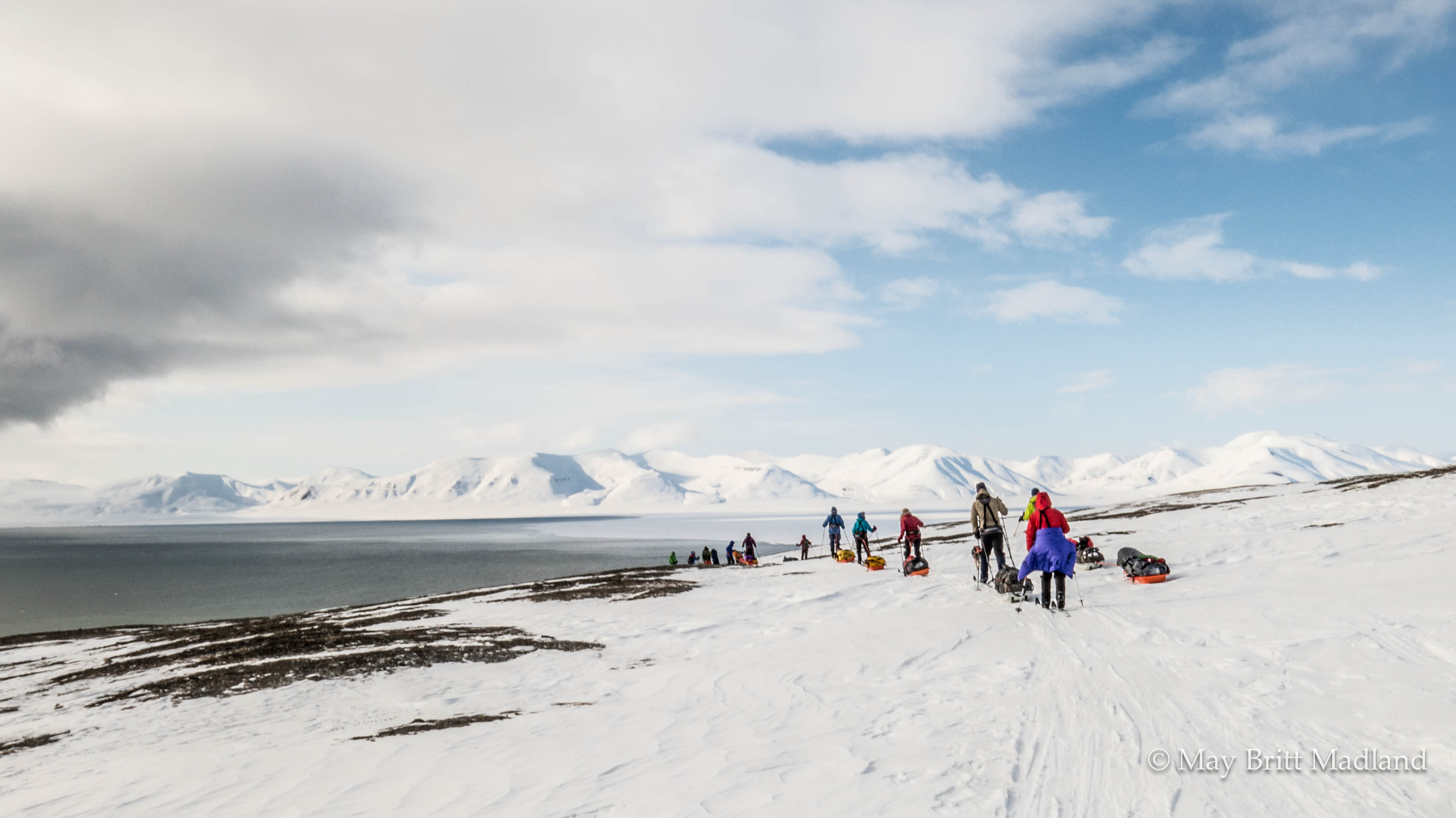
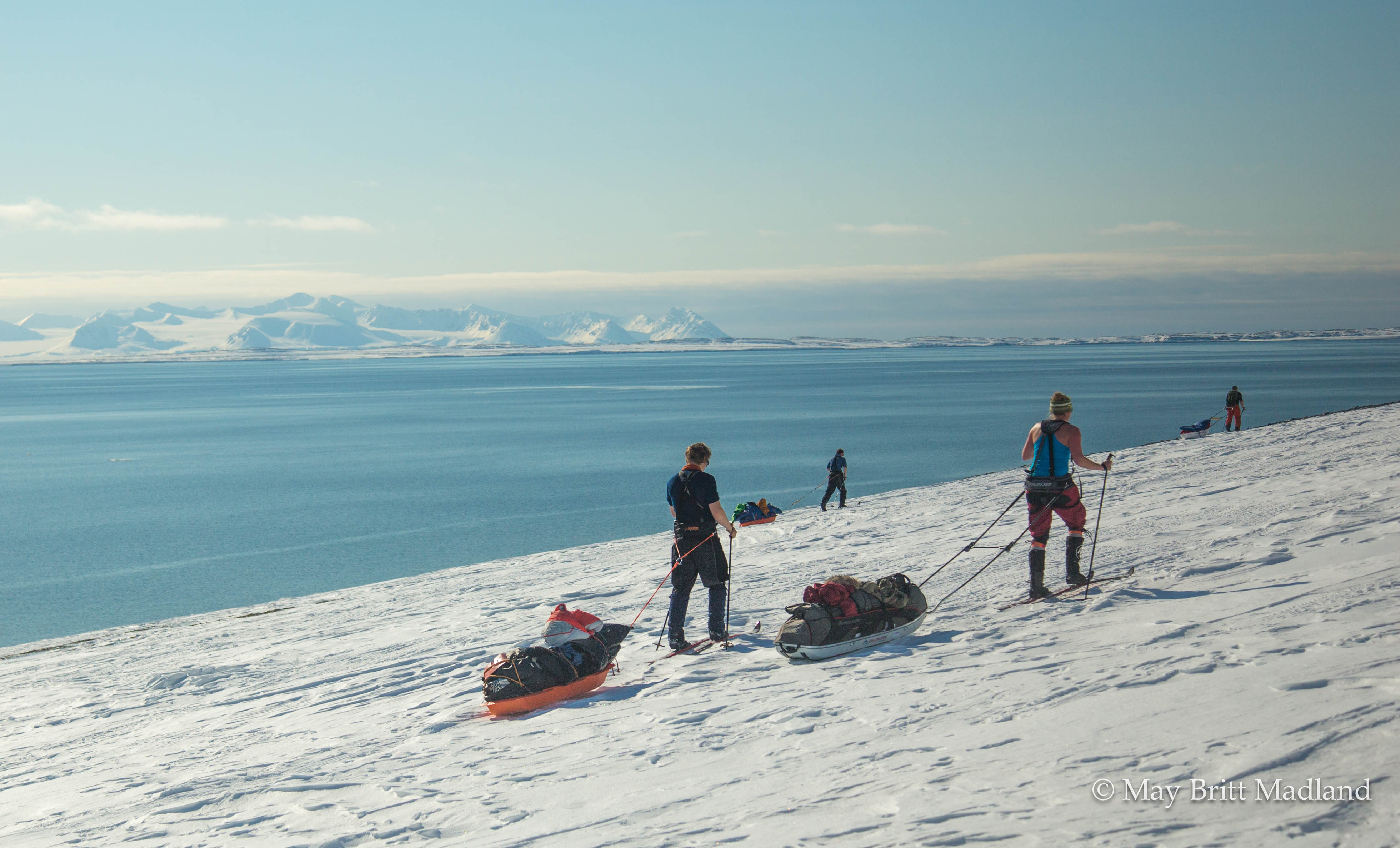
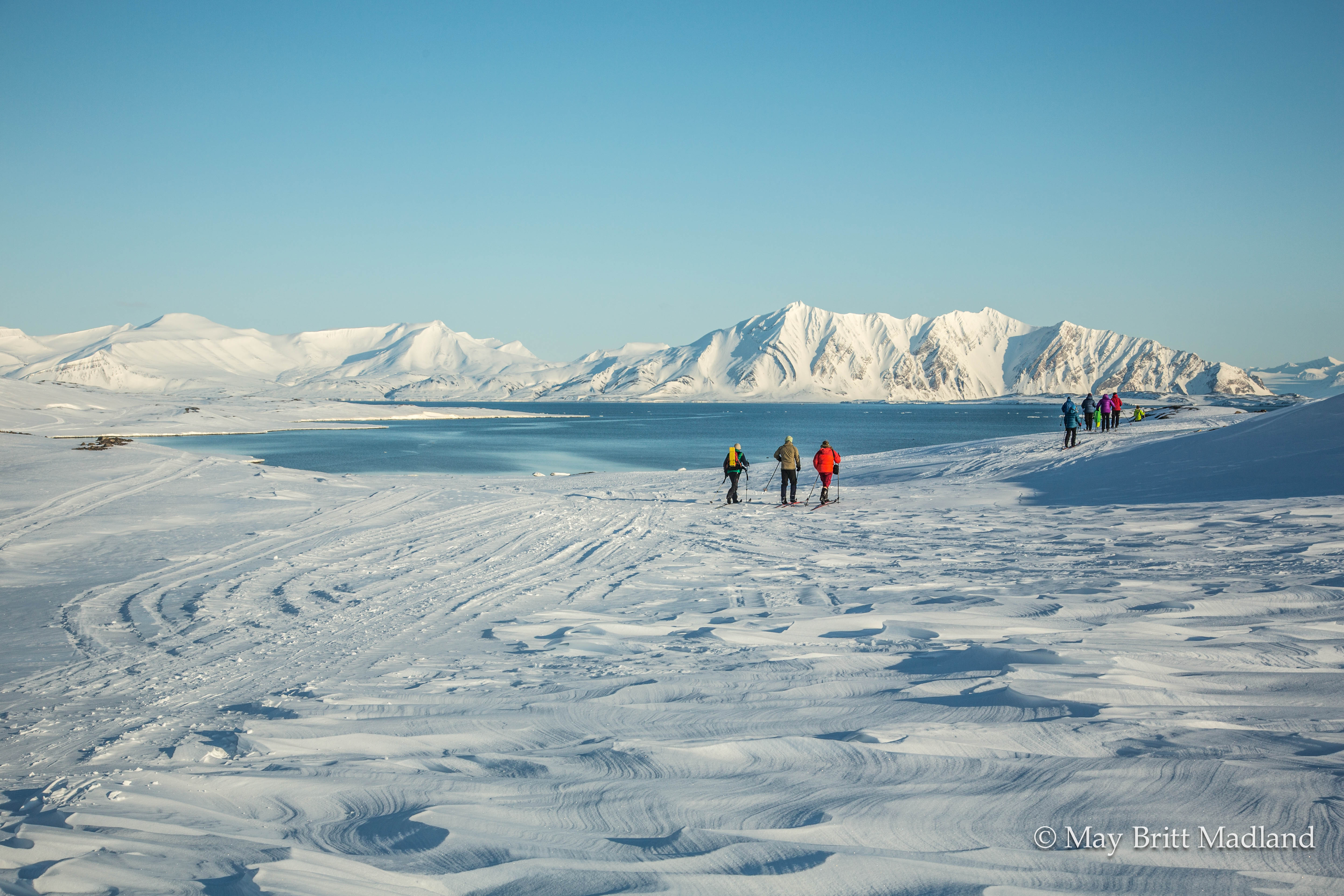
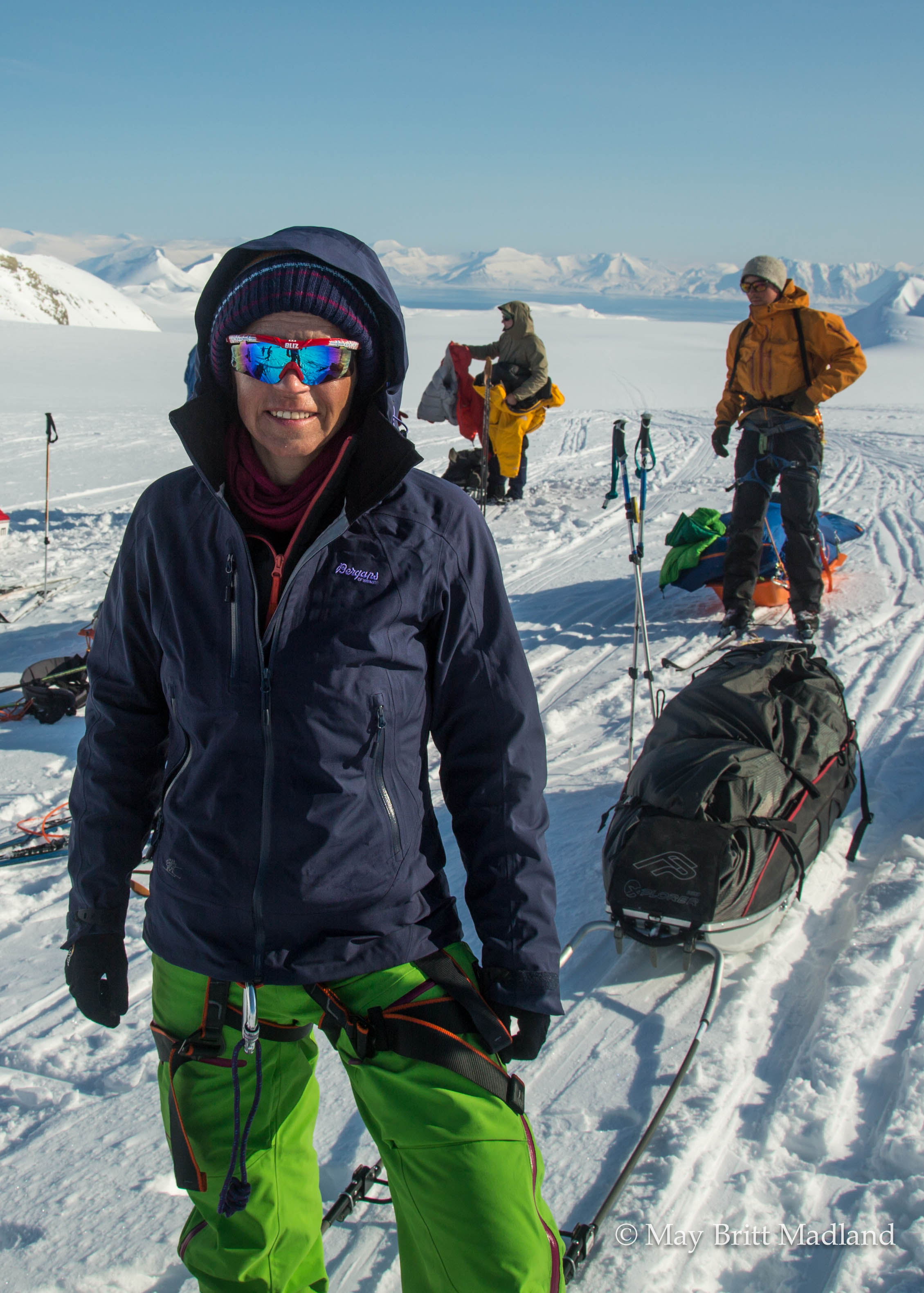
We all enjoyed the beautiful weather, skiing along the fjord. A few uphill parts but mostly flat until we where turning around the mountain side and was facing the side way slope again. My sledge was not very cooperative and kept turning over. The luggage kept shifting to the side so I had a few stops along the way to re-organize and try to get the weight to the right side.

_60A5089  _60A5116

_60A5121  _60A5133

_60A5157  _60A5125

We found a nice spot for lunch and where surprised by the guides serving us Cheese and cured meats. During lunch we could hear some birds in the background. Getting up on the hill we saw some rock ptarmigan walking up the hill.

_60A5164  _60A5191

_60A5196  _60A5199

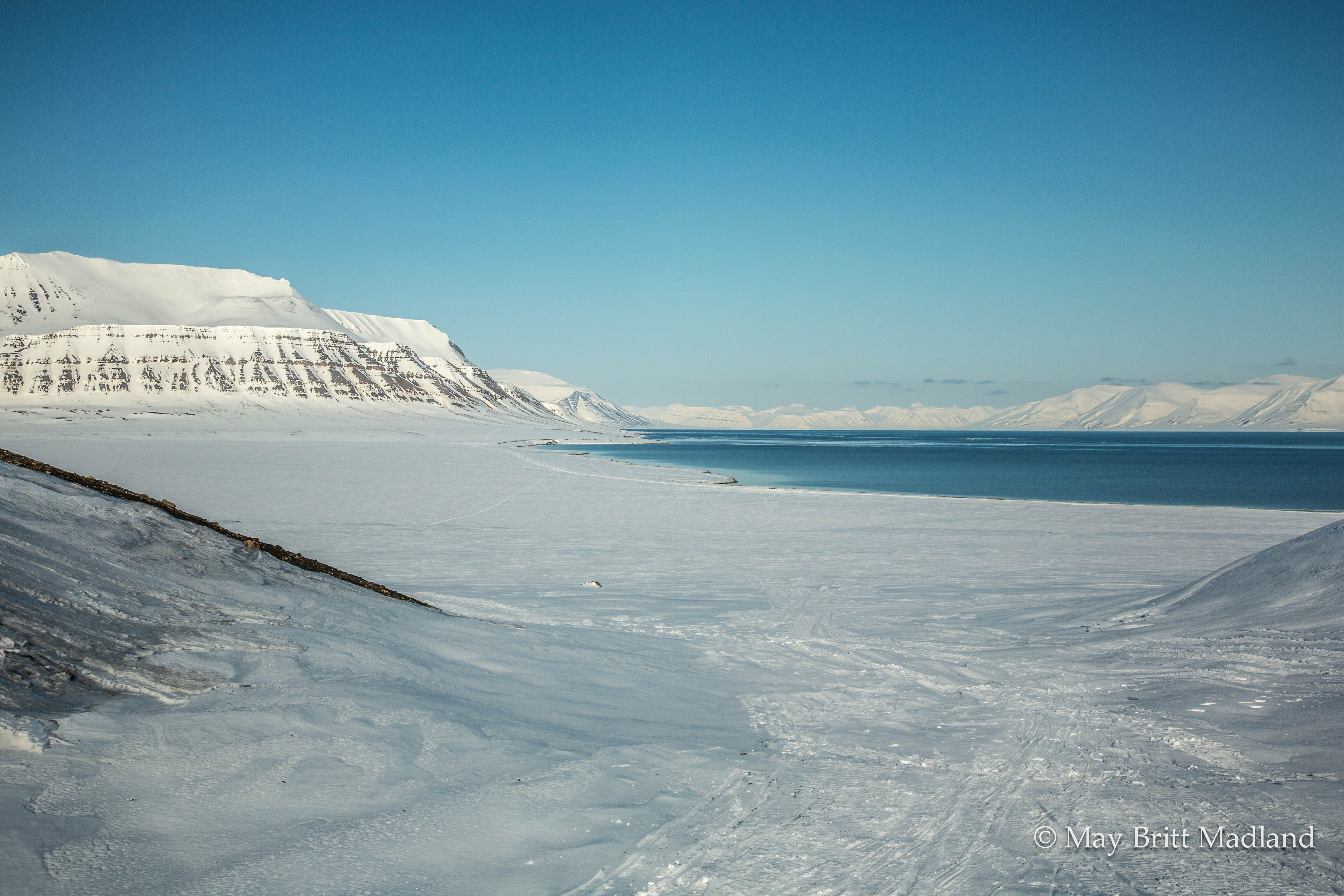
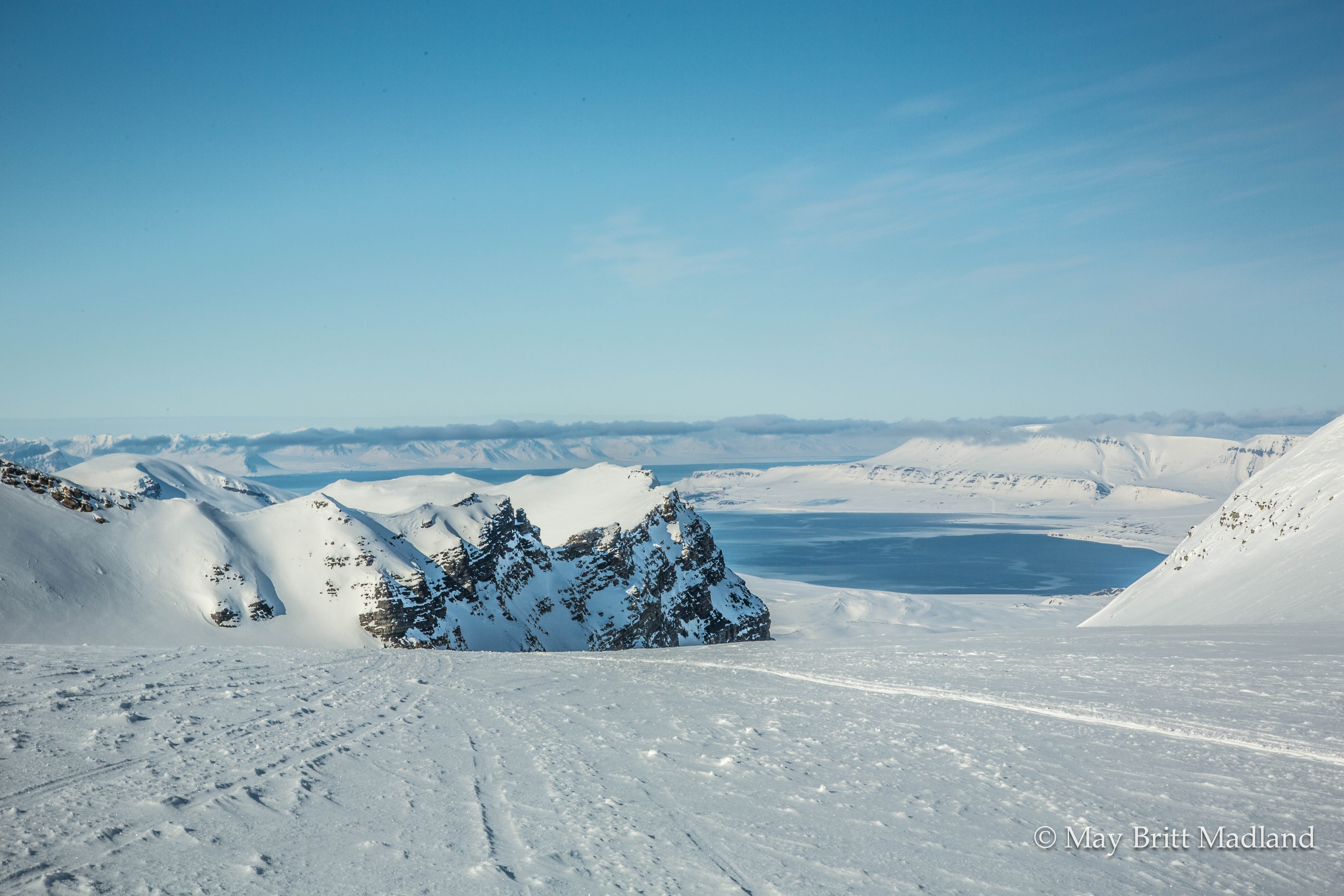
We continued in the nice weather, passing some reindeer along the way, enjoying the sun and the nice view as we were skiing along the fjord and entering fridtjovhamna. From here we could see Akseloya that is almost crossing from one side of the fjord to the other. just leaving a small pass for the boats to enter.

G60A5252  _60A5231

_60A5264  _60A5280

_60A5275  _60A5281

It was a beautiful day and even with my sledge not being on my side, this day could not have been more perfect. Entering Fridtjovbreen we put up our camp for the night. Some went with a few of the guides up on the glacier before dinner and some of us just stayed at the tent and relaxed. This evening the guides prepared dinner for us, Salmon with mashed potatoes and vegetables. Being Saturday we had a few shot glasses of whiskey cheering for a fantastic day. Chatting and laughter from the other tents where a sign that they where enjoying the evening as much as us.

_60A5295  _60A5310

_60A5301  _60A5316

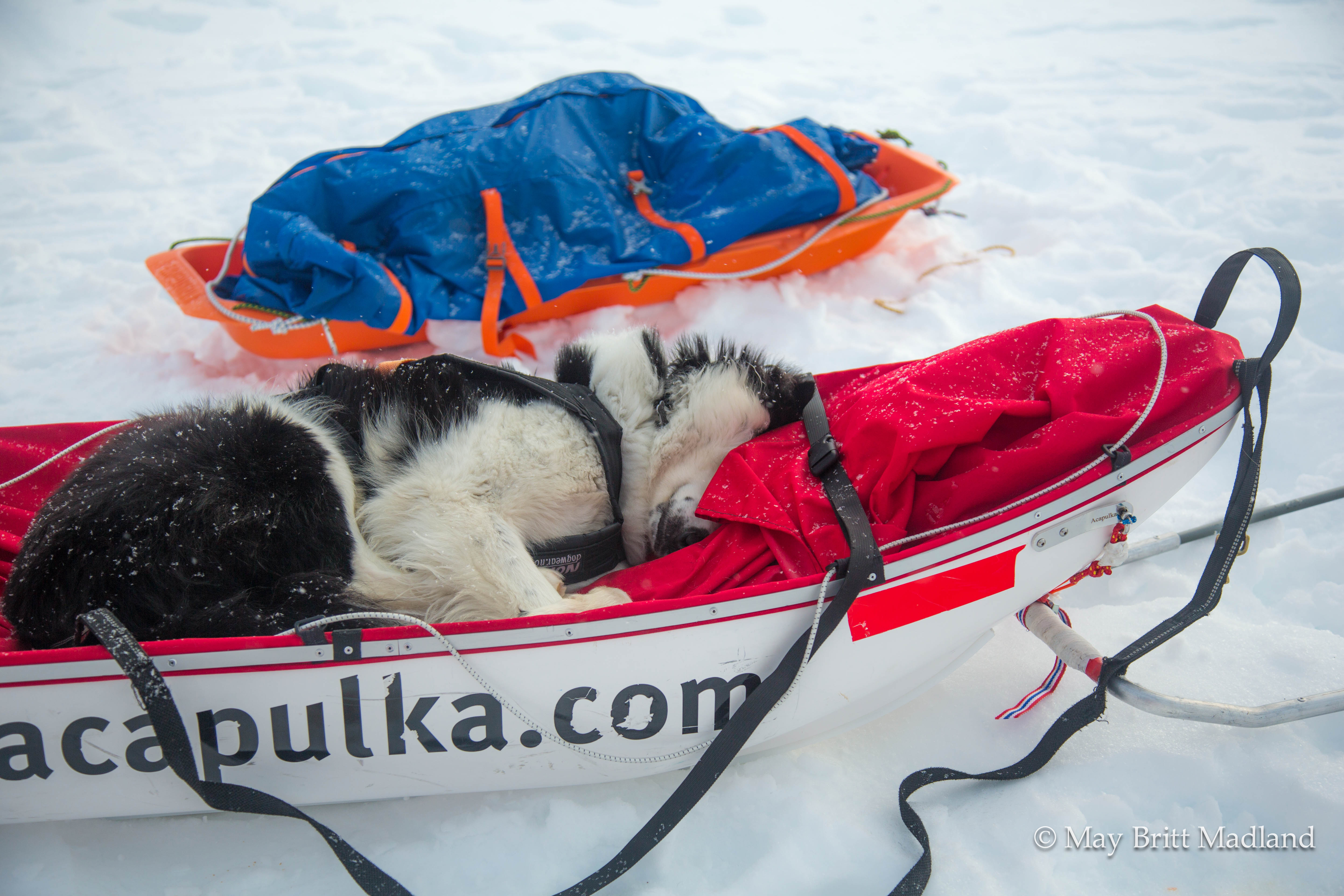
I woke up early next morning and stepping outside the tent all was quiet. The 2 dogs was sleeping. One of them had made himself comfortable in one of the sledge. It was cloudy and a bit of snow in the air, but looked like it might clear up during the day.

_60A5326  _60A5324

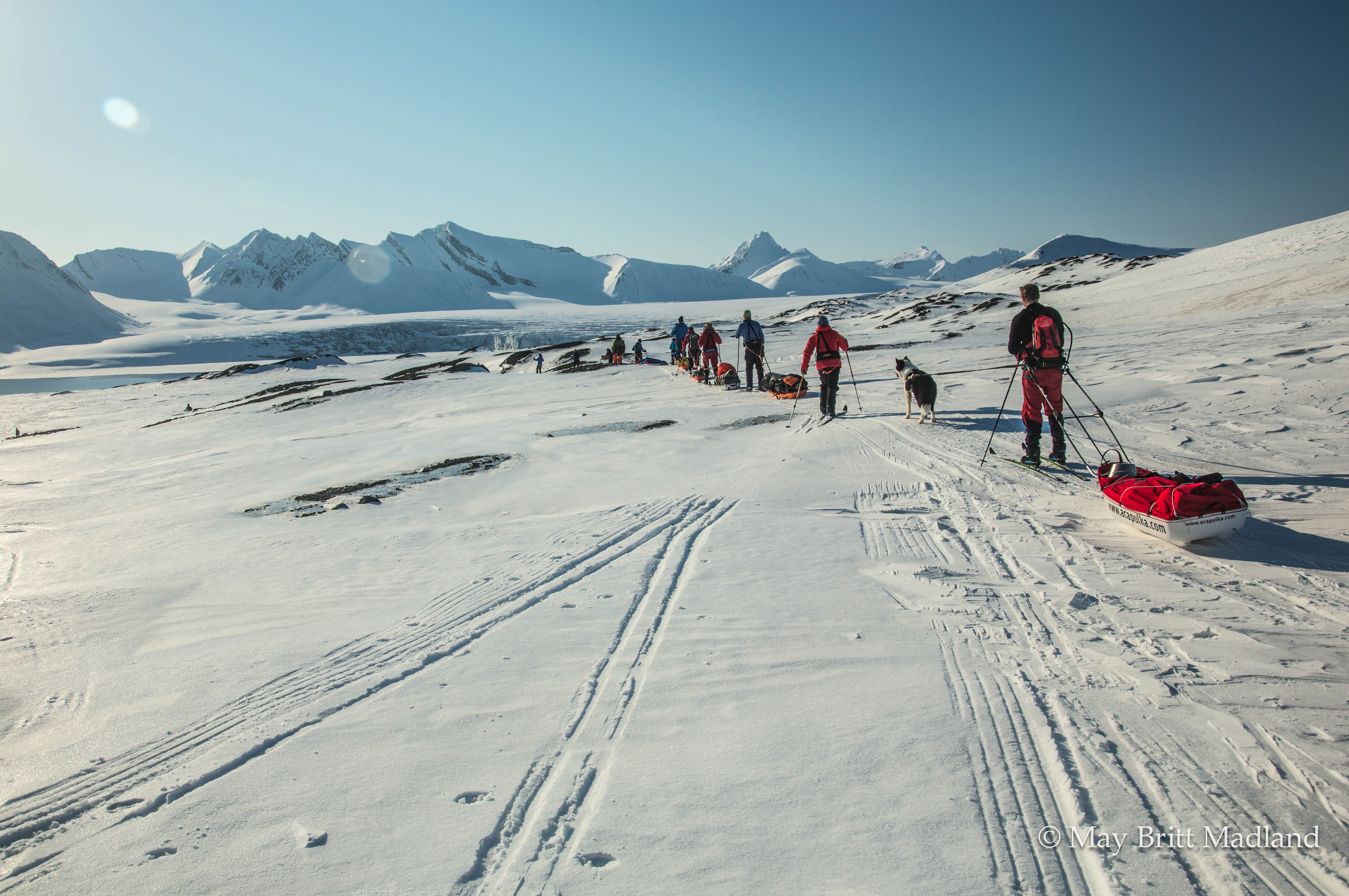
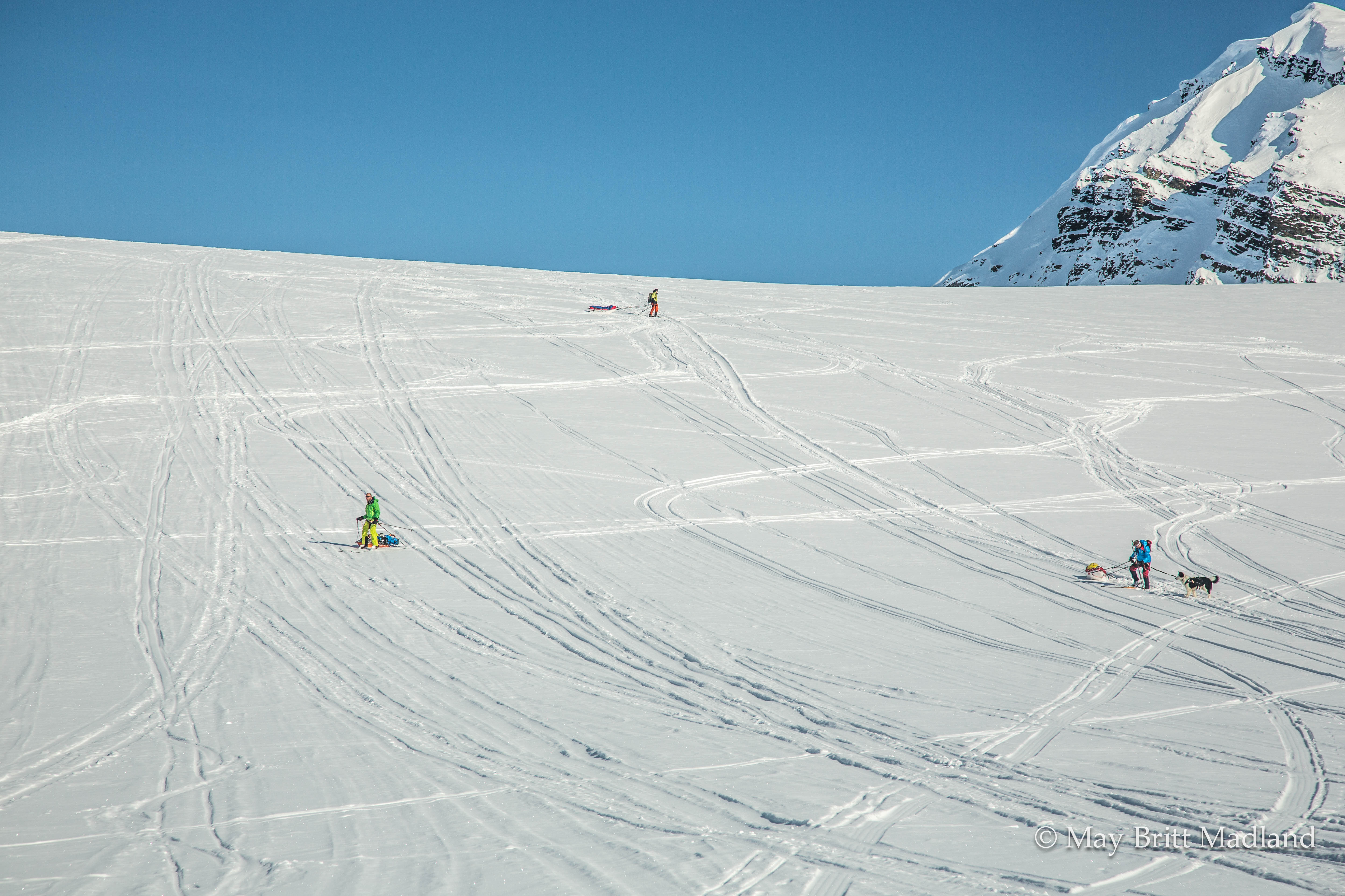
We started off with a few steep uphill parts when entering up on the glacier, Fridtjovbreen, and this morning my sledge was not one with me. I wanted to get up and the sledge wanted to stay down. Looking at the others getting up the slopes without problems I was wondering what they had eaten for breakfast that I did not eat. Maybe it was just that I was tired from the other days of skiing, but with a little support and some push on my sledge from the others i managed to get up the first part. After the first part struggling it became easier. During lunchtime some took the opportunity to have a nap and get some rest for the next part up the glacier.

_60A5327  _60A5337

_60A5410  _60A5409

The weather kept changing from cloudy to sunny so It was difficult to dress correct to not get cold and not get to hot and sweet, so I kept putting my jacket on and off.

_60A5378  _60A5342

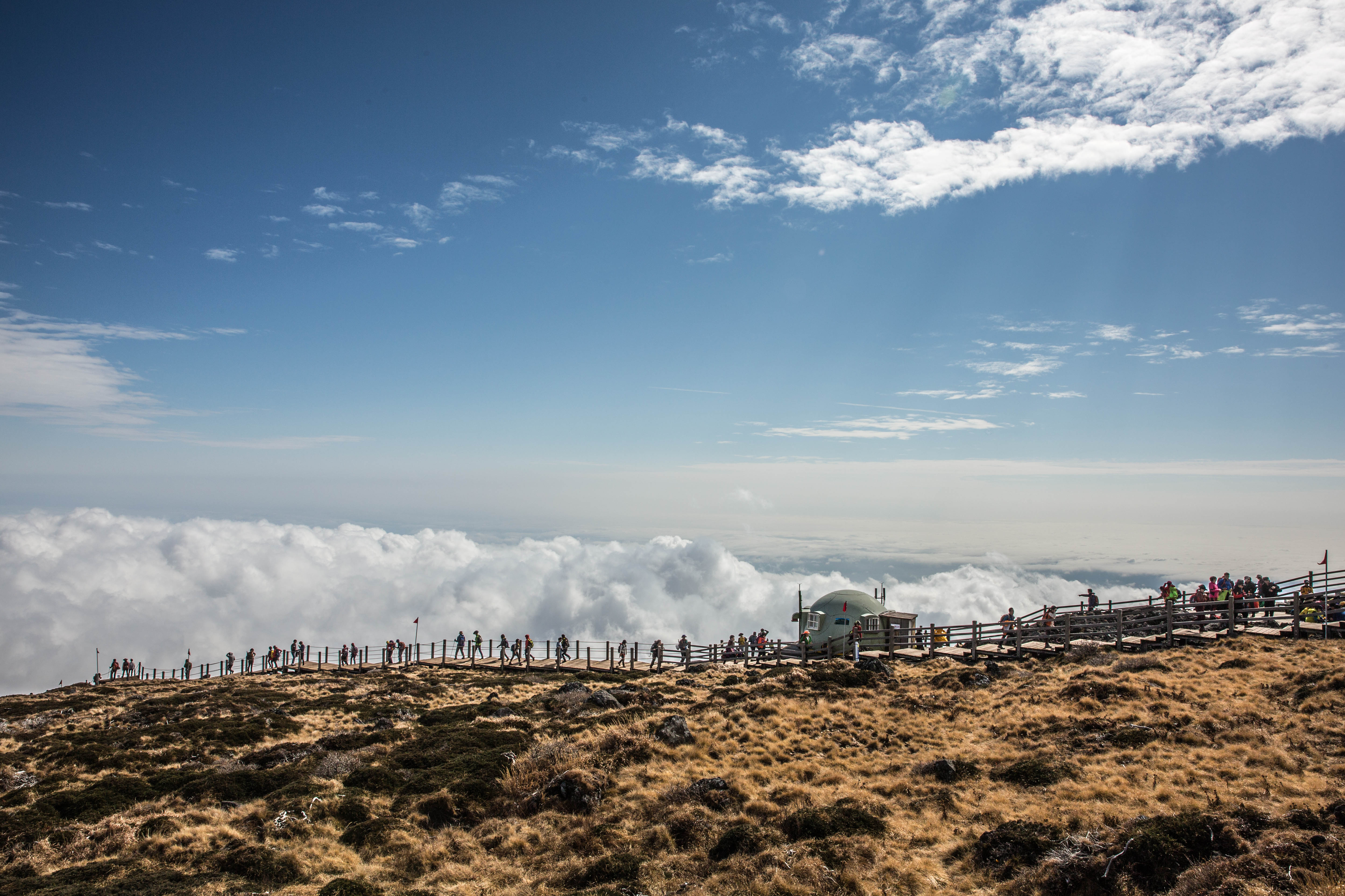
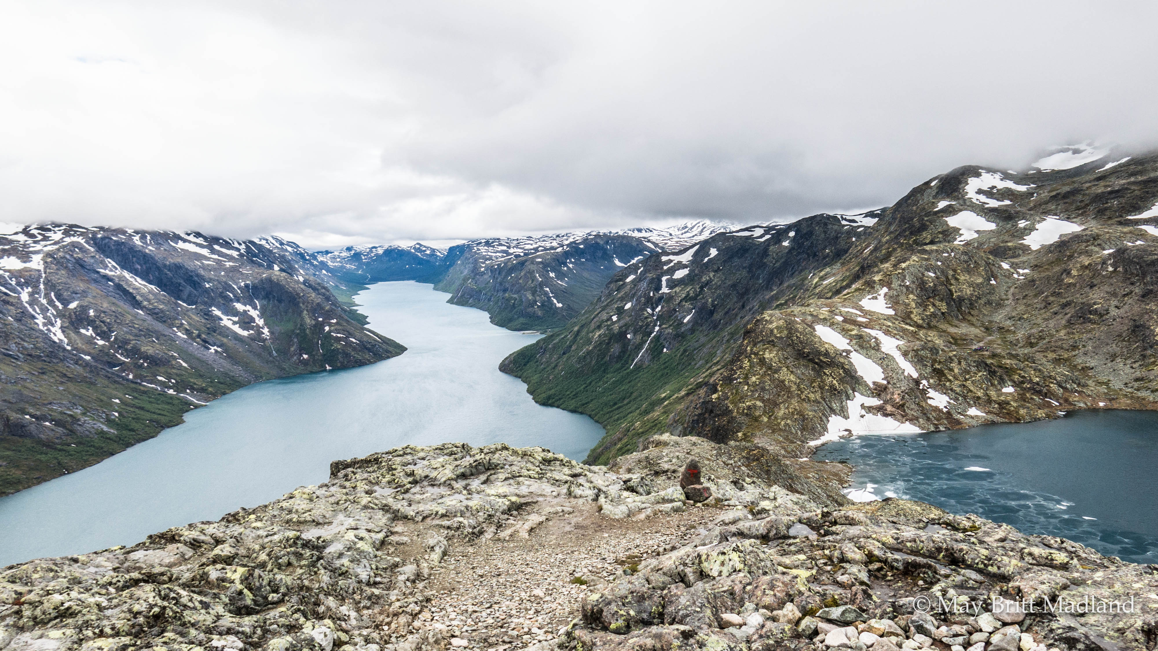
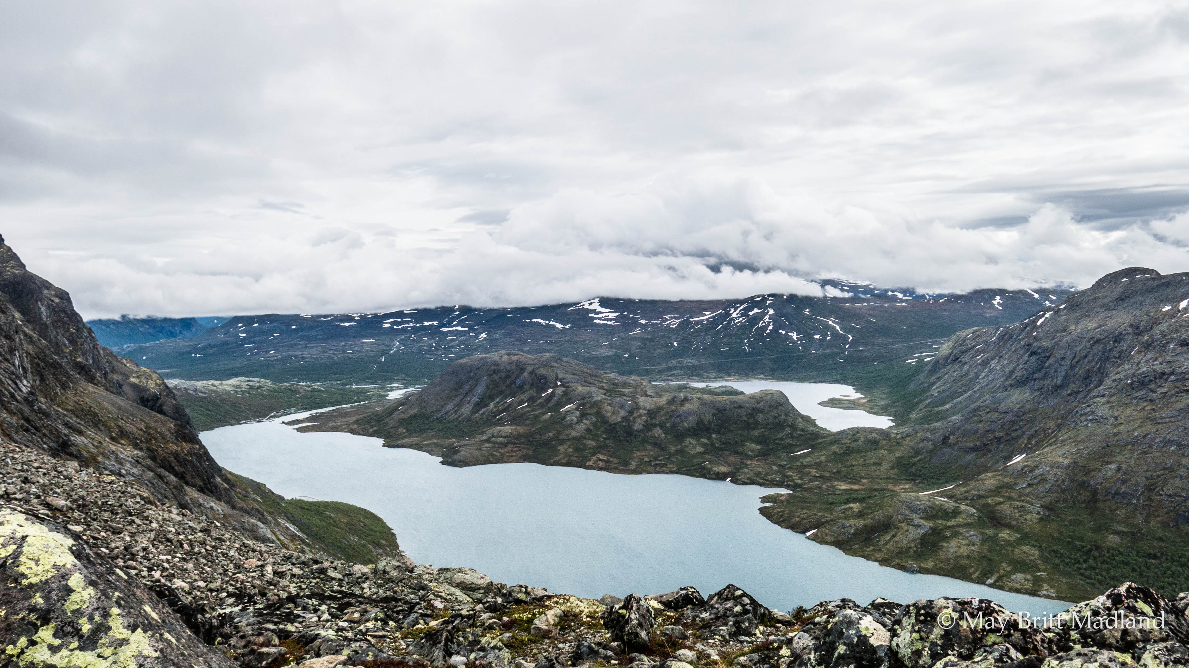
Arriving at the top of the glacier the weather gods where on our side and the sun where shining. We where facing a stunning view on both side of the glacier and the feeling standing on the top, enjoying the view, felt amazing.

_60A5423  _60A5465

_60A5460  _60A5470

To ski uphill was quite hard but the downhill with the sledge for me was more challenging. I had to find a techniques to ski with the sledge on the side so it would not overtake me. It took a lot of energy to keep control of the sledge and myself with the ski at the same time.

_60A5473  _60A5521

_60A5513  _60A5499

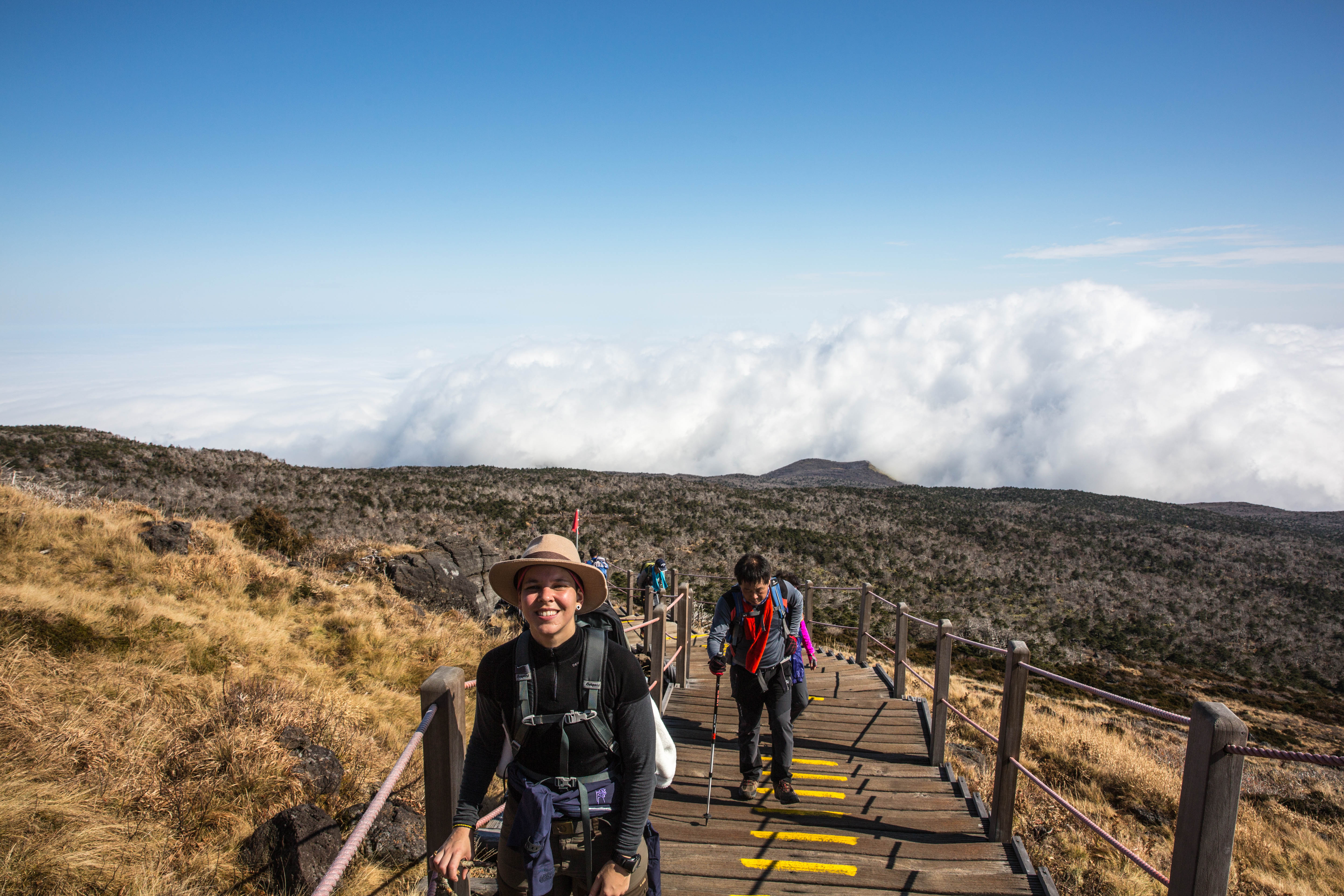
We all managed to get down. Some easier than others and some tried the option on sitting on the sledge down. With blue sky and no wind we decided to continue out the valley before setting up the camp. The distance did not seam far and we continued ski, with 50 min ski, 10 min break. Just keep going. It felt like there was no end to the valley. We where on day 6 and the following day we would reach Isfjord Radio, so we all agreed to continue until reaching the sea to get a shorter leg the next day.

_60A5553  _60A5556

Reaching the sea the sky started to be cloudy and we had a nice light. Almost like a sunset.

_60A5563  _60A5577

Our last evening sleeping in tent. We had become quite good at setting up and packing down the tent and it felt a bit strange to know that this would be the last time on this trip that we would have to put it up and take it down. I was looking forward to sleeping in a bed again, but still would miss this atmosphere you get when sleeping in tent out in the wild nature.

_60A5575  _60A5576

Getting organized inside the tent we heard some snowmobile arriving outside. The guides asked us to come outside and again we where surprised with the cook and worker from Isfjord Radio showing up with waffles. What a fantastic surprise. We where all happy, eating and enjoying, until there where no more left. The guides had called them to get some supply of food for the dogs and had not mention anything about waffles. Waffles and Norwegian goat cheese and as Eva still had some crackers left we enjoyed Crackers and cheese for our coffee. And with a shot of whiskey we all forgot that we where exhausted after a long day of skiing. We had done 30 km on ski that day, up Fridtjovbreen, down on the other side and out the valley reaching the sea, enjoying the beautiful weather making us able to enjoy the scenic landscape surrounding us from all angles.

_60A5582  _60A5598

_60A5588  _60A5585

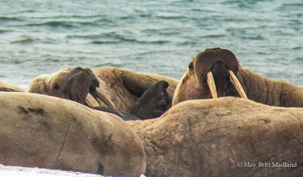
The Arctic region of Svalbard is incredible and a fantastic location for seeking out wildlife and we where lucky to see a group of bloated walrus laying on the beach. One of them more gray and pale, so we where sure he had seen his last days, but there was still some life in him as he was moving his head.

_60A5683  _60A5679

_60A5689  _60A5676

Continuing along the coast with the view of Isfjord Radio in front of us.

_60A5692  _60A5693

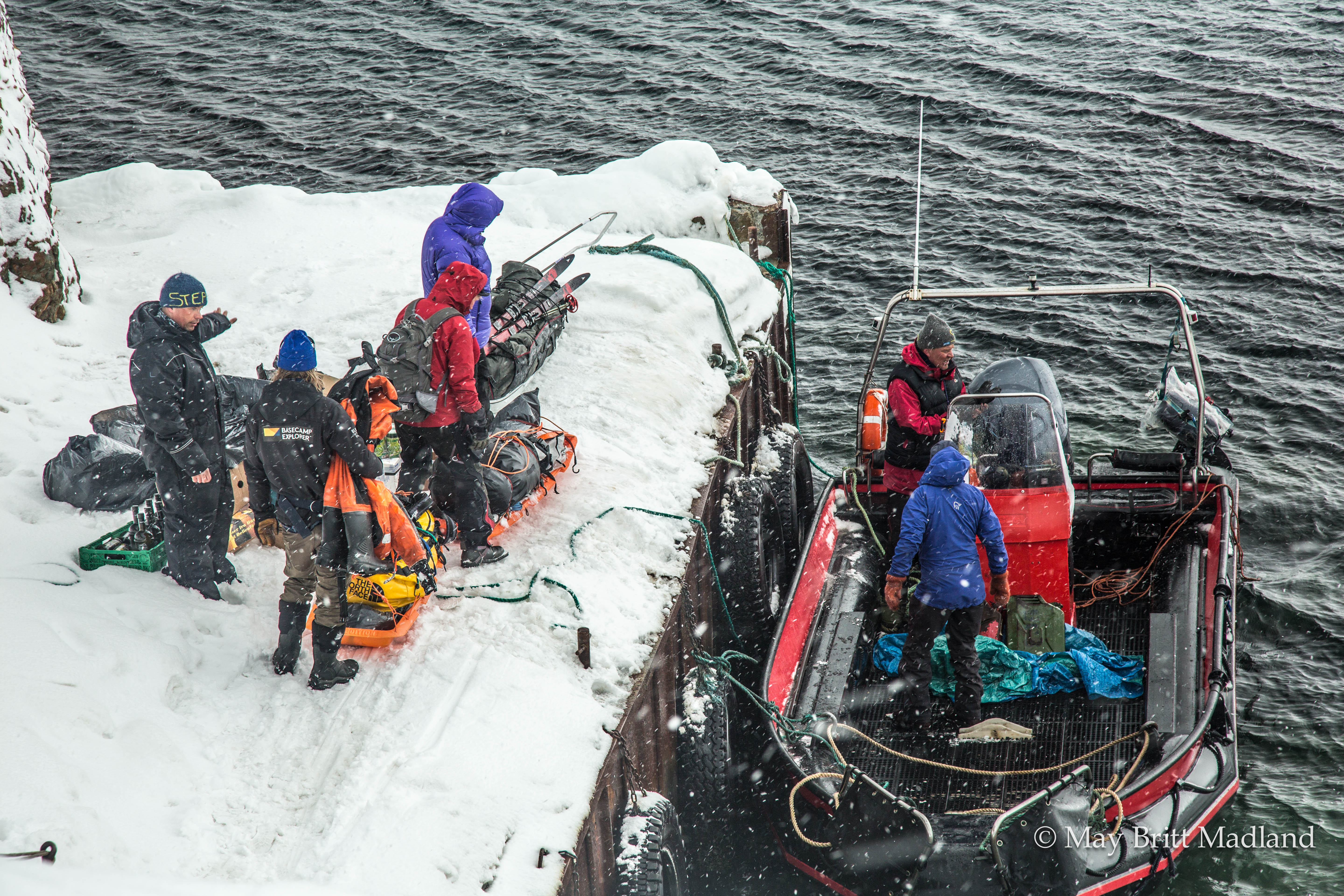
Arriving, it was a group of blissful, tired but happy, tanned faces toasting with hot wine, beer and champagne. It was an emotional moment shared with friends and people I got to know during this week that went by way to fast.

_60A5722  _60A5716

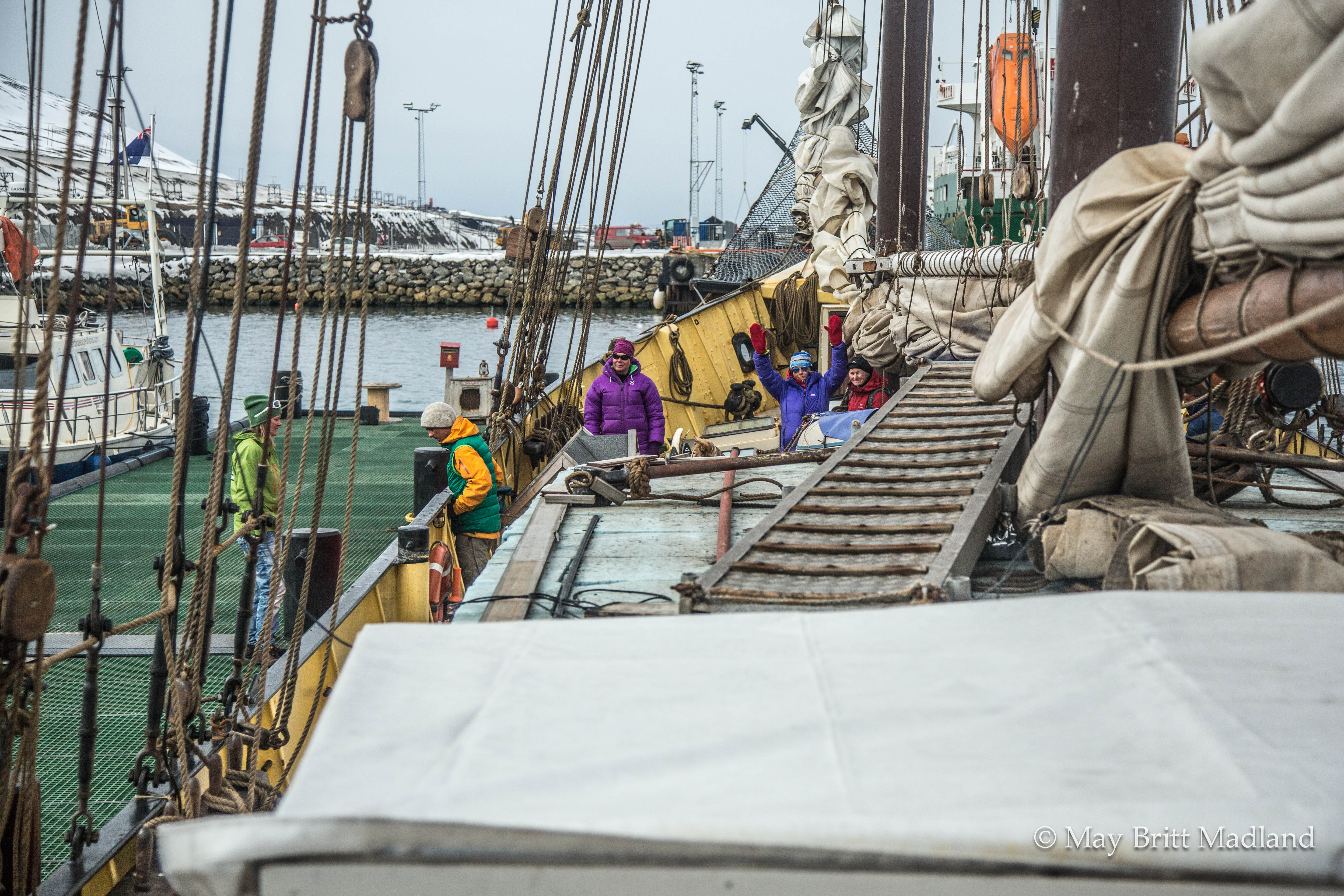
We spent the afternoon enjoying and toasting over some beer and wine, having a well earned shower and was served a 4 course dinner that tasted heavenly. A good night sleep in a bed and then our transport, the sailboat, Noorderlicht, was ready to take us back to Longyearbyen.

_60A5723  _60A5733

_60A5737  _60A5756

A week together with a fantastic group of people, learning new things along the way was over.

The trip was booked via Hvitserk: http://www.hvitserk.no/

Guides where from Basecamp Spitsbergen: http://www.basecampspitsbergen.com/

Our hotel in Longyearbyen was the Basecamp Trapper’s hotel


Escape to sandy beaches, crystal waters and Mouth watering cuisine

Parador La Huella, A restaurant located at the Beach, just outside the small town of José Ignacio, brings back memory of my visit to Uruguay. The restaurant is located on the outskirt of Punta del Este, also known as the St. Tropez of Uruguay. La Huella is known as one of Uruguay’s number one restaurants with it’s laid back atmosphere, it’s well known sushi dishes and wood-grilled platters and not to mention the location right on the beach front, perfect for a barefoot walk along the sand.

IMG_2733  IMG_2742

G60A7765  G60A7766

A year ago just before ester I was visiting Rio Grande Do Sul in Brazil. It is not a town you would spend your ester weekend as most things would be closed and not much happening, so we planned a trip to Uruguay. As Rio Grande is located close to the border of Uruguay we decided to rent a car and drive down. Trying to book a car we realized it was not that easy as all the car rental companies don’t allow you to drive the car outside of Brazil. So we started to look at option of other places to visit in Brazil, but we did not give up on the idea of Uruguay and at the end we found a local company that would rent us a car with the papers needed to cross the border. Then It was the hotel booking. Again, we got a surprise as we would never imagine most hotels would be fully booked at this time of the year. Punta del Este is known for being busy during the summer months from December to March. All hotels in the center of the City was fully booked so we ended up booking a room in a B&B outside of the town. And it ended up being a perfect location for our stay.

G60A7763

Hitting the road late afternoon on Thursday evening we planned to spend a night on the bordering town, Chui, to split up the journey. Arriving in Chui and checking at the few hotels on both side of the border we realized that it was not only us that had that Idea, so no room available anywhere. We decided to drive to the next town so drove down to La Coronilla. After a few stops and no room available we ended up asking some local people that pointed us in the direction of the beach as they said there would be a hotel there we could check, so we ended up at a rundown hotel that probably was our only option and decided to take it.

G60A7613  G60A7614

The hotel was in need of some painting and an makeover in my eyes, but well it was a room and a bed to sleep inn. The room had a padlock on the outside of the door and one of these easy locks you just push to the side on the inside. We had to lift the door up a bit to be able to get the lock in place and after shaking some dust out of the woolen blankets it was time to get some sleep.

IMG_3285

We got up early, took a shower in a bathroom that also was in need of some touch up. Looking at the bathroom, It seamed like it probably had been installed with a bathtub before and when they decided to change they put a shower head up in the middle of the wall pointing out where the mid of the bathtub probably had been, so not in the direction you logical would have put it, so with the shower head fixed on the wall pointing out to the bathroom floor and no way to adjust it, it was an interesting project to get some water drops on the body. As we where leaving early we missed the breakfast, but considering the standard of the hotel, we where fine with having our breakfast a place along the way.

G60A7617  G60A7624

We found a bakery in a town on the way where we stopped for some supply and had our breakfast in the car. It was the only shop we could find that was open this early in the morning. The streets where empty and quiet and only a few person out shopping for some bread.

G60A7628

G60A7627  G60A7629

We made our check in at the B&B. The house was located just across the road from the beach so it could not have been a more perfect location. It was a small house, nice room and a outside area with a swimming pool and tables where they would serve us breakfast. The host was friendly but only Spanish speaking. With a mix of Spanish, Portuguese and English we all managed to communicate in some way and got some information about the area and the city.

G60A7631  G60A7632

We took the car and went in to the city center to have a stroll around the town. We walked around in the streets and headed down to the seaside and the beaches that was crowded with people enjoying the sunny day. We tried out some local seafood on the seaside restaurants and had a walk around the more upscale area of the town.

IMG_2658  G60A7651

G60A7663  G60A7655

G60A7684  G60A7687

G60A7650  G60A7669

We found out that a great way to spend our days would be to bike around as we where staying outside of the city center but again not to far out. So with a bicycle it was easy to get to most places that was worth seeing during our stay. So when back at the B&B we managed to organize some bikes being delivered early next morning and we rented them for the rest of our stay and the company would come pick them up at the B&B. It could not be more easy than that.

IMG_2741  IMG_3292

Our B&B was located in La Barra. An area with great restaurants and beaches. La Barra is connected to Punta del Este with a Curvy Bridge, so you will get some up and down hill and the most of the road around the area has small curves up and down with small side roads taking you down to the different beaches. A popular activity in the town is fishing and you see it all over. On the pier and down on the beaches. And what could be better than some fresh catch of the day on the grill.

IMG_3295  IMG_3299

At the popular seaside playground of Punta del Este, there’s a unique beach vibe for all kind of traveler.

IMG_3339  IMG_3336

IMG_3341  IMG_3343

From the fashionable Bikini beach, where you’ll find sun-kissed, bronzed bodies to more relaxed beaches and not to mention the Playa Brava Beach with Punta del Este’s famous landmark, the monster-sized hand emerging from the sand.

G60A7706  G60A7702

G60A7697  G60A7703

La Mano en la Arena, sculpted in iron and cement by Chilean artist Mario Irarrazabal in 1982, won first prize in a monumental art contest that year and has been a Punta fixture ever since.

G60A7750  G60A7665  G60A7713

IMG_2746  IMG_3342

Breakfast by the Pool served with ester bunny chocolates, biking around in the city, visit to some of the areas hip beaches, Watching the sunrise early morning walking in the untouched sand, dining at top notch restaurants and time relaxing on the beach was just what we where looking for.

G60A7712

Punta del Este is well worth a visit. I did not know much about Punta del Este before visiting. I will for sure go back when i have the opportunity. Arriving from outside of Uruguay the best option is to fly in to Montevideo. From Montevideo you can rent a car or take a bus. You can also do like we did and drive from Rio Grande in Brazil and the roads are in good conditions and straight froward easy driving.


The Green Corridor of Singapore

A few weeks ago after hiking Bukit timah I discovered the Green Corridor of Singapore. I was on my way down to the main road to catch a cab and saw some people climbing up a steep path to the top of a small bridge. Being curious I decided to follow the path to see what was up there. Arriving on the bridge I realized I was on Singapore’s old railway line. Some friends told me about it and I wanted to check it out but never got around to do it. Little did i know that every time I had walked below this bridge it had been there right above my head.

IMG_6768  IMG_6763

On 1 July 2011, the historical Tanjong Pagar Railway Station was closed for good. It was replaced with the Woodlands Railway Station that’s close to Johor Bahru, Malaysia. With the closure of the old railway station, the entire stretch of land from Tanjong Pagar in South to Woodlands in North was re-developed. Malaysia took back its railway tracks and stretch of lush greenery was made in to what today is known as the Green Corridor.

This morning when I woke up I decided to go back and hike the Green Corridor. It was cloudy outside so a good weather to hike here in Singapore as it can be quite hot and humid during a sunny day. I packed my backpack with some water, some snack and sunblock. Looking out the window it looked like it might be a good chance it would rain, so in the last minute i grabbed an umbrella just in case. I can survive some rain, but I was more worried for my camera in case of heavy rain. I started the hiking off Lover delta Road as i live close to here and I found a path going down next to the bridge.

_60A3643  _60A3649

A few people passed by, one on a bike and some running.

_60A3644

I walked in the direction of Bukit Timah and my plan was to walk there and see how the weather was and if good my plan was to continue to the end and the woodlands. It was still cloudy but no rain yet. I walked along the path that had become more yellow as it had not been raining in Singapore for some weeks. I walked for a few km without meeting any people. Maybe due to that it was early Sunday morning or that it was a good chance for rain or just that not a lot of people know about this track.

_60A3656  _60A3646

_60A3655  _60A3648

It started to drizzle a bit but I kept my umbrella in the backpack and kept walking for another km or so before the heavy rain started.

_60A3662  _60A3665

I passed this village/kampong-like house along the track. In the days before the public housing was wide-spread, many people in Singapore stayed in houses like this and it is not common to see in Singapore today. At this point the rain had become more heavy so I took shelter under a bridge where they had done some artwork on the walls.

_60A3674  _60A3671

_60A3673  _60A3676

I realized the rain would not stop so I continued my walk. Passing the next bridge a group of people was doing the same as I had done and had taken shelter under a bridge and some did not mind the rain at all. Or maybe they just did not have the time or patience to wait it out as it looked like it would last for some time.

_60A3682  _60A3685

I was enjoying the nature and being able to walk continues km after km without having to pass any road. I could just hear the traffic passing above me when crossing under the bridges.

_60A3659  _60A3680

I passed the Bukit Timah Railway Station that is still there today. It is blocked off by a fence so it is not possible to get in to the station. At this station there where several railway tracks to control the different trains coming in different directions to not come on collision course. These where manual operated so not like today where you have the electronic to control the circuits.

_60A3689  _60A3690

So here I was back where I discovered the Green Corridor a few weeks ago. Just next to the Bukit Timah Nature Reserve.

_60A3657  _60A3693  _60A3695

Due to the heavy rain and I could hear the Thunder and Lightning coming I decided to end my journey at this point and not continue as planned.

_60A3698  walking-1

So the continue of the trail will have to be for my next adventure and hopefully with less rain than today. Even do I enjoyed my walk in the rain.

If you are looking for a day out walking, biking or running this is one of the places to look for.

For more information about the Green Corridor check out the following sites:

http://www.thegreencorridor.org/

http://www.sla.gov.sg/htm/BTRS/BTRS.htm

Hiking Besseggen – A part of the Norwegian National park Jotunheimen

I had my hiking boots ready, woke up early and was looking outside, it was raining, just as the forecast had promised but not what I was hoping for.

_60A9717

I took my time eating my breakfast, hoping for the weather to clear up in the next hour. But with the dripping rain and the fog in the air I did not have much hope. I glimpsed out of the window to check the queue for the first boat leaving and as expected It was just a few persons standing there. I had to make up my mind if I i should gamble with the weather and go for this boat or wait it out for the next and hope for better weather. Quickly checking the forecast again it looked like it might clear up around mid-day, so calculating the time for when I would be at Lake Bessvatnet that should be about half way of the hike, I decided to wait for the next boat. I spent the time reading my book, looking out hoping for the rain to stop. I made my lunch pack ready during breakfast but checking my backpack I would need some more water. I went to the store and as the rain was still poring down I just stayed in here until people started to queue up for the boat.

IMG_0588  IMG_0590

So here I was, just getting off the Ferry from Gjendesheim to Memurubu,  ready to hike the Besseggen Ridge, one of the most famous hiking destinations in Norway and a part of the Jotunheimen national park. Hiking Besseggen you have the option to start at Gjendesheim and do the hike to Memurubu and catch the boat back or do as I did, take the boat to Memurubu and hike back to Gjendesheim. I had been wanted to do this hiking for years so I had checked it out and was sure that the only option for me having fare of heights would be to hike it this way. The drawback hiking it this way is the crowd, as most people prefer hiking it this way. The ferry was crowded but as it was a rainy day and still early in the season, it still had capacity to take more people. The first part is uphill and quite steep so I stopped a few places on the way up to let the crowd pass me and took the the opportunity to take some nice photos and get a photo taken of myself.

IMG_0595  IMG_0601

It was June so still snow on the mountain tops.

IMG_0608  IMG_0611

It was clearing up a bit but the fog kept coming and going. The marking of the trail is quite good but as I was hiking alone in this weather I was letting the crowd in front of me but stayed just behind them for the first part uphill. As most of the crowd was making a good effort of walking fast the first part they needed a break at the first top, so I passed them and walked for a long time by myself. I love walking in the mountains just surrounded by the beauty of the nature. So quiet and peaceful, so I kept walking for about an hour almost by myself. Then I could see some people far in front of me. They might have been walking in front of me without me notice it as it was still foggy and it was only when the fog cleared I could see them.

IMG_0618  IMG_0620

The group in front of me looked like being 2 couples so I just kept going in this tempo and stayed at a distance, but close enough to see them. It felt more comfortable as I know the Norwegian mountains and how fast the weather can change.

IMG_0621  IMG_0627

IMG_0628  IMG_0632

The snow had been melting so the level of the water was quite high, something I would experience later on the trail as well,  so at edge of the lake I had to balance on the stones for a part and managed quite well without getting wet on my shoes. I was enjoying the beauty of the nature around me and the amazing view.

_60A9728  IMG_0640

_60A9739   _60A9738

Arriving at Lake Bessvatnet it was still foggy but the rain had stopped. It is quite a challenge to get down this part but I just took it easy and tried to follow the people in front of me and when down there was a track in the snow to follow so it got easier.

IMG_0642  IMG_0643

IMG_0651  IMG_0648

I reached the point of the trail where I had Bessvatnet at one side and Lake Gjende at the other side. So then I new I was about half way. Looking at the watch I had kept a good pace.  And now was the time where the most challenging part start. At least for me it was. Just looking up seeing people climbing made me dizzy and I started considering if I would be able to make it. Options would be going back and well that was not an option. Other option could be to follow the Bessvatnet and see if i could get up at some other point to avoid the steep climbing, but sitting having my lunch break and evaluating it I ended up with the challenging option to just follow the track and hope for the best.

IMG_0656  IMG_0659

I was still a step behind the 2 couples that had been in front of me for the most of the trip. and at this stage I was consider this as being quite clever as now I could follow where they where climbing and hopefully they would choose the best route and make it easier for me. So I was thinking if they can do it then I can do it. And as long as i don’t look down before I feel i am on safe ground this will go well. One step at a time. Finding my grip, the right place to put my feet and push myself up. At one point I passed a couple climbing down. They where asking me if it was far and well for me it was difficult to say as I was not looking behind, at least trying my best not to, so looking up I told them that they where probably half way. The women almost started crying telling me she would never do this again. It was the most scary thing she had done and she was not sure she would make it. I tried my best to tell her that the part until here was not so bad and she seamed more relaxed. I continued climbing up, trying not to look down but at some parts I was just at the edge so difficult not to look down. I just took a deep breath and continued. So far so good. I even challenged myself to turn around a few times to take some photos.

IMG_0662 IMG_0663

The 2 couples was still in front of me and I could see that one of them started to have some problems with the height as well. I was just next to them now and one of the girl told me she had problems with fare of height but had overcome it, but now it came back. But we all managed to reach the top and could finally look back en enjoy the beautiful view. They made a break at this point as one of the guy was not in the best shape and he told me this part was more challenging that he had imagined.

IMG_0664

I took some photos and enjoyed the view and continued my way back to the starting point where I had taken the boat this morning. The rest of the trip was easy walking as most was flat or downhill.

IMG_0672  IMG_0669

IMG_0676  IMG_0675

As I kept walking I started to get the view down to the Gjendeheim where I had slept the night before. I stopped took some photos and just enjoyed the view.

_60A9761  _60A9787

_60A9757

At a few places going down I had to watch out. At one point the waterfall was quite heavy and had taken away a part of the trail so was difficult to cross and I was trying not to get my shoes under the water. I was close to  Gjendesheim and could see it at a short distance and I was thinking wow I did it and now I could understand why it is one of the most popular hiking destinations in Norway. I got down, picked up my car, feeling tired but in a good way and was happy I did the hike even if the weather was not the best. Looking at the watch I had spent about 5 hours from I got of the boat and reaching back to Gjendesheim. Not bad at all and now being tired and hungry I was looking forward to reaching my next destination that would be the Elveseter hotel, enjoying a good dinner with some good wine before my next hiking adventure the next day before heading back to Oslo.

IMG_0683

To get to Gjendeheim I rented a car in Oslo. I stayed over at Gjendesheim so a good thing is to book in front to make sure to get a room. It can be quite busy during the peak season.

When to go:
The main summer season in the Norwegian mountains is July and August.  These months will be your best bet for sunny, warm days, but be prepared for all kind of weather.

Getting there:
The start or finish of the Besseggen ridge is located at Gjendesheim, on the eastern end of lake Gjende and Jotunheimen national park itself.  Here you’ll find a full service DNT hut, a small shop/cafe, toilets, the ferry boat, and parking area.

By Bus:
Several busses travel to Gjendesheim daily.  The two options are to travel via Fagernes (to/from Oslo) in the south.  To the north the bus travels to Vagamo where one can transfer east to Otta and the train, or continue west through the fjords.

By Train:
There is no direct train link to Jotunheimen national park.  If traveling by train, say from Trondheim in the north, exit at Otta, where you will have to take the bus to Vagamo, then on to Gjendesheim.  The bus/train does not always meet at a convenient time, so be sure to check schedules.

Transportation links:
https://www.nsb.no/ – Train info
http://www.nor-way.no/ – Bus info
http://www.ruteinfo.no/ – Local bus info
http://gjende.no/ – Ferry boat info

Other Useful links:
http://www.turistforeningen.no/ – The Norwegian trekking association
http://www.yr.no/ – Norwegian weather